青藏高原土地覆盖数据集(2001-2020)
收藏国家青藏高原科学数据中心2022-06-08 更新2024-03-06 收录
下载链接:
https://data.tpdc.ac.cn/zh-hans/data/fe919431-ce3b-4c01-97ec-ba910a88ba7a
下载链接
链接失效反馈官方服务:
资源简介:
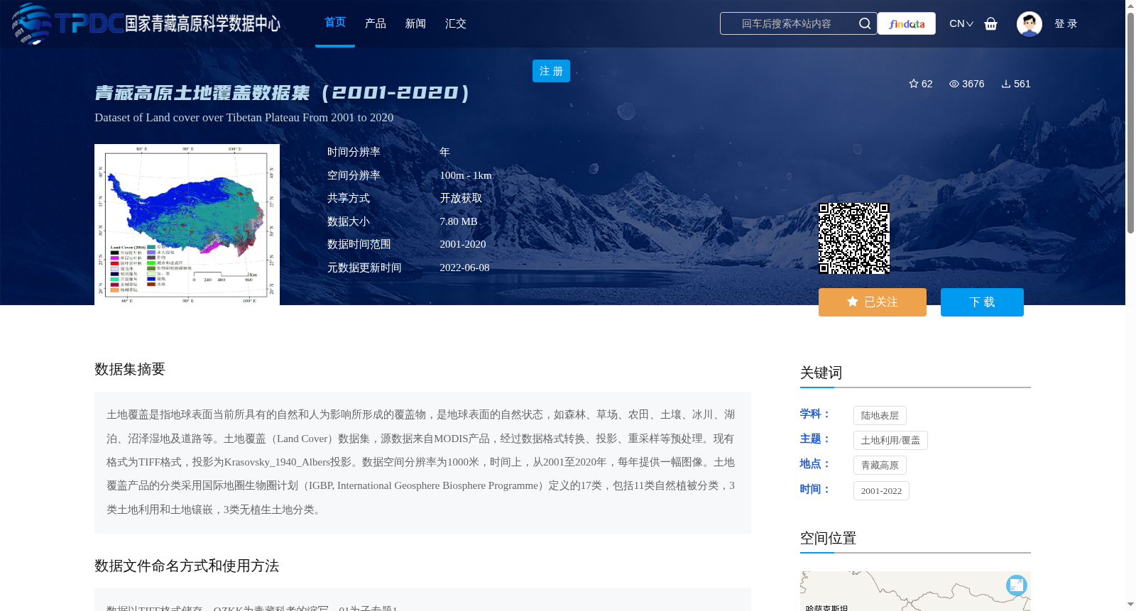
土地覆盖是指地球表面当前所具有的自然和人为影响所形成的覆盖物,是地球表面的自然状态,如森林、草场、农田、土壤、冰川、湖泊、沼泽湿地及道路等。土地覆盖(Land Cover)数据集,源数据来自MODIS产品,经过数据格式转换、投影、重采样等预处理。现有格式为TIFF格式,投影为Krasovsky_1940_Albers投影。数据空间分辨率为1000米,时间上,从2001至2020年,每年提供一幅图像。土地覆盖产品的分类采用国际地圈生物圈计划(IGBP, International Geosphere Biosphere Programme)定义的17类,包括11类自然植被分类,3类土地利用和土地镶嵌,3类无植生土地分类。
Land cover refers to the surface coverings formed by both natural and anthropogenic impacts on the Earth's current surface, representing the natural state of the Earth's surface, including forests, grasslands, farmlands, soils, glaciers, lakes, marshes, wetlands, roads, and others. The Land Cover dataset uses source data from MODIS products, and has undergone preprocessing procedures such as data format conversion, projection transformation, and resampling. Currently, the dataset is stored in TIFF format with the Krasovsky_1940_Albers projection. It has a spatial resolution of 1000 meters, and temporally, one image is provided annually from 2001 to 2020. The classification system of this land cover product adopts 17 categories defined by the International Geosphere Biosphere Programme (IGBP), which consists of 11 natural vegetation categories, 3 land use and land mosaic categories, and 3 non-vegetated land categories.
提供机构:
朱军涛
创建时间:
2022-06-04
搜集汇总
数据集介绍
背景与挑战
背景概述
青藏高原土地覆盖数据集(2001-2020)提供了每年一幅的TIFF格式图像,空间分辨率为1000米,采用IGBP的17类分类体系,涵盖了青藏高原的自然植被、土地利用和无植生土地等类型。数据来源于MODIS产品,经过预处理后以Krasovsky_1940_Albers投影存储。
以上内容由遇见数据集搜集并总结生成


