2019“三江并流”遗产地危害风险动态监测30m专题数据集
收藏地球大数据科学工程2024-03-04 收录
下载链接:
https://data.casearth.cn/sdo/detail/6538a77f819aec0f2615dd60
下载链接
链接失效反馈官方服务:
资源简介:
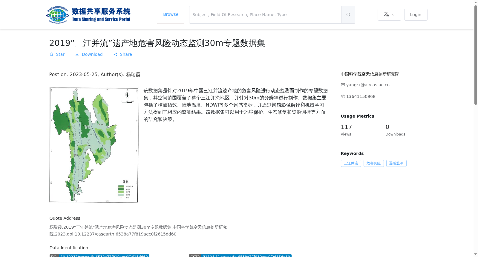
该数据集是针对2019年中国三江并流遗产地的危害风险进行动态监测而制作的专题数据集,其空间范围覆盖了整个三江并流地区,并针对30m的分辨率进行制作。数据集主要包括了植被指数、陆地温度、NDWI等多个遥感指标,并通过遥感影像解译和机器学习方法得到了相应的监测结果。该数据集可以用于环境保护、生态修复和资源调控等方面的研究和决策。
This is a thematic dataset created for dynamic hazard risk monitoring in the Three Parallel Rivers World Heritage Site of China in 2019. Its spatial scope encompasses the entire Three Parallel Rivers region, and it was generated at a 30-meter spatial resolution. The dataset primarily includes multiple remote sensing indices such as vegetation index, land surface temperature, and NDWI (Normalized Difference Water Index), alongside corresponding monitoring results derived from remote sensing image interpretation and machine learning approaches. This dataset can be utilized for research and decision-making in areas including environmental protection, ecological restoration, resource regulation and other relevant fields.
提供机构:
中国科学院空天信息创新研究院
搜集汇总
数据集介绍
背景与挑战
背景概述
该数据集是2019年中国三江并流遗产地的危害风险动态监测专题数据,覆盖整个三江并流地区,分辨率为30m,包含植被指数、陆地温度等遥感指标,适用于环境保护和生态修复研究。数据以GeoTiff格式存储,总容量10.9GB。
以上内容由遇见数据集搜集并总结生成


