A fine resolution mangrove map of China for 2019 derived from 10-m-resolution satellite observations and Google Earth images
收藏www.doi.org2025-03-23 收录
下载链接:
https://www.doi.org/10.11922/sciencedb.00245
下载链接
链接失效反馈官方服务:
资源简介:
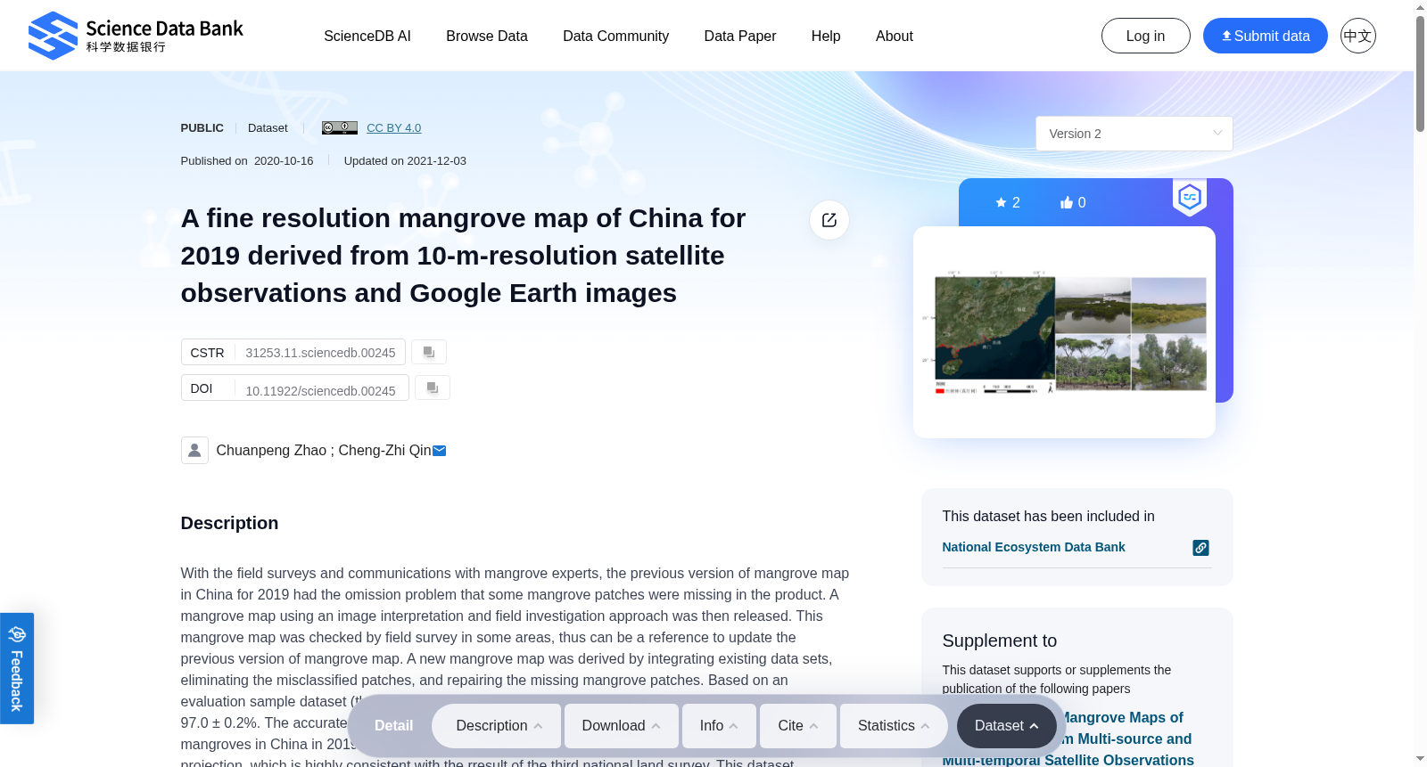
With the field surveys and communications with mangrove experts, the previous version of mangrove map in China for 2019 had the omission problem that some mangrove patches were missing in the product. A mangrove map using an image interpretation and field investigation approach was then released. This mangrove map was checked by field survey in some areas, thus can be a reference to update the previous version of mangrove map. A new mangrove map was derived by integrating existing data sets, eliminating the misclassified patches, and repairing the missing mangrove patches. Based on an evaluation sample dataset (the data was in doi:10.11922/sciencedb.00279), the overall accuracy reached 97.0 ± 0.2%. The accurate rate in metrics of 1096 field sample plots was 96.7%. The total area of \u200b\u200bmangroves in China in 2019 is estimated to be 27053.07 ha under the asia north albers equal area conic projection, which is highly consistent with the rresult of the third national land survey. This dataset provides a basis for mangrove protection, restoration, and management in China, mangrove related carbon sink estimation, and related studies in China. 
经实地考察与红树林专家的沟通,2019年中国版红树林地图的先前版本存在遗漏问题,即某些红树林斑块在成果中未体现。随后,一种采用图像解释和实地调查方法的红树林地图被发布。该地图在部分地区经实地考察验证,因此可作为更新先前红树林地图的参考。通过整合现有数据集,消除误分类的斑块并修复缺失的红树林斑块,衍生出新的红树林地图。基于评估样本数据集(数据编号为doi:10.11922/sciencedb.00279),整体精度达到97.0 ± 0.2%。在1096个实地样本斑块中的准确率达到了96.7%。按照亚洲北阿尔伯特等面积圆锥投影,估算2019年中国红树林总面积为27053.07公顷,这一结果与第三次全国土地调查的结果高度一致。本数据集为中国红树林的保护、恢复与管理提供了基础,并为红树林相关碳汇估算以及中国相关研究提供了支持。
提供机构:
www.doi.org
搜集汇总
数据集介绍
背景与挑战
背景概述
该数据集提供了2019年中国红树林的详细分布图,基于10米分辨率的卫星观测和Google Earth图像,修正了以往数据中的遗漏和误分类问题,总体精度高达97.0%,为红树林保护、恢复和管理提供了重要依据。
以上内容由遇见数据集搜集并总结生成


