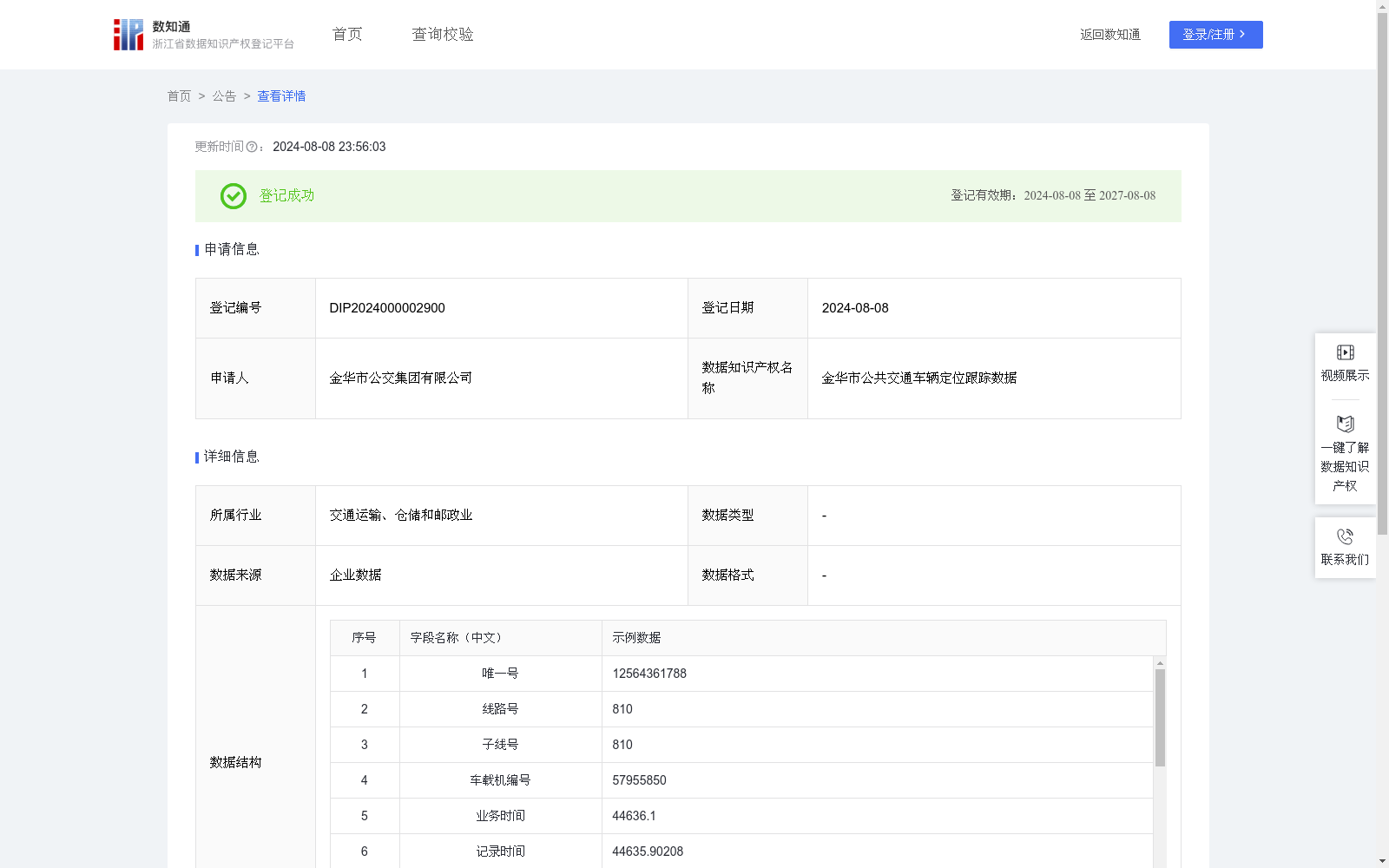
金华市公共交通车辆定位跟踪数据
收藏浙江省数据知识产权登记平台2024-08-08 更新2024-08-09 收录
下载链接:
https://www.zjip.org.cn/home/announce/trends/48686
下载链接
链接失效反馈官方服务:
资源简介:
通过金华市公交集团的指挥调度监控系统,收集公交车辆的最新GPS定位数据,掌握公交车辆的实时运行情况,为监控车辆安全运行和车辆排班调度提供可视化分析决策支撑。1、数据采集:通过安装在公交车辆上的车载设备采集公交车辆的经度、维度、GPS里程等信息;
2、数据处理:对采集到GPS定位数据进行清洗校验,剔除错误上报数据;
3、数据加工:根据当前经纬度数据和上一次上报的经纬度数据计算GPS速度和方向角,GPS速度=(当前GPS里程数-前一次GPS里程数)/时间间隔;采用反正切函数计算方向角,方向角=arctan(前一次经度,前一次维度,本次经度,本次维度);
4、数据展示:将车辆的最新经纬度数据映射至地图上,根据上报数据行程公交车辆的GIS轨迹。
Collected through the command, dispatch and monitoring system of Jinhua Public Transport Group, the latest GPS positioning data of public transit vehicles is used to acquire their real-time operational status, providing visual analysis and decision-making support for vehicle safety monitoring and scheduling.
1. Data Collection: Relevant information including longitude, latitude, GPS mileage and other parameters of public transit vehicles is collected via on-board devices installed on the buses.
2. Data Processing: Clean and validate the collected GPS positioning data, and eliminate erroneous reported data.
3. Data Enrichment: Calculate the GPS speed and direction angle based on the current latitude and longitude data and the previously reported data. The GPS speed is calculated as (current GPS mileage - previous GPS mileage) / time interval. The direction angle is computed using the arctangent function, with the formula: direction angle = arctan(previous longitude, previous latitude, current longitude, current latitude).
4. Data Visualization: Map the latest longitude and latitude data of the vehicles onto a digital map, and generate the GIS trajectory of public transit vehicles based on the reported data.
提供机构:
金华市公交集团有限公司
创建时间:
2024-07-08
搜集汇总
数据集介绍
以上内容由遇见数据集搜集并总结生成


