青藏高原东北缘1000m土地利用类型数据(2015)
收藏国家青藏高原科学数据中心2024-02-28 更新2024-05-06 收录
下载链接:
https://data.tpdc.ac.cn/zh-hans/data/45cb1991-fcf3-4e01-bc13-22905248d732
下载链接
链接失效反馈官方服务:
资源简介:
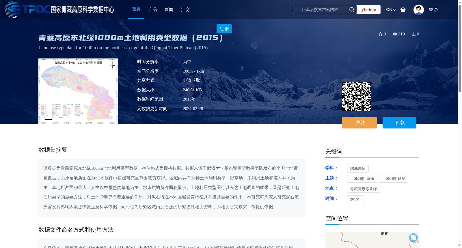
该数据为青藏高原东北缘1000m土地利用类型数据,存储格式为栅格数据。数据来源于武汉大学杨杰和黄昕教授团队发布的全国土地覆被数据,由原始地质图在ArcGIS软件中按照研究区范围裁剪获得。区域内共有24种土地利用类型,以草地、未利用土地和灌木林地为主,草地所占面积最大,其中以中覆盖度草地为主,水库坑塘所占面积最小。土地利用类型图可以表达土地调查的成果,又是研究土地使用类型的重要方法,对土地学研究有着重要的作用,对泥石流在不同区域发育特征具有极其重要的作用。本研究可为深入研究泥石流灾害发育影响因素提供数据及科学依据,同时也为研究区域内泥石流的研究提供相关资料,为相关防灾减灾工作提供依据。
This dataset is 1000m-resolution land use type data for the northeastern margin of the Qinghai-Tibet Plateau, stored in raster format. It is derived from the national land cover data released by the team of Professors Yang Jie and Huang Xin from Wuhan University, and was obtained by cropping the original dataset according to the study area boundary using ArcGIS software. A total of 24 land use types are present within the study area, dominated by grassland, unused land and shrubland. Grassland accounts for the largest area, among which medium-coverage grassland is the most prevalent, while reservoirs and ponds occupy the smallest area. Land use type maps can represent the outcomes of land surveys and serve as an important approach for studying land use types, playing a significant role in land science research and being critically important for analyzing the developmental characteristics of debris flows in different regions. This study can provide data and scientific evidence for in-depth research on the influencing factors of debris flow disasters, supply relevant materials for debris flow studies within the study area, and offer support for related disaster prevention and mitigation efforts.
提供机构:
杨为民
创建时间:
2024-01-02
搜集汇总
数据集介绍
背景与挑战
背景概述
该数据集是2015年青藏高原东北缘1000米空间分辨率的土地利用类型栅格数据,包含24种类型,以草地、未利用土地和灌木林地为主,主要用于土地学研究和泥石流灾害分析。数据来源于全国土地覆被数据裁剪而成,需通过申请获取,并遵循特定引用规范。
以上内容由遇见数据集搜集并总结生成


