ChinaUIS: National-Scale Urban Informal Settlements Mapping in Chinese Major Cities
收藏DataCite Commons2025-04-27 更新2025-04-16 收录
下载链接:
https://www.scidb.cn/detail?dataSetId=2a1fa9a8d27245fa839eea2b78330e97
下载链接
链接失效反馈官方服务:
资源简介:
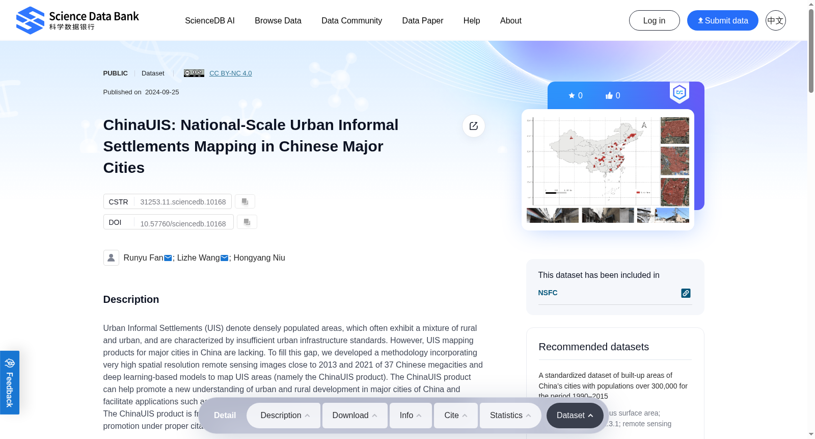
Urban Informal Settlements (UIS) denote densely populated areas, which often exhibit a mixture of rural and urban, and are characterized by insufficient urban infrastructure standards. However, UIS mapping products for major cities in China are lacking. To fill this gap, we developed a methodology incorporating very high spatial resolution remote sensing images close to 2013 and 2021 of 37 Chinese megacities and deep learning-based models to map UIS areas (namely the ChinaUIS product). The ChinaUIS product can help promote a new understanding of urban and rural development in major cities of China and facilitate applications such as urban poverty estimation, urban\rural planning, and urban sustainability. The ChinaUIS product is free to use for non-commercial forms including scientific research and science promotion under proper citation.
城市非正规聚居区(Urban Informal Settlements, UIS)指人口密集的区域,通常兼具城乡混合的特征,且以城市基础设施标准不足为典型表征。然而,当前针对中国主要城市的非正规聚居区制图产品仍较为稀缺。为填补这一研究空白,我们构建了一套研究方法,整合了37座中国特大城市接近2013年与2021年的超高空间分辨率遥感影像,以及基于深度学习的模型,用于绘制非正规聚居区范围(即ChinaUIS产品)。ChinaUIS产品有助于推动学界对中国主要城市城乡发展的全新认知,并可助力城市贫困评估、城乡规划以及城市可持续发展等领域的应用。本ChinaUIS产品可在规范引用的前提下,免费用于科学研究、科学普及等非商业用途。
提供机构:
Science Data Bank
创建时间:
2024-09-25
搜集汇总
数据集介绍
背景与挑战
背景概述
ChinaUIS数据集提供了中国37个大城市的非正规居住区(UIS)测绘产品,基于2013年和2021年的高分辨率遥感图像和深度学习模型。该数据集旨在支持城市贫困估计、城乡规划和城市可持续性研究,数据量为6.48GB,适用于非商业用途。
以上内容由遇见数据集搜集并总结生成


