基于多源融合气象要素数据的青藏高原干旱指数(1979-2018)
收藏国家青藏高原科学数据中心2024-09-02 更新2024-10-12 收录
下载链接:
https://data.tpdc.ac.cn/zh-hans/data/551d8ac2-bdfe-4d0b-acbf-8e86a51cb6bc
下载链接
链接失效反馈官方服务:
资源简介:
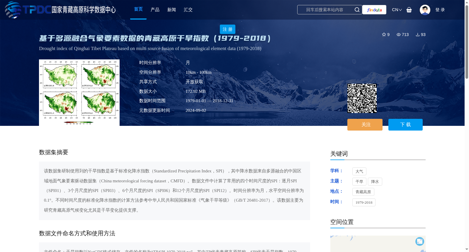
该数据集研制使用到的干旱指数是基于标准化降水指数(Standardized Precipitation Index,SPI),其中降水数据来自多源融合的中国区域地面气象要素驱动数据集(China meteorological forcing dataset,CMFD)。数据文件中计算了常用的四个时间尺度的SPI:逐月SPI(SPI01)、3个月尺度的SPI(SPI03)、6个月尺度的SPI(SPI06)和12个月尺度的SPI(SPI12)。时间分辨率为月,水平空间分辨率为0.1°。不同时间尺度的标准化降水指数的计算方法参考中华人民共和国国家标准《气象干旱等级》(GB/T 20481-2017)。该数据主要为研究青藏高原气候变化尤其是干旱变化提供支撑。
The drought index developed for this dataset is based on the Standardized Precipitation Index (SPI). Precipitation data is sourced from the China Meteorological Forcing Dataset (CMFD), a multi-source fused ground meteorological forcing dataset for China. Four commonly used temporal scales of SPI are calculated in the data files: monthly SPI (SPI01), 3-month scale SPI (SPI03), 6-month scale SPI (SPI06), and 12-month scale SPI (SPI12). The dataset has a monthly temporal resolution and a horizontal spatial resolution of 0.1°. The calculation methodology for SPI across different temporal scales refers to the National Standard of the People's Republic of China "Grade of Meteorological Drought" (GB/T 20481-2017). This dataset primarily supports research on climate change over the Tibetan Plateau, particularly variations in drought conditions.
提供机构:
王晨鹏,翟盘茂,周佰铨,廖圳
创建时间:
2024-09-02
搜集汇总
数据集介绍
背景与挑战
背景概述
该数据集提供了1979-2018年青藏高原的干旱指数,基于多源融合气象要素数据计算了不同时间尺度的标准化降水指数(SPI),时间分辨率为月,空间分辨率为0.1°,主要用于研究青藏高原的气候变化和干旱情况。
以上内容由遇见数据集搜集并总结生成


