2025年1月7日定日县震后陆地探测卫星遥感影像数据集
收藏国家青藏高原科学数据中心2025-01-08 更新2025-01-18 收录
下载链接:
https://data.tpdc.ac.cn/zh-hans/data/61d0fe2e-8d1c-40ed-9584-b015b1a0e76d
下载链接
链接失效反馈官方服务:
资源简介:
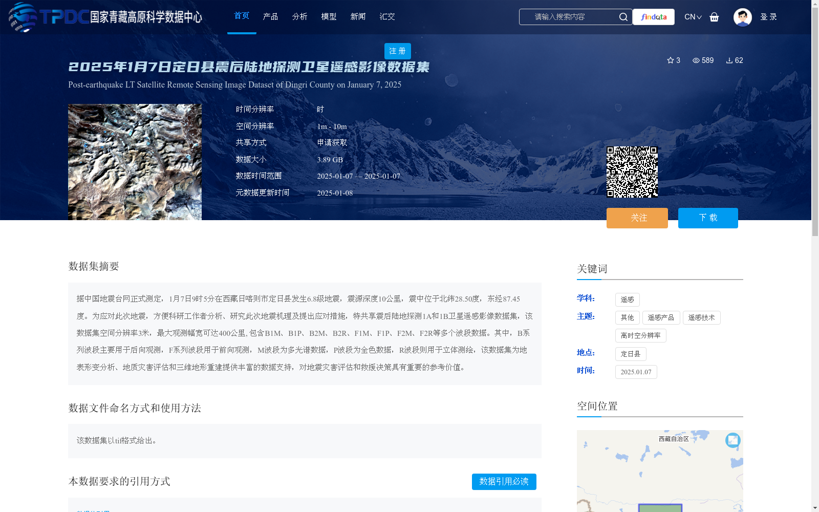
据中国地震台网正式测定,1月7日9时5分在西藏日喀则市定日县发生6.8级地震,震源深度10公里,震中位于北纬28.50度,东经87.45度。为应对此次地震,方便科研工作者分析、研究此次地震机理及提出应对措施,特共享震后陆地探测1A和1B卫星遥感影像数据集,该数据集空间分辨率3米,最大观测幅宽可达400公里, 包含B1M、B1P、B2M、B2R、F1M、F1P、F2M、F2R等多个波段数据。其中,B系列波段主要用于后向观测,F系列波段用于前向观测,M波段为多光谱数据,P波段为全色数据,R波段则用于立体测绘,该数据集为地表形变分析、地质灾害评估和三维地形重建提供丰富的数据支持,对地震灾害评估和救援决策具有重要的参考价值。
Officially determined by the China Earthquake Networks Center, a 6.8-magnitude earthquake struck Dinggyê County, Xigazê City, Tibet Autonomous Region at 09:05 on January 7, with a focal depth of 10 km and the epicenter located at 28.50°N, 87.45°E. In response to this earthquake and to facilitate researchers' analysis and study of the earthquake mechanism as well as the formulation of response measures, the post-earthquake remote sensing image datasets of Land Exploration 1A and 1B satellites are hereby publicly shared. This dataset has a spatial resolution of 3 meters, a maximum observation swath of up to 400 km, and includes multiple spectral bands such as B1M, B1P, B2M, B2R, F1M, F1P, F2M and F2R. Specifically, the B-series bands are mainly used for backward observation, while the F-series bands are designed for forward observation. The M band corresponds to multispectral data, the P band is panchromatic data, and the R band is used for stereomapping. This dataset provides rich data support for surface deformation analysis, geological hazard assessment and 3D terrain reconstruction, and holds significant reference value for earthquake disaster assessment and rescue decision-making.
提供机构:
高分辨率对地观测系统甘肃数据与应用中心
创建时间:
2025-01-08
搜集汇总
数据集介绍
背景与挑战
背景概述
该数据集是针对2025年1月7日西藏定日县6.8级地震后获取的陆地探测卫星遥感影像,空间分辨率为3米,包含多个波段数据,支持地表形变分析、地质灾害评估和三维地形重建。数据集大小为3.89 GB,通过申请获取方式共享,主要用于地震灾害评估和救援决策参考。
以上内容由遇见数据集搜集并总结生成


