祁连山综合观测网:青海湖流域地表过程综合观测网(温性草原芨芨草站气象要素梯度观测系统-2021)
收藏国家青藏高原科学数据中心2022-06-29 更新2024-03-06 收录
下载链接:
https://data.tpdc.ac.cn/zh-hans/data/799b7ffd-4e21-4d39-92fd-6d74c811cabf
下载链接
链接失效反馈官方服务:
资源简介:
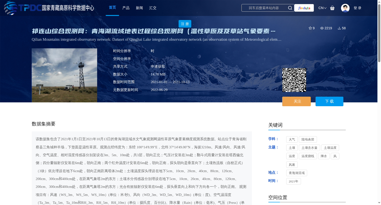
该数据集包含了2021年1月1日至2021年10月13日的青海湖流域水文气象观测网温性草原气象要素梯度观测系统数据。站点位于青海省刚察县三角城种羊场,下垫面是温性草原。观测点经纬度为:东经 100°14'8.99"E,北纬 37°14'49.00"N,海拔3210m。风速/风向、风速/风向、空气温度、相对湿度传感器分别架设在3m、5m、10m处,共3层,朝向正北;气压计安装在3m处;翻斗式雨量计安装在塔西偏北侧;四分量辐射仪安装在6m处,朝向正南;两个红外温度计安装在6m处,朝向正南,探头朝向是垂直向下;土壤热流板(自校正式)(3块)依次埋设在地下6cm处,朝向正南距离塔体2m处;土壤温度探头埋设在地下5cm、10cm、20cm、40cm、80cm、120cm、200cm、300cm和400cm处,在距离气象塔2m的东方;土壤水分传感器分别埋设在地下5cm、10cm、20cm、40cm、80cm、120cm、200cm、300cm和400cm处,在距离气象塔2m的东方;光合有效辐射仪安装在6m处,探头垂直向上和向下方向各一个,朝向正南。
观测项目有:风速(WS_3m、WS_5m、WS_10m)(单位:米/秒)、风向(WD_3m、WD_5m、WD_10m)(单位:度)、空气温湿度(Ta_3m、Ta_5m、Ta_10m和RH_3m、RH_5m、RH_10m)(单位:摄氏度、百分比)、降水量(Rain)(单位:毫米)、气压(Press)(单位:百帕)、地表辐射温度(IRT_1、IRT_2)(单位:摄氏度)、向上与向下光合有效辐射(PAR_U_up、PAR_U_down)(单位:微摩尔/平方米秒) 、四分量辐射(DR、UR、DLR_Cor、ULR_Cor、Rn)(单位:瓦/平方米)、土壤热通量(Gs_1、Gs_2、Gs_3)(单位:瓦/平方米)、土壤水分(Ms_5cm、Ms_10cm、Ms_20cm、Ms_40cm、Ms_80cm、Ms_120cm、Ms_200cm、Ms_300cm、Ms_400cm)(单位:百分比)、土壤温度(Ts_5cm、Ts_10cm、Ts_20cm、Ts_40cm、Ts_80cm、Ts_120cm、Ts_200cm、Ts_300cm、Ts_400cm)(单位:摄氏度)。
观测数据的处理与质量控制:(1)确保每天144个数据(每10min),若出现数据的缺失,则由-6999标示;(2)剔除有重复记录的时刻;(3)删除了明显超出物理意义或超出仪器量程的数据;(4)数据中以红字标示的部分为有疑问的数据;(5)日期和时间的格式统一,并且日期、时间在同一列。如,时间为:2018/8/31 10:30。
This dataset contains data from the temperate grassland meteorological element gradient observation system of the hydrometeorological observation network in the Qinghai Lake Basin, covering the period from January 1, 2021 to October 13, 2021. The observation site is located at Sanjiancheng Sheep Farm, Gangcha County, Qinghai Province, with a temperate grassland underlying surface. The geographic coordinates of the observation point are: 100°14'8.99" E longitude, 37°14'49.00" N latitude, and an altitude of 3210 m.
Wind speed and direction sensors, air temperature and relative humidity sensors are mounted at 3 m, 5 m, and 10 m height respectively, totaling 3 layers, facing due north; a barometer is installed at 3 m height; a tipping-bucket rain gauge is installed on the northwest side of the tower; a four-component radiometer is installed at 6 m height, facing due south; two infrared thermometers are installed at 6 m height, facing due south, with their probes pointing perpendicularly downward; three self-calibrating soil heat flux plates are buried at a depth of 6 cm underground, facing due south, 2 m away from the tower body; soil temperature probes are buried at depths of 5 cm, 10 cm, 20 cm, 40 cm, 80 cm, 120 cm, 200 cm, 300 cm and 400 cm underground, 2 m east of the meteorological tower; soil moisture sensors are buried at the same depths as the soil temperature probes, 2 m east of the meteorological tower; a photosynthetically active radiation (PAR) sensor is installed at 6 m height, with one probe facing vertically upward and one facing vertically downward, facing due south.
Observation items include: wind speed (WS_3m, WS_5m, WS_10m) (unit: meters per second), wind direction (WD_3m, WD_5m, WD_10m) (unit: degrees), air temperature and relative humidity (Ta_3m, Ta_5m, Ta_10m and RH_3m, RH_5m, RH_10m) (units: degrees Celsius, percent), precipitation (Rain) (unit: millimeters), atmospheric pressure (Press) (unit: hectopascals), surface radiation temperature (IRT_1, IRT_2) (unit: degrees Celsius), upward and downward photosynthetically active radiation (PAR_U_up, PAR_U_down) (unit: micromoles per square meter per second), four-component radiation (DR, UR, DLR_Cor, ULR_Cor, Rn) (unit: watts per square meter), soil heat flux (Gs_1, Gs_2, Gs_3) (unit: watts per square meter), soil moisture (Ms_5cm, Ms_10cm, Ms_20cm, Ms_40cm, Ms_80cm, Ms_120cm, Ms_200cm, Ms_300cm, Ms_400cm) (unit: percent), and soil temperature (Ts_5cm, Ts_10cm, Ts_20cm, Ts_40cm, Ts_80cm, Ts_120cm, Ts_200cm, Ts_300cm, Ts_400cm) (unit: degrees Celsius).
Data processing and quality control for the observed data are as follows: (1) Ensure 144 data records per day (one record every 10 minutes); missing data will be marked with -6999; (2) Remove duplicate timestamp records; (3) Delete data that obviously exceeds physical limits or instrument measurement ranges; (4) Data marked in red are questionable records; (5) Unify date and time formats, with date and time in the same column. For example, the timestamp format is: 2018/8/31 10:30.
提供机构:
李小雁
创建时间:
2022-06-29
搜集汇总
数据集介绍
背景与挑战
背景概述
该数据集包含2021年青海湖流域温性草原芨芨草站的多层气象要素观测数据,涵盖风速、温湿度、降水、土壤温湿度等多种指标,数据经过质量控制,时间跨度为2021年1月至10月。
以上内容由遇见数据集搜集并总结生成


