CCSM3和CAM3模拟输出的东亚北方季风区的海陆水汽源降水变化数据集(过去300 ka)
收藏国家地球系统科学数据中心2024-12-13 更新2024-12-14 收录
下载链接:
https://www.geodata.cn/data/datadetails.html?dataguid=45926647143371&docId=1997
下载链接
链接失效反馈官方服务:
资源简介:
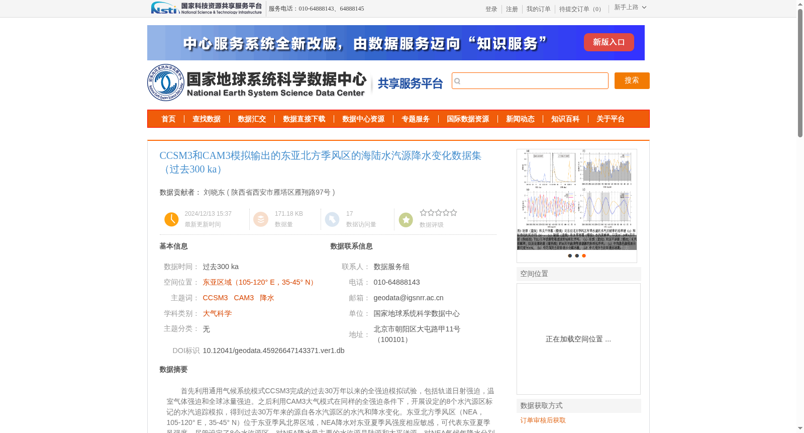
首先利用通用气候系统模式CCSM3完成的过去30万年以来的全强迫模拟试验,包括轨道日射强迫,温室气体强迫和全球冰量强迫。之后利用CAM3大气模式在同样的全强迫条件下,开展设定的8个水汽源区标记的水汽追踪模拟,得到过去30万年来的源自各水汽源区的水汽和降水变化。东亚北方季风区(NEA,105-120° E,35-45° N)位于东亚季风北界区域,NEA降水对东亚夏季风强度相应敏感,可代表东亚夏季风强度。尽管设定了8个水汽源区,对NEA降水最主要的水汽源是陆源和太平洋源,对NEA气候年降水分别贡献57.6%和20.9%。数据分别提供了模拟的东亚北方季风区NEA过去30万年年降水变化和陆源降水和太平洋源降水的变化。
First, a fully forced simulation experiment covering the past 300,000 years was conducted using the Community Climate System Model 3 (CCSM3), which includes orbital insolation forcing, greenhouse gas forcing, and global ice volume forcing. Subsequently, targeted water vapor tracking simulations labeled with 8 specified source regions were carried out using the Community Atmosphere Model 3 (CAM3) under the same fully forced conditions, yielding variations in water vapor and precipitation derived from each source region over the past 300,000 years. The northern East Asian monsoon region (NEA, 105–120° E, 35–45° N) is located at the northern boundary of the East Asian monsoon system. Precipitation in the NEA is highly sensitive to the intensity of the East Asian summer monsoon, thus can serve as a proxy for the strength of the East Asian summer monsoon. Although 8 water vapor source regions were specified, the dominant water vapor sources for NEA precipitation are terrestrial and Pacific sources, which contribute 57.6% and 20.9% of the annual precipitation in the NEA respectively. This dataset separately provides the simulated annual precipitation variations over the past 300,000 years for the NEA, as well as the precipitation variations originating from terrestrial and Pacific sources.
提供机构:
陕西省西安市雁塔区雁翔路97号
创建时间:
2024-12-13
搜集汇总
数据集介绍
背景与挑战
背景概述
该数据集利用CCSM3和CAM3气候模式模拟了过去30万年间东亚北方季风区的降水变化,特别关注陆源(贡献57.6%)和太平洋源(贡献20.9%)的水汽对降水的影响,数据时间分辨率为100年,适用于古气候和大气科学研究。
以上内容由遇见数据集搜集并总结生成


