哈萨克斯坦17个小流域2.5米分辨率土壤水蚀模数数据集(2019)
收藏资源简介:
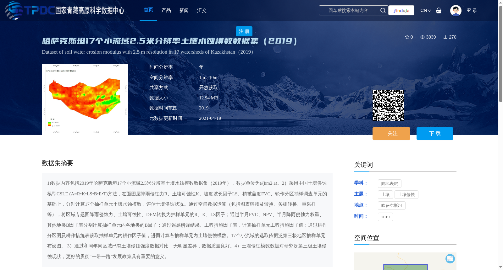
1)数据内容包括2019年哈萨克斯坦17个小流域2.5米分辨率土壤水蚀模数数据集(2019年),数据单位为t/(hm2·a)。2)采用中国土壤侵蚀模型CSLE (A=R•K•LS•B•E•T)方法,在面图层降雨侵蚀力R、土壤可蚀性K、坡度坡长因子LS、植被盖度FVC、轮作分区抽样调查单元的基础上,分别计算17个抽样单元土壤水蚀模数,评估土壤侵蚀状况。通过空间数据运算(包括图表链接及转换、矢栅转换、重采样等),将区域专题图降雨侵蚀力、土壤可蚀性、DEM转换为抽样单元的R、K、LS因子;通过半月FVC、NPV、半月降雨侵蚀力权重、其他地类B因子表分别计算抽样单元内各地类的B因子;通过遥感解译结果、工程措施因子表,计算抽样单元工程措施因子值;通过耕作分区图及耕作措施表获取抽样单元内耕作因子值,进而计算各抽样单元内土壤侵蚀模数。17个小流域的选取依据泛第三极地区抽样单元布设图。 3)通过和同年同区域已有土壤侵蚀强度数据对比,无明显差异,数据质量良好。4)土壤侵蚀模数数据对研究泛第三极土壤侵蚀现状,更好的贯彻“一带一路”发展政策具有重要的意义。
1) The dataset contains the 2.5 m-resolution soil water erosion modulus dataset of 17 small watersheds in Kazakhstan in 2019, with the data unit being t/(hm²·a). 2) The Chinese Soil Loss Equation (CSLE, A=R•K•LS•B•E•T) was adopted to calculate the soil water erosion modulus of the 17 sampling units and assess soil erosion conditions, based on the areal layer data of rainfall erosivity R, soil erodibility K, slope length and steepness factor LS, vegetation coverage FVC, and sampling units for rotation zoning. Specifically, regional thematic maps of rainfall erosivity, soil erodibility and DEM were converted into the R, K and LS factors for the sampling units via spatial data operations including graph linking and conversion, raster-vector transformation, resampling and others. The B factor for each land cover type within the sampling units was calculated using half-month FVC, NPV, half-month rainfall erosivity weight, and the B factor table for other land cover types. The engineering practice factor value for the sampling units was calculated based on remote sensing interpretation results and the engineering practice factor table. The tillage practice factor value within the sampling units was obtained via tillage zoning maps and tillage practice tables, and then the soil erosion modulus for each sampling unit was calculated. The selection of the 17 small watersheds was based on the sampling unit layout map of the Pan-Third Pole Region. 3) No significant differences were observed when compared with the existing soil erosion intensity data of the same region in the same year, demonstrating good data quality. 4) The soil erosion modulus dataset holds great significance for researching the current soil erosion status in the Pan-Third Pole Region and better implementing the development policies of the Belt and Road Initiative.