黑河流域1公里土地覆盖格网数据集(2000)
收藏国家青藏高原科学数据中心2021-04-20 更新2024-03-01 收录
下载链接:
https://data.tpdc.ac.cn/zh-hans/data/13487d5c-d469-4f36-82ea-b820b57ecb12
下载链接
链接失效反馈官方服务:
资源简介:
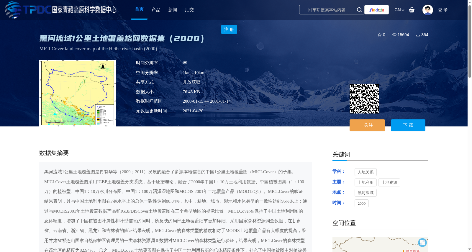
黑河流域1公里土地覆盖图是冉有华等(2009;2011)发展的融合了多源本地信息的中国1公里土地覆盖图(MICLCover)的子集。MICLCover土地覆盖图采用IGBP土地覆盖分类系统,基于证据理论,融合了2000年中国1:10万土地利用数据、中国植被图集(1:100万)的植被型、中国1:10万冰川分布图、中国1:100万沼泽湿地图和MODIS 2001年土地覆盖产品(MOD12Q1)。MICLCover的验证结果表明,其与中国土地利用图在7类水平上的总体一致性达到88.84%,其中,耕地、城市、湿地和水体类型的一致性达到95%以上;通过与MODIS2001年土地覆盖数据产品和IGBPDISCover土地覆盖图在三个典型地区的视觉比较,MICLCover在保持了中国土地利用图的总体精度,增加了中国植被图叶属性和叶型信息的同时,所反映的局部土地覆盖细节更加详细。采用国家森林资源调查数据,在甘肃省、云南省、浙江省、黑龙江和吉林省的验证结果表明,MICLCover的森林类型的精度相对于MODIS土地覆盖产品有大幅度的提高;采用甘肃省祁连山国家自然保护区管理局的一类森林资源调查数据对MICLCover的森林类型进行验证,结果表明,MICLCover的森林类型在该地区的精度为82.94%。
总之,MICLCover土地覆盖图在保持了中国土地利用数据的总体精度条件下,补充了中国植被图中对植被类型及植被季相的信息,更新的中国湿地图、中国冰川图最新信息,使得中国土地覆盖数据的精度得到大大提高,分类系统更加通用,该数据可为陆面过程模型提供更高精度的土地覆盖信息。
The 1-kilometer land cover map of the Heihe River Basin is a subset of the Chinese 1-kilometer land cover map (MICLCover) developed by Ran et al. (2009; 2011) by fusing multi-source local information. The MICLCover land cover map adopts the IGBP land cover classification system, and integrates the 2000 Chinese 1:100,000 land use dataset, vegetation types from the 1:1,000,000 Vegetation Atlas of China, the 1:100,000 glacier distribution map of China, the 1:1,000,000 marsh and wetland map of China, and the MODIS 2001 land cover product (MOD12Q1) based on evidence theory. Validation results of MICLCover show that its overall agreement with the Chinese land use map reaches 88.84% at the seven-category level, and the agreement for cropland, urban areas, wetlands and water bodies exceeds 95%. Through visual comparison with the MODIS 2001 land cover product and the IGBP DISCover land cover map in three typical regions, MICLCover not only retains the overall accuracy of the Chinese land use map and adds the leaf attribute and leaf type information from the Chinese vegetation map, but also reflects more detailed local land cover details. Validation using national forest inventory data in Gansu Province, Yunnan Province, Zhejiang Province, Heilongjiang Province and Jilin Province shows that the accuracy of forest types in MICLCover has been greatly improved compared to the MODIS land cover product. Further validation of the forest types in MICLCover using the first-class forest inventory data from the Administration of Qilian Mountain National Nature Reserve in Gansu Province shows that the accuracy of forest types in MICLCover in this region reaches 82.94%.
In summary, while retaining the overall accuracy of the Chinese land use data, MICLCover supplements the information on vegetation types and vegetation phenology in the Chinese vegetation map, and updates the latest information from the Chinese wetland map and Chinese glacier map, thereby greatly improving the accuracy of China's land cover data and making the classification system more universal. This dataset can provide higher-precision land cover information for land surface process models.
提供机构:
冉有华,李新
创建时间:
2013-07-28
搜集汇总
数据集介绍
背景与挑战
背景概述
该数据集是黑河流域2000年的1公里分辨率土地覆盖格网数据,基于多源信息融合方法(MICLCover)生成,采用IGBP分类系统,融合了土地利用、植被、冰川和湿地等本地数据。它在保持高总体精度(如耕地、城市等类型一致性超95%)的同时,增强了植被细节和局部覆盖信息,显著提高了森林类型精度,适用于陆面过程模型等研究。
以上内容由遇见数据集搜集并总结生成


