青藏高原活动层厚度数据集V1.0
收藏国家青藏高原科学数据中心2025-05-26 更新2025-06-07 收录
下载链接:
https://data.tpdc.ac.cn/zh-hans/data/210d4f77-c04e-4a59-8804-0158094716e0
下载链接
链接失效反馈官方服务:
资源简介:
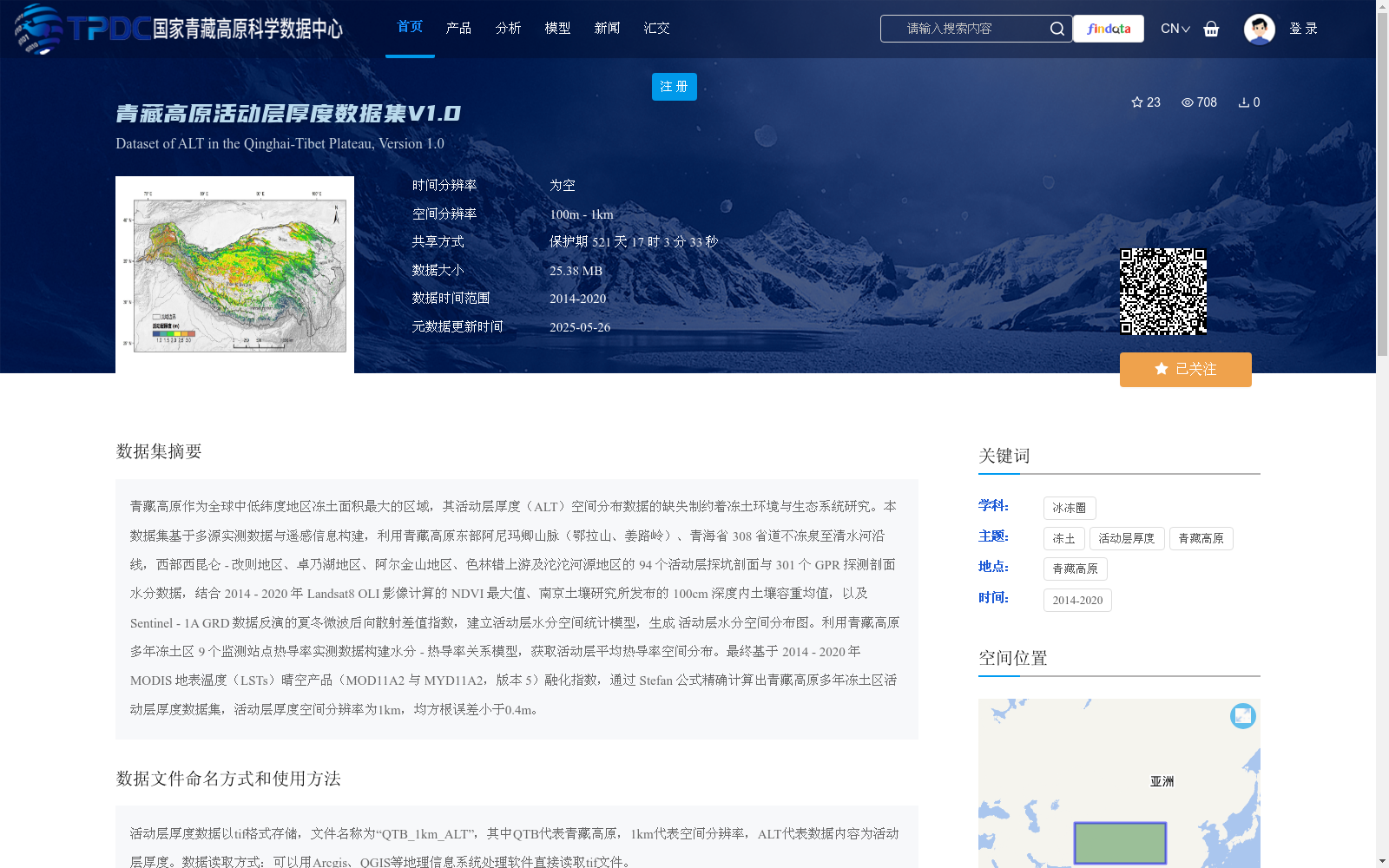
青藏高原作为全球中低纬度地区冻土面积最大的区域,其活动层厚度(ALT)空间分布数据的缺失制约着冻土环境与生态系统研究。本数据集基于多源实测数据与遥感信息构建,利用青藏高原东部阿尼玛卿山脉(鄂拉山、姜路岭)、青海省 308 省道不冻泉至清水河沿线,西部西昆仑 - 改则地区、卓乃湖地区、阿尔金山地区、色林错上游及沱沱河源地区的 94 个活动层探坑剖面与 301 个 GPR 探测剖面水分数据,结合 2014 - 2020 年 Landsat8 OLI 影像计算的 NDVI 最大值、南京土壤研究所发布的 100cm 深度内土壤容重均值,以及 Sentinel - 1A GRD 数据反演的夏冬微波后向散射差值指数,建立活动层水分空间统计模型,生成 活动层水分空间分布图。利用青藏高原多年冻土区 9 个监测站点热导率实测数据构建水分 - 热导率关系模型,获取活动层平均热导率空间分布。最终基于 2014 - 2020 年 MODIS 地表温度(LSTs)晴空产品(MOD11A2 与 MYD11A2,版本 5)融化指数,通过 Stefan 公式精确计算出青藏高原多年冻土区活动层厚度数据集,活动层厚度空间分辨率为1km,均方根误差小于0.4m。
The Qinghai-Tibet Plateau (QTP) boasts the largest permafrost area across the mid-low latitudes globally. The lack of spatial distribution data for active layer thickness (ALT) has restricted research on permafrost environments and ecosystems. This dataset was constructed based on multi-source in-situ measurement data and remote sensing information: moisture data from 94 active layer test pit profiles and 301 ground-penetrating radar (GPR) detection profiles, collected in the eastern A'nyêmaqên Mountains (Ela Mountain and Jiangluling) along the Budongquan-Qingshuihe section of Provincial Highway S308 in Qinghai Province, as well as in the western regions including West Kunlun-Gêrzê, Zonag Lake, Altun Mountains, upper Siling Co basin and the source region of the Tuotuo River, were integrated with the maximum NDVI calculated from Landsat 8 OLI images from 2014 to 2020, the mean soil bulk density within 0–100 cm depth released by the Nanjing Institute of Soil Science, and the summer-winter microwave backscattering difference index retrieved from Sentinel-1A GRD data to establish a spatial statistical model for active layer moisture and generate the spatial distribution map of active layer moisture. Then, using in-situ measured thermal conductivity data from 9 monitoring stations in the permafrost regions of the QTP, a moisture-thermal conductivity relationship model was built to obtain the spatial distribution of average active layer thermal conductivity. Finally, based on the melting index derived from MODIS land surface temperature (LSTs) clear-sky products (MOD11A2 and MYD11A2, Version 5) between 2014 and 2020, the active layer thickness dataset for the permafrost regions of the QTP was accurately calculated via the Stefan formula, with a spatial resolution of 1 km and a root mean square error (RMSE) of less than 0.4 m.
提供机构:
杜二计,赵林
创建时间:
2025-04-26
搜集汇总
数据集介绍
背景与挑战
背景概述
该数据集提供了2014-2020年青藏高原多年冻土区活动层厚度(ALT)的空间分布数据,旨在弥补该区域ALT数据缺失的局限。数据集基于多源实测剖面数据和遥感信息(如Landsat8、Sentinel-1A、MODIS)构建统计模型,并通过Stefan公式计算生成,空间分辨率为1km,精度较高(均方根误差小于0.4m)。数据以tif格式存储,适用于冻土环境与生态系统研究。
以上内容由遇见数据集搜集并总结生成


