黄土高原1km分辨率逐月平均气温数据集(2001-2014年
收藏国家地球系统科学数据中心2019-05-31 更新2024-03-04 收录
下载链接:
https://www.geodata.cn/data/datadetails.html?dataguid=192841920706821&docId=17148
下载链接
链接失效反馈官方服务:
资源简介:
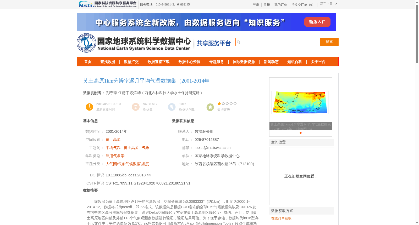
该数据为黄土高原地区逐月平均气温数据,空间分辨率为0.0083333°(约1km),时间为2000.1-2014.12。数据格式为netcdf,即.nc格式。该数据集是根据CRU发布的全球0.5°气候数据集以及CNERN发布的中国区高分辨率气候数据集,通过Delta空间降尺度方案在黄土高原地区降尺度生成的。并且,使用黄土高原地区内部及外部113个气象观测点数据进行验证,验证结果可信。为了便于存储,数据均为int16型存于nc文件中,平均温单位为 0.1℃。nc格式数据可用高版本ArcMap(Multidimension Tools)读取生成栅格数据或MATLAB直接读写。该数据集包括2000-2014年逐月平均气温数据,一共有168个图层,如果用ArcMap打开,在Dimension选项value处选择所需月份打开。
如需要提取单点、多点、子区域数据,请联系数据生成者彭守璋,可提供matlab代码。Email:szp@nwafu.edu.cn
This dataset contains monthly mean air temperature data for the Loess Plateau, with a spatial resolution of 0.0083333° (approximately 1 km), covering the period from January 2000 to December 2014. The data is stored in netCDF format (i.e., .nc files). This dataset was downscaled to the Loess Plateau using the Delta spatial downscaling method, based on the global 0.5° climate dataset released by CRU and the high-resolution climate dataset for China released by CNERN. Moreover, it was validated using data from 113 meteorological stations both inside and outside the Loess Plateau, and the validation results demonstrate its reliability. For efficient storage, all data are stored as int16 (16-bit integers) in the .nc files, with the unit of mean air temperature being 0.1℃. Data in netCDF format can be read to generate raster data using recent versions of ArcMap (via the Multidimension Tools) or directly read/written with MATLAB. This dataset includes monthly mean air temperature data from 2000 to 2014, totaling 168 layers. When opening it with ArcMap, select the desired month in the 'value' field of the Dimension option to load the corresponding data. If you need to extract data for single points, multiple points or sub-regions, please contact the dataset creator Peng Shouzhang. MATLAB code for extraction will be provided upon request. Email: szp@nwafu.edu.cn
提供机构:
西北农林科技大学水土保持研究所
创建时间:
2018-05-21
搜集汇总
数据集介绍
背景与挑战
背景概述
该数据集提供了黄土高原地区2000年1月至2014年12月的逐月平均气温数据,空间分辨率约为1公里,以netcdf格式存储,共包含168个图层。数据基于CRU和CNERN气候数据集通过Delta降尺度方法生成,并经过113个气象观测点验证,确保其准确性和可信度,适用于气候研究和区域分析。
以上内容由遇见数据集搜集并总结生成


