2000-2019年北极海冰区海冰融池覆盖度数据集
收藏地球大数据科学工程2024-03-04 收录
下载链接:
https://data.casearth.cn/sdo/detail/60e55fca819aec59a2af7080
下载链接
链接失效反馈官方服务:
资源简介:
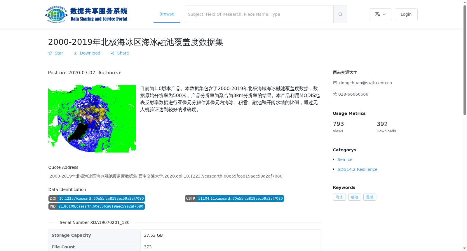
目前为1.0版本产品。本数据集包含了2000-2019年北极海域海冰融池覆盖度数据,数据原始分辨率为500米,产品分辨率为聚合为3km分辨率的结果。本产品利用MODIS地表反射率数据进行亚像元分解估算像元内海冰、积雪、融池和开阔水域的比例,通过无人机验证达到较好的准确度。
This dataset is currently at version 1.0. It contains sea ice melt pond coverage data over the Arctic Ocean from 2000 to 2019. The original spatial resolution of the raw data is 500 meters, and the product's final spatial resolution is aggregated to 3 km. This product uses MODIS surface reflectance data to perform sub-pixel decomposition, estimating the proportions of sea ice, snow, melt ponds, and open water within each pixel. Validation via unmanned aerial vehicles (UAVs) has demonstrated that this product achieves good accuracy.
提供机构:
西南交通大学
搜集汇总
数据集介绍
背景与挑战
背景概述
该数据集提供了2000-2019年北极海域海冰融池覆盖度的3km分辨率数据,基于MODIS地表反射率数据通过亚像元分解方法生成,并经过无人机验证确保准确性。
以上内容由遇见数据集搜集并总结生成


