2025年1月7日定日县地震震中位置数据
收藏国家青藏高原科学数据中心2025-01-09 更新2025-01-25 收录
下载链接:
https://data.tpdc.ac.cn/zh-hans/data/cf6ccf0a-6cda-4dee-aa8d-67e9a71b794d
下载链接
链接失效反馈官方服务:
资源简介:
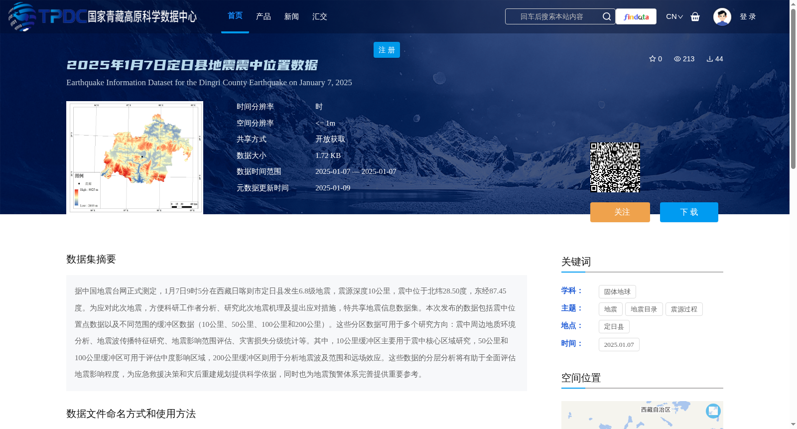
据中国地震台网正式测定,1月7日9时5分在西藏日喀则市定日县发生6.8级地震,震源深度10公里,震中位于北纬28.50度,东经87.45度。为应对此次地震,方便科研工作者分析、研究此次地震机理及提出应对措施,特共享地震信息数据集。本次发布的数据包括震中位置点数据以及不同范围的缓冲区数据(10公里、50公里、100公里和200公里)。这些分区数据可用于多个研究方向:震中周边地质环境分析、地震波传播特征研究、地震影响范围评估、灾害损失分级统计等。其中,10公里缓冲区主要用于震中核心区域研究,50公里和100公里缓冲区可用于评估中度影响区域,200公里缓冲区则用于分析地震波及范围和远场效应。这些数据的分层分析将有助于全面评估地震影响程度,为应急救援决策和灾后重建规划提供科学依据,同时也为地震预警体系完善提供重要参考。
Officially determined by the China Earthquake Networks Center, a Ms 6.8 earthquake struck Dinggyê County, Xigazê City, Tibet Autonomous Region at 09:05 on January 7, with a focal depth of 10 km, and the epicenter located at 28.50°N, 87.45°E. In response to this earthquake and to facilitate researchers' analysis and study of the earthquake mechanism and the formulation of response measures, this earthquake information dataset is hereby publicly shared. The dataset released this time includes the epicenter coordinate data and buffer zone datasets with four different radii: 10 km, 50 km, 100 km, and 200 km. These zoned datasets can be applied to multiple research directions, including analysis of the geological environment around the epicenter, study of seismic wave propagation characteristics, assessment of earthquake impact scope, graded statistics of disaster losses, and so on. Specifically, the 10 km buffer zone is mainly used for research on the core area around the epicenter; the 50 km and 100 km buffer zones can be used to assess moderately affected areas; and the 200 km buffer zone is employed to analyze the seismic wave propagation scope and far-field effects. Hierarchical analysis of these datasets will help comprehensively assess the extent of earthquake impacts, provide scientific basis for emergency rescue decision-making and post-disaster reconstruction planning, and also offer important references for the improvement of earthquake early warning systems.
提供机构:
高分辨率对地观测系统甘肃数据与应用中心
创建时间:
2025-01-09
搜集汇总
数据集介绍
背景与挑战
背景概述
该数据集包含2025年1月7日西藏定日县6.8级地震的震中位置及不同范围的缓冲区数据(10公里、50公里、100公里和200公里),适用于地震机理研究、影响范围评估和灾害损失统计等。数据以shp格式提供,需按规范引用。
以上内容由遇见数据集搜集并总结生成


