黄土高原1:100万典型小流域边界及水系图(2018年)
收藏国家地球系统科学数据中心2024-11-29 更新2024-11-30 收录
下载链接:
https://www.geodata.cn/data/datadetails.html?dataguid=23719796635378&docId=2102
下载链接
链接失效反馈官方服务:
资源简介:
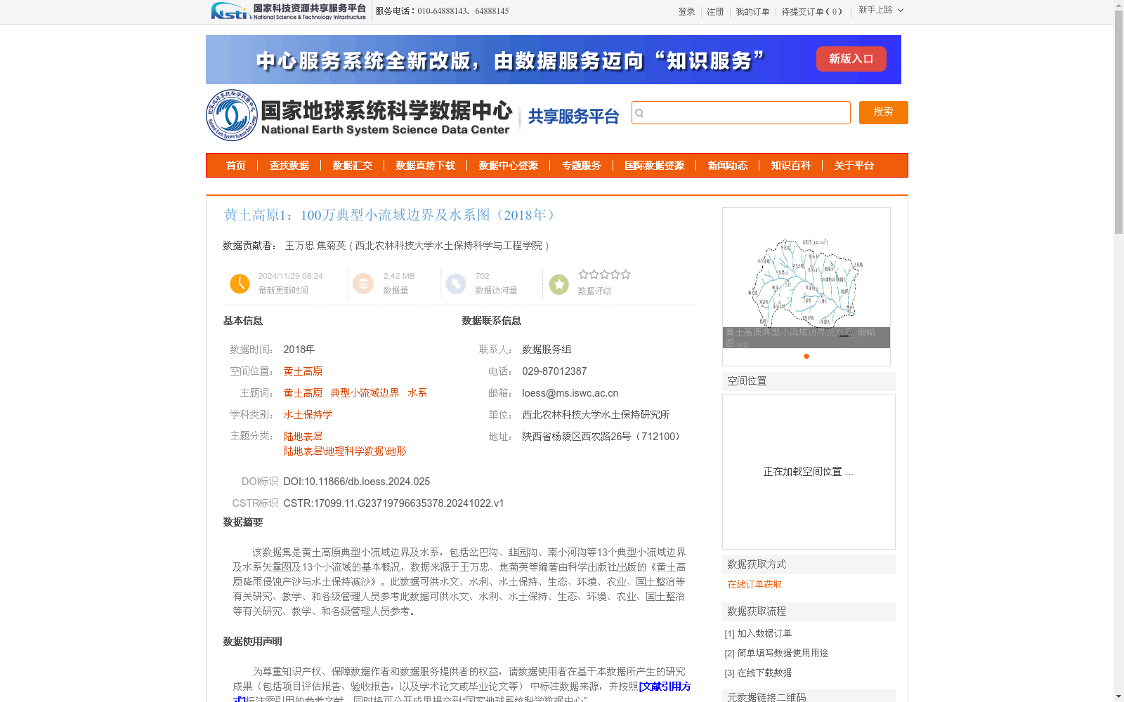
该数据集是黄土高原典型小流域边界及水系,包括岔巴沟、韭园沟、南小河沟等13个典型小流域边界及水系矢量图及13个小流域的基本概况,数据来源于王万忠、焦菊英等编著由科学出版社出版的《黄土高原降雨侵蚀产沙与水土保持减沙》。此数据可供水文、水利、水土保持、生态、环境、农业、国土整治等有关研究、教学、和各级管理人员参考此数据可供水文、水利、水土保持、生态、环境、农业、国土整治等有关研究、教学、和各级管理人员参考。
This dataset contains the boundaries and water systems of typical small watersheds on the Loess Plateau. It includes vector maps of the boundaries and water systems of 13 typical small watersheds including Chabagou, Jiuyuangou, Nanxiaohegou and others, as well as the basic profiles of these 13 small watersheds. The data is sourced from the monograph *Rainfall Erosion, Sediment Yield and Sediment Reduction via Soil and Water Conservation on the Loess Plateau*, compiled by Wang Wanzhong, Jiao Juying and other scholars, and published by Science Press. This dataset can be used as a reference for relevant researchers, educators and managers at all levels working in the fields of hydrology, water conservancy, soil and water conservation, ecology, environmental protection, agriculture, land consolidation and other related disciplines.
提供机构:
西北农林科技大学水土保持科学与工程学院
创建时间:
2024-10-22
搜集汇总
数据集介绍
背景与挑战
背景概述
该数据集是2018年黄土高原地区13个典型小流域(如岔巴沟、韭园沟、南小河沟)的边界及水系矢量图,比例尺为1:100万,来源于《黄土高原降雨侵蚀产沙与水土保持减沙》一书的数字化成果,空间投影为GCS_WGS_1984。数据集专注于水土保持学领域,提供小流域基本概况,适用于水文、水利、生态、环境、农业等相关研究和教学,数据质量规范且精度可靠。
以上内容由遇见数据集搜集并总结生成


