东帕米尔-南天山15米分辨率ASTER遥感影像(2010)
收藏国家青藏高原科学数据中心2025-04-07 更新2025-04-12 收录
下载链接:
https://data.tpdc.ac.cn/zh-hans/data/31beea44-d8d1-4245-9786-76437a2ed132
下载链接
链接失效反馈官方服务:
资源简介:
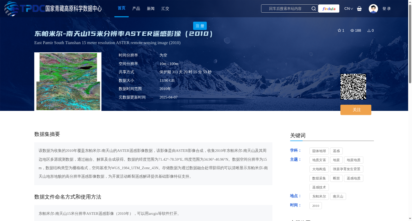
该数据为收集的2010年覆盖东帕米尔-南天山的ASTER遥感影像数据,该影像是由ASTER影像合成,收集2010年东帕米尔-南天山及其周边地区多源观测数据,通过融合、解算及合成获得。数据的经度范围为71.42°-78.59°E, 纬度范围为34.96°-40.96°N。数据空间分辨率为15 m,数据结构类型为栅格格式,空间基准为WGS_1984_UTM_Zone_43N。存储数据为通过数据融合处理获得的可以清晰显示东帕米尔-南天山地形地貌的高分辨率遥感影像数据,为开展活动断裂遥感解译提供基础影像特征支持。
This dataset comprises ASTER remote sensing imagery collected in 2010 covering the Eastern Pamir-Southern Tianshan region. The imagery was synthesized using multi-source observation data gathered in 2010 for the Eastern Pamir-Southern Tianshan and its surrounding areas, which was processed via fusion, solution and synthesis steps. The spatial coverage of the dataset ranges from 71.42°E to 78.59°E in longitude and 34.96°N to 40.96°N in latitude. It has a spatial resolution of 15 m, adopts a raster data structure, and uses the WGS_1984_UTM_Zone_43N spatial reference system. The stored high-resolution remote sensing image data, obtained through data fusion processing, clearly displays the topography and geomorphology of the Eastern Pamir-Southern Tianshan region, providing fundamental image feature support for remote sensing interpretation of active faults.
提供机构:
陈杰
创建时间:
2025-01-03
搜集汇总
数据集介绍
背景与挑战
背景概述
该数据集是2010年覆盖东帕米尔-南天山地区的15米分辨率ASTER遥感影像,数据格式为栅格,空间基准为WGS_1984_UTM_Zone_43N,旨在通过高分辨率影像支持活动断裂的遥感解译研究。
以上内容由遇见数据集搜集并总结生成


