TINITALY, a digital elevation model of Italy with a 10 meters cell size, version 1.1
收藏DataCite Commons2025-04-09 更新2024-07-13 收录
下载链接:
https://tinitaly.pi.ingv.it/
下载链接
链接失效反馈官方服务:
资源简介:
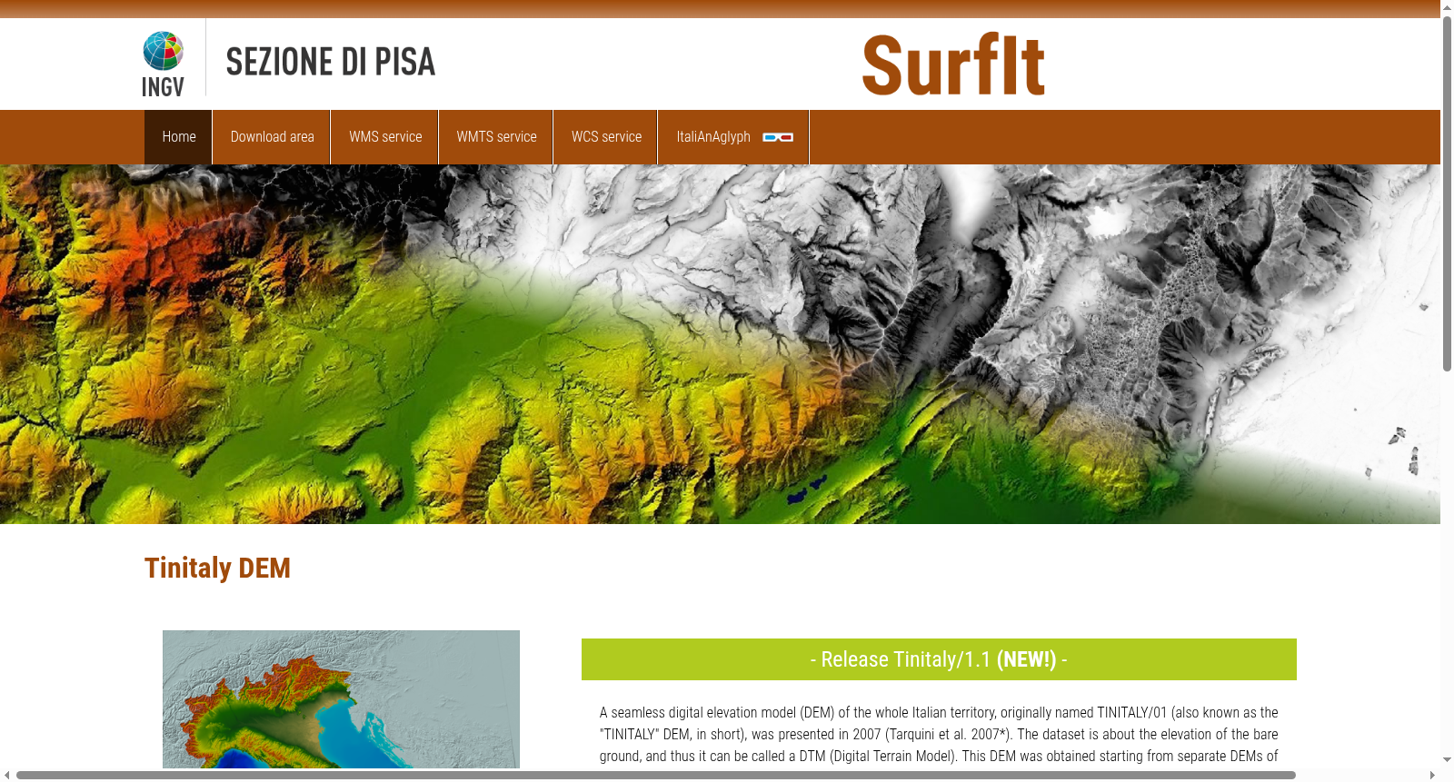
The dataset is a 10 m-resolution DEM in grid format covering the whole Italian territory. The DEM is obtained by interpolating the original DEM in Triangular Irregular Network (TIN) format. The TIN version benefited from the systematic application of the DEST algorithm. The projection is UTM, the World Geodetic System 1984 (WGS 84). To provide the dataset as a single seamless DEM, the sole zone 32 N was selected, although about half of Italy belongs to zone 33 N. The database is arranged in 193 square tiles having approximately 50 km side. In addition to the DEM (TINItaly_DEM), the OGC links supply the following DEM-derived products: (i) shaded relief map (TINItaly_Hillshade); (ii) slope map (TINItaly_Slope); (iii) Sky view Factor (SVF) map using 2.5σ clipping as technique for image enhancement (TINItaly_SVF_2d5); (iv) SVF map using equal area equalization as technique for image enhancement (TINItaly_SVF_EA); (v) openness down map using equal area equalization as technique for image enhancement (TINItaly_OD); and (vi) Hue-Saturation-Value (HSV) composition image with slope (2.5σ clipping) as saturation and SVF (2.5σ clipping) as value, according to RRIM (Red Relief Image Maps) style maps (TINItaly_HSV); (vii) slope map using 2.5σ clipping as technique for image enhancement (TINItaly_Slope_2d5). For more information about the generation of the DEM-derived products refer to Favalli and Fornaciai (2017) - https://doi.org/10.1016/j.geomorph.2017.02.029.
本数据集为覆盖意大利全境的网格格式10米分辨率数字高程模型(Digital Elevation Model, DEM)。该DEM由不规则三角网(Triangulated Irregular Network, TIN)格式的原始DEM插值生成。此TIN格式数据集经系统性应用DEST算法优化处理。其投影采用通用横轴墨卡托投影(Universal Transverse Mercator, UTM),大地基准为1984年世界大地坐标系(World Geodetic System 1984, WGS 84)。为将数据集整合为单一无缝DEM,仅选用了32N投影带,尽管意大利约有一半领土隶属于33N投影带。该数据集以193幅边长约50千米的方形瓦片进行组织存储。
除基础DEM产品(TINItaly_DEM)外,开放地理空间联盟(Open Geospatial Consortium, OGC)提供的链接可获取以下DEM衍生产品:(i) 阴影晕渲图(TINItaly_Hillshade);(ii) 坡度图(TINItaly_Slope);(iii) 采用2.5σ裁剪作为图像增强技术的天空可视因子(Sky view Factor, SVF)图(TINItaly_SVF_2d5);(iv) 采用等面积均衡作为图像增强技术的天空可视因子图(TINItaly_SVF_EA);(v) 采用等面积均衡作为图像增强技术的下视开阔度图(TINItaly_OD);(vi) 遵循红色晕渲影像图(Red Relief Image Maps, RRIM)风格的合成影像:以坡度(2.5σ裁剪)作为饱和度通道、以天空可视因子(2.5σ裁剪)作为明度通道的色相-饱和度-明度(Hue-Saturation-Value, HSV)合成图(TINItaly_HSV);(vii) 采用2.5σ裁剪作为图像增强技术的坡度图(TINItaly_Slope_2d5)。
有关上述DEM衍生产品的生成细节,可参考Favalli与Fornaciai(2017)的研究文献——https://doi.org/10.1016/j.geomorph.2017.02.029。
提供机构:
Istituto Nazionale di Geofisica e Vulcanologia (INGV)
创建时间:
2023-01-17
搜集汇总
数据集介绍
背景与挑战
背景概述
TINITALY是意大利全境10米分辨率的数字高程模型数据集,最新1.1版本修正了之前的不准确性并新增了多种DEM衍生产品。数据采用UTM WGS 84投影系统和GeoTIFF格式,遵循CC BY 4.0许可协议。
以上内容由遇见数据集搜集并总结生成


