祁连山国家自然保护区野生动物红外立体相机数据集(2020.08)
收藏国家青藏高原科学数据中心2021-11-16 更新2024-03-01 收录
下载链接:
https://data.tpdc.ac.cn/zh-hans/data/1cc70c99-4654-4a6a-96be-983f408adb71
下载链接
链接失效反馈官方服务:
资源简介:
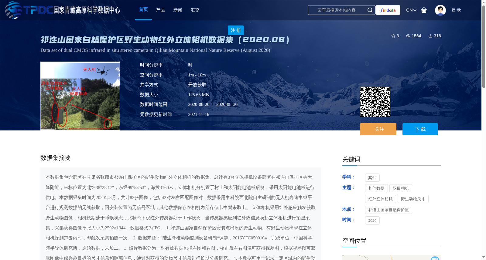
本数据集包含部署在甘肃省张掖市祁连山保护区的野生动物红外立体相机的数据集。总计有3台立体相机设备部署在祁连山保护区寺大隆附近,坐标位置为北纬38°28′17″,东经99°53′53″,海拔3160米,立体相机分别置于树上和太阳能电池板后侧,采用太阳能电池板进行供电。本数据采集时间为2020年8月,共计82张图像,包括42对左右匹配图像对,数据采用中科院西北院自主研制的无人机高速中继平台进行观测数据的无线获取,因安装位置为无信号区域,其他数据保存在相机内部存储卡中暂未取出。
立体相机采用红外感应触发获取野生动物图像,相机长期处于睡眠状态,此状态下仅红外传感器处于工作状态,当传感器感应到红外热信息唤起立体相机进行拍照采集,采集获得图像单张大小为2592×1944,数据格式为JPG。
1. 祁连山国家自然保护区安装点出没的野生动物。有野生动物出现在立体相机探测范围内时,即触发采集拍照一次。
2. 数据来源:"陆生脊椎动物监测设备研制“课题,2016YFC0500104,完成单位:中国科学院半导体研究所,原始数据,未加工。
3. 照片数据分为一对有效数据包括左图和右图,校正后左右图像可获得视差图,根据视差图可获取图像中感兴趣目标的尺寸信息和距离信息,通过对获得的动物尺寸信息进行长期分析研究。
4. 本数据可用于记录一定区域内的野生动物种群数量和体型大小,可建立真实野生动物体型数据库,获取不同区域、年龄和性别下的动物体型数据信息,为野生动物研究提供支撑数据。
This dataset consists of data collected by wildlife infrared stereo cameras deployed in the Qilian Mountain National Nature Reserve, Zhangye City, Gansu Province.
A total of 3 stereo camera units were deployed near Sidalong in the reserve, at coordinates 38°28′17″ N, 99°53′53″ E, with an altitude of 3160 m. The cameras were installed on trees and behind solar panels respectively, and powered by solar panels. The data was collected in August 2020, totaling 82 images including 42 pairs of matched left-right images. Observation data was wirelessly acquired via a high-speed unmanned aerial vehicle (UAV) relay platform independently developed by the Northwest Institute of the Chinese Academy of Sciences. Due to the lack of signal coverage at the deployment site, other remaining data has not been retrieved from the camera's internal memory card yet.
The stereo cameras capture wildlife images via infrared induction triggering. The cameras remain in a low-power sleep mode for long periods, during which only the infrared sensor is active. When the sensor detects infrared thermal information, it wakes up the stereo cameras to capture images. Each captured image has a resolution of 2592×1944 and is stored in JPG format.
1. Wildlife spotted at the deployment site in Qilian Mountain National Nature Reserve: A single capture is triggered whenever a wild animal enters the detection range of the stereo cameras.
2. Data Source: Research project "Development of Terrestrial Vertebrate Monitoring Equipment" (Grant No. 2016YFC0500104), Completing Institution: Institute of Semiconductors, Chinese Academy of Sciences. Raw unprocessed data.
3. Photo data: Each valid data pair consists of a left image and a right image. After calibration, a disparity map can be generated from the left and right images. The disparity map enables acquisition of size and distance information for targets of interest in the images, allowing long-term analytical research on the size information of captured animals.
4. Applications of this dataset: It can be used to record wildlife population size and body size within a designated area, establish a real-world wildlife body size database, and obtain animal body size data across different regions, age groups and genders, providing supporting data for wildlife research.
提供机构:
周燕
创建时间:
2021-11-09
搜集汇总
数据集介绍
背景与挑战
背景概述
该数据集是2020年8月在祁连山国家自然保护区部署的3台红外立体相机采集的野生动物图像数据,包含82张图像(42对左右匹配图像对),数据通过红外感应触发获取,用于记录野生动物种群数量和体型大小,支持建立真实野生动物体型数据库,为生态研究提供支撑。数据具有开放获取特性,采集时间集中、空间位置精确,适用于野生动物监测和分析研究。
以上内容由遇见数据集搜集并总结生成


