洞庭湖区堤垸1949-2013空间分布数据集
收藏地球大数据科学工程2018-06-12 更新2025-12-20 收录
下载链接:
https://data.casearth.cn/dataset/653887ec819aec0f26fa56d8
下载链接
链接失效反馈官方服务:
资源简介:
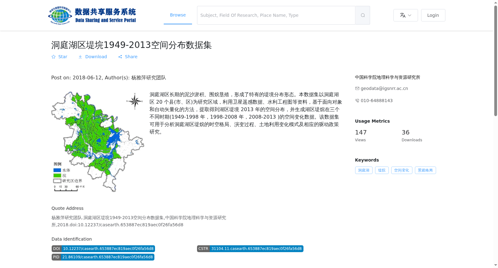
洞庭湖区长期的泥沙淤积、围烷垦殖,形成了特有的堤境分布形态。本数据集以洞庭湖区 20 个县(市、区)为研究区域,利用卫星遥感数据、水利工程图等资料,基于面向对象和自动矢量化的方法,提取得到湖区堤境 2013 年的空间分布,并生成湖区堤烷在三个不同时期(1949-1998 年,1998-2008 年,2008-2013 )的空间变化数据。该数据集可用于分析洞庭湖区堤烷的时空格局、演变过程、土地利用变化模式及相应的驱动政策研究。
Long-term sediment deposition and polder enclosure reclamation in the Dongting Lake region have formed the unique distribution pattern of levee-enclosed polders. This dataset takes 20 counties (cities, districts) in the Dongting Lake region as the study area. Leveraging satellite remote sensing data, hydraulic engineering maps and other relevant materials, and adopting object-oriented and automatic vectorization methods, the spatial distribution of levee-enclosed polders in the lake region in 2013 was extracted, and spatial change data of these polders during three distinct periods (1949–1998, 1998–2008, and 2008–2013) were generated. This dataset can be used to analyze the spatiotemporal patterns, evolutionary processes and land use change patterns of levee-enclosed polders in the Dongting Lake region, and conduct research on their corresponding driving policies.
创建时间:
2023-06-01
搜集汇总
数据集介绍
背景与挑战
背景概述
本数据集提供了洞庭湖区堤垸1949年至2013年的空间分布和变化数据,基于卫星遥感和水利工程资料,通过面向对象方法提取,涵盖20个县(市、区)的堤垸形态和三个时期的时空演变。数据为矢量格式(shp),适用于景观格局、土地利用变化及政策驱动研究,支持地理空间分析。
以上内容由遇见数据集搜集并总结生成


