1979-1985年第二次全国县级土地利用概查数据西部地区土地利用平衡(分省)统计表
收藏国家林业和草原科学数据中心2004-02-23 更新2024-03-06 收录
下载链接:
https://www.forestdata.cn/dataDetail.html?id=CSTR:17575.11.0120020909128.000004.V1
下载链接
链接失效反馈官方服务:
资源简介:
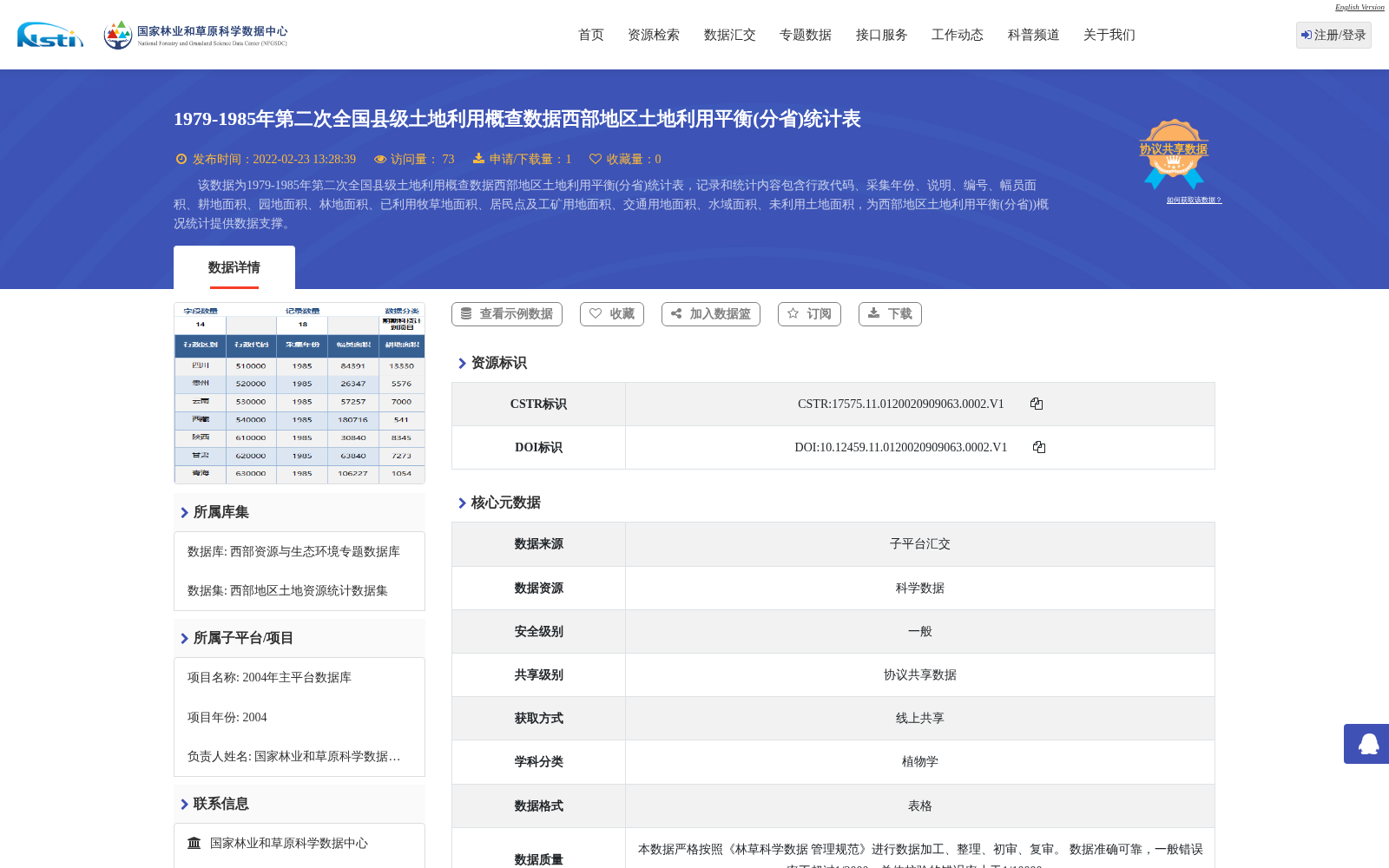
该数据为1979-1985年第二次全国县级土地利用概查数据西部地区土地利用平衡(分省)统计表,记录和统计内容包含行政代码、采集年份、说明、编号、幅员面积、耕地面积、园地面积、林地面积、已利用牧草地面积、居民点及工矿用地面积、交通用地面积、水域面积、未利用土地面积,为西部地区土地利用平衡(分省))概况统计提供数据支撑。
This dataset is the statistical table of land use balance in Western China (by province) from the Second National General Survey on County-level Land Use, spanning the period from 1979 to 1985. The recorded and statistically compiled contents include administrative code, data collection year, notes, serial number, total territorial area, arable land area, garden plot area, woodland area, utilized pasture land area, residential, industrial and mining land area, transportation land area, water area, and unused land area. This dataset provides data support for the general statistical overview of land use balance in Western China (by province).
提供机构:
国家林业和草原科学数据中心
创建时间:
2004-02-23
搜集汇总
数据集介绍
背景与挑战
背景概述
该数据集为1979-1985年第二次全国县级土地利用概查中西部地区土地利用平衡的分省统计表,包含耕地、林地、水域等多项面积指标,旨在为西部地区分省土地利用概况提供数据支撑。
以上内容由遇见数据集搜集并总结生成


