中国北方温性草地地上生物量数据集(1993-2019)
收藏国家青藏高原科学数据中心2022-04-18 更新2024-03-01 收录
下载链接:
https://data.tpdc.ac.cn/zh-hans/data/cc72d8d2-0f2a-4ad0-88f4-b230333b3861
下载链接
链接失效反馈官方服务:
资源简介:
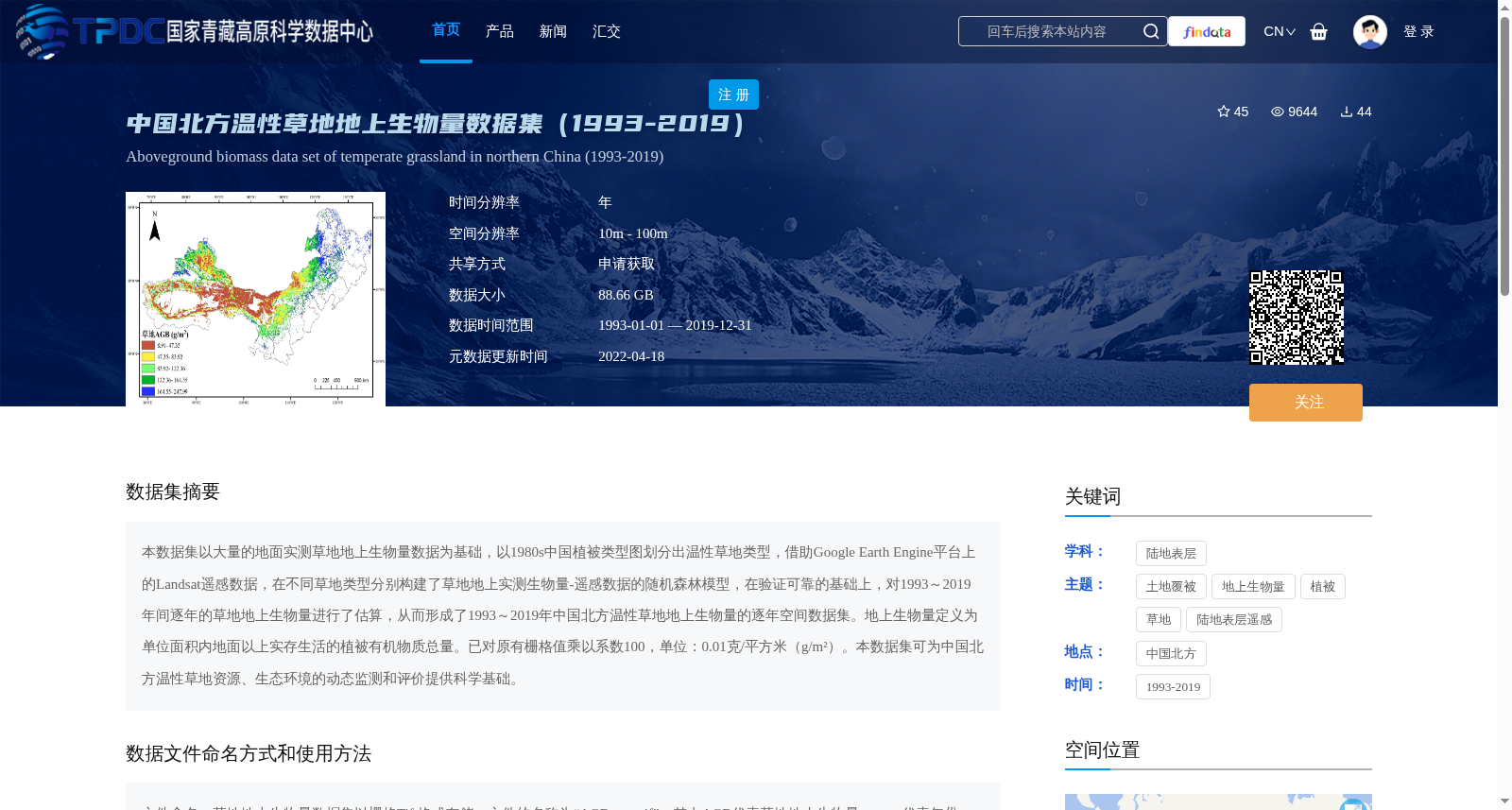
本数据集以大量的地面实测草地地上生物量数据为基础,以1980s中国植被类型图划分出温性草地类型,借助Google Earth Engine平台上的Landsat遥感数据,在不同草地类型分别构建了草地地上实测生物量-遥感数据的随机森林模型,在验证可靠的基础上,对1993~2019年间逐年的草地地上生物量进行了估算,从而形成了1993~2019年中国北方温性草地地上生物量的逐年空间数据集。地上生物量定义为单位面积内地面以上实存生活的植被有机物质总量。已对原有栅格值乘以系数100,单位:0.01克/平方米(g/m²)。本数据集可为中国北方温性草地资源、生态环境的动态监测和评价提供科学基础。
This dataset is developed based on a large amount of field-measured aboveground biomass data of grasslands. It classifies temperate grassland types using the 1980s Chinese vegetation type map, and leverages Landsat remote sensing data on the Google Earth Engine platform. Random forest models linking field-measured grassland aboveground biomass and remote sensing data were constructed separately for each grassland type. After rigorous validation, annual grassland aboveground biomass from 1993 to 2019 was estimated, thereby forming an annual spatial dataset of aboveground biomass for temperate grasslands in northern China during 1993–2019.
Aboveground biomass is defined as the total amount of viable organic matter of vegetation above the ground per unit area. The original raster values have been multiplied by a factor of 100, with the unit of 0.01 gram per square meter (g/m²). This dataset can provide a scientific foundation for the dynamic monitoring and evaluation of temperate grassland resources and ecological environment in northern China.
提供机构:
张娜
创建时间:
2021-01-22
搜集汇总
数据集介绍
背景与挑战
背景概述
该数据集是中国北方温性草地1993年至2019年的逐年地上生物量空间数据集,基于地面实测和Landsat遥感数据,通过随机森林模型估算生成,空间分辨率为10米至100米,数据单位为0.01克/平方米,主要用于草地资源动态监测和生态环境评价。
以上内容由遇见数据集搜集并总结生成


