2003-2022年黄河流域TCI、VCI、VHI、TVDI逐年1km分辨率数据集
收藏国家生态科学数据中心2024-05-31 收录
下载链接:
http://www.nesdc.org.cn/sdo/detail?id=663f49c37e28172539d2b8eb
下载链接
链接失效反馈官方服务:
资源简介:
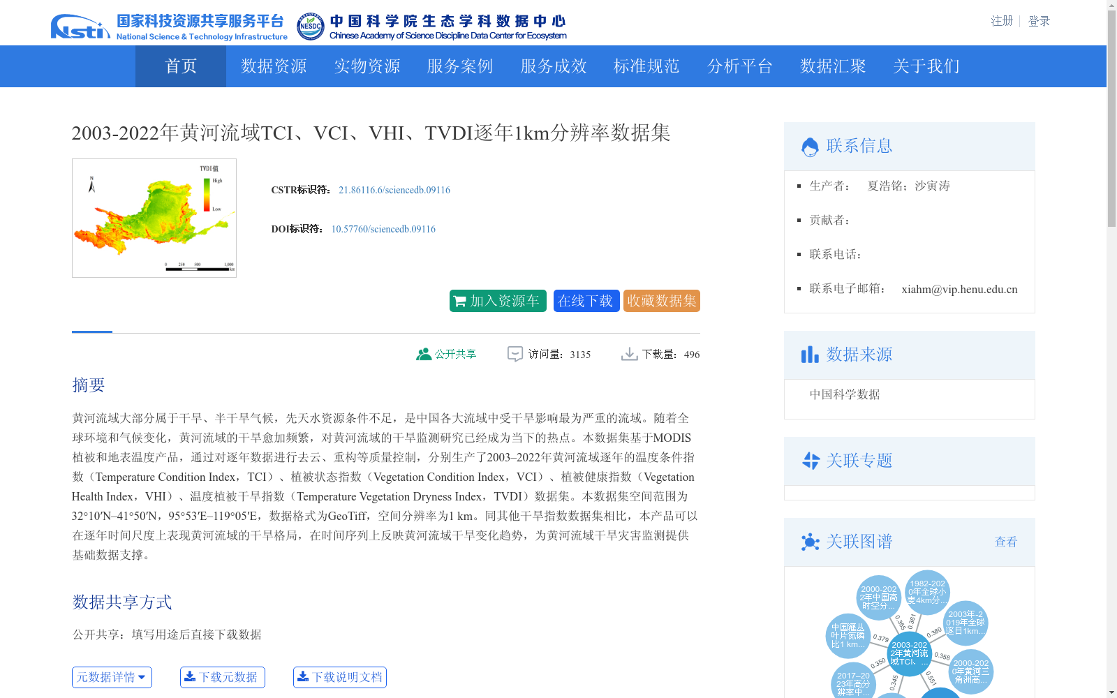
黄河流域大部分属于干旱、半干旱气候,先天水资源条件不足,是中国各大流域中受干旱影响最为严重的流域。随着全球环境和气候变化,黄河流域的干旱愈加频繁,对黄河流域的干旱监测研究已经成为当下的热点。本数据集基于MODIS植被和地表温度产品,通过对逐年数据进行去云、重构等质量控制,分别生产了2003–2022年黄河流域逐年的温度条件指数(Temperature Condition Index,TCI)、植被状态指数(Vegetation Condition Index,VCI)、植被健康指数(Vegetation Health Index,VHI)、温度植被干旱指数(Temperature Vegetation Dryness Index,TVDI)数据集。本数据集空间范围为32°10′N–41°50′N,95°53′E–119°05′E,数据格式为GeoTiff,空间分辨率为1 km。同其他干旱指数数据集相比,本产品可以在逐年时间尺度上表现黄河流域的干旱格局,在时间序列上反映黄河流域干旱变化趋势,为黄河流域干旱灾害监测提供基础数据支撑。
Most of the Yellow River Basin is situated in arid and semi-arid climates, with inherently insufficient water resources, making it the most severely drought-affected major basin in China. Against the backdrop of global environmental and climatic changes, drought events in the Yellow River Basin have grown increasingly frequent, rendering drought monitoring and research on the Yellow River Basin a current research hotspot. This dataset is developed based on MODIS vegetation and land surface temperature products. Through quality control procedures including cloud removal and data reconstruction for annual datasets, it generates annual datasets of four key drought-related indices for the Yellow River Basin spanning 2003 to 2022: Temperature Condition Index (TCI), Vegetation Condition Index (VCI), Vegetation Health Index (VHI), and Temperature Vegetation Dryness Index (TVDI). The spatial coverage of this dataset ranges from 32°10′N to 41°50′N and 95°53′E to 119°05′E, with a data format of GeoTiff and a spatial resolution of 1 km. Compared with other existing drought index datasets, this product can characterize the drought patterns of the Yellow River Basin on an annual time scale and reveal the long-term drought change trends of the basin via time series analysis, providing fundamental data support for drought disaster monitoring in the Yellow River Basin.
创建时间:
2023-09-12
搜集汇总
数据集介绍
背景与挑战
背景概述
本数据集包含2003-2022年黄河流域逐年1km分辨率的TCI、VCI、VHI和TVDI数据,适用于干旱监测和气候变化研究。数据格式为GeoTiff,覆盖黄河流域(32°10′N–41°50′N,95°53′E–119°05′E)。
以上内容由遇见数据集搜集并总结生成


