A dataset of UAV multispectral images for banana Fusarium wilt survey
收藏Mendeley Data2023-06-08 更新2024-06-27 收录
下载链接:
https://www.doi.org/10.57760/sciencedb.07000
下载链接
链接失效反馈官方服务:
资源简介:
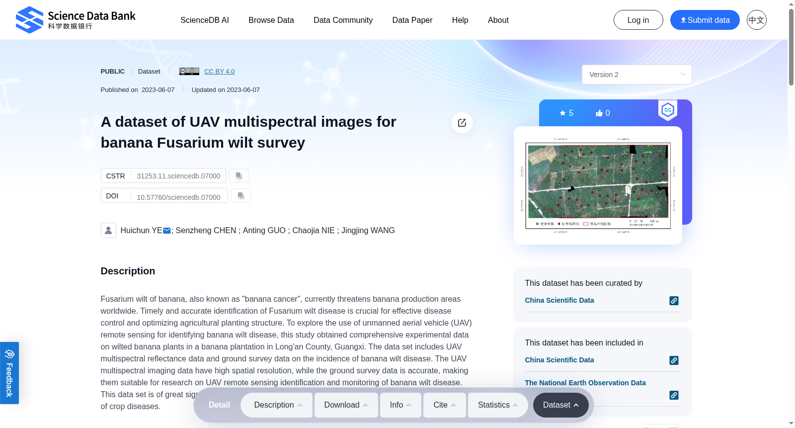
Fusarium wilt of banana, also known as "banana cancer", currently threatens banana production areas worldwide. Timely and accurate identification of Fusarium wilt disease is crucial for effective disease control and optimizing agricultural planting structure. To explore the use of unmanned aerial vehicle (UAV) remote sensing for identifying banana wilt disease, this study obtained comprehensive experimental data on wilted banana plants in a banana plantation in Long'an County, Guangxi. The data set includes UAV multispectral reflectance data and ground survey data on the incidence of banana wilt disease. The UAV multispectral imaging data have high spatial resolution, while the ground survey data is accurate, making them suitable for research on UAV remote sensing identification and monitoring of banana wilt disease. This data set is of great significance for promoting research and application of remote sensing monitoring of crop diseases.
香蕉枯萎病(Fusarium wilt of banana)俗称“香蕉癌症”,当前已对全球各香蕉产区造成严重威胁。及时且精准地识别香蕉枯萎病,是开展高效病害防控、优化农业种植结构的核心前提。为探究无人机(unmanned aerial vehicle, UAV)遥感技术在香蕉枯萎病识别中的应用潜力,本研究于广西隆安县某香蕉种植园采集了蕉株枯萎病相关的综合试验数据集。该数据集涵盖无人机多光谱反射率数据与香蕉枯萎病发病情况的地面调查数据两类内容。其中,无人机多光谱成像数据具备较高空间分辨率,地面调查数据则具有精准可靠的优势,二者均适用于香蕉枯萎病的无人机遥感识别与监测相关研究。本数据集对于推动作物病害遥感监测领域的研究与应用具有重要意义。
创建时间:
2023-06-08
搜集汇总
数据集介绍
背景与挑战
背景概述
该数据集是一个用于香蕉枯萎病调查的无人机多光谱影像集合,包含高空间分辨率的无人机多光谱反射率数据和准确的地面病害发生率调查数据。它旨在支持无人机遥感技术在作物病害识别和监测方面的研究,对促进农业病害遥感监测的应用具有重要意义。
以上内容由遇见数据集搜集并总结生成


