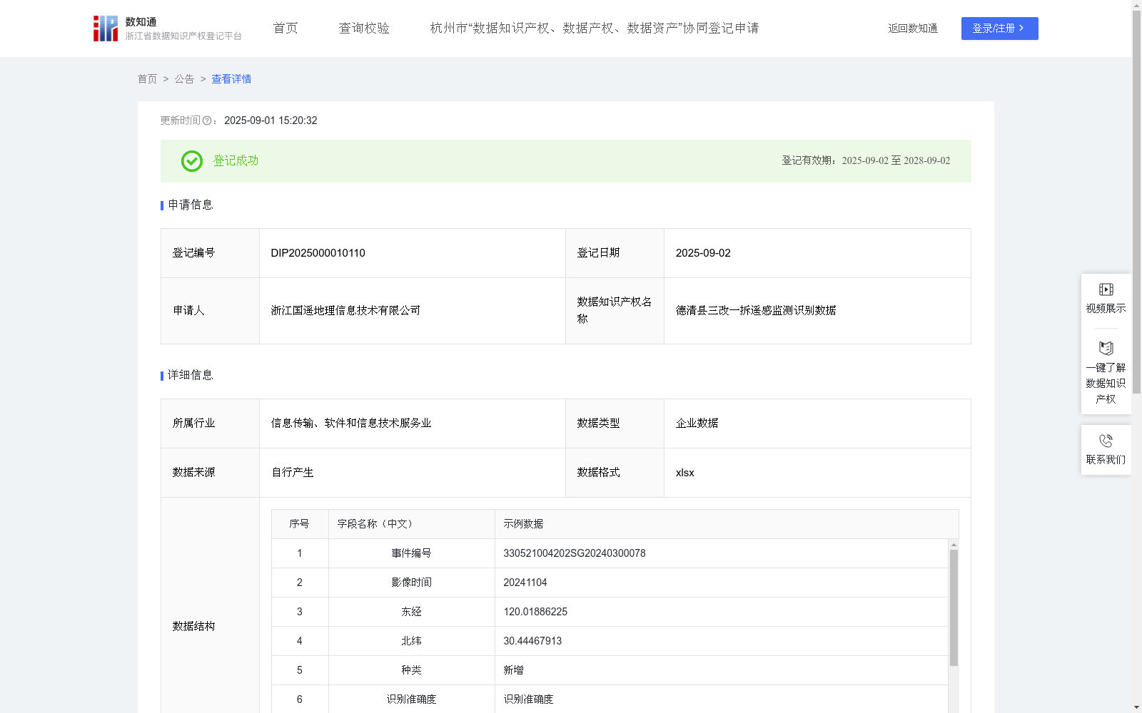
德清县三改一拆遥感监测识别数据
收藏资源简介:
用于实现对德清县三改一拆遥感监测中问题点位的高效精准识别,包括建筑物新增、翻建等建筑物发生变化的现象。自动识别问题点位的坐标,便于确定需要进行实地处理的位置。自动识别点位问题类型,精准发现建筑物新增与翻建。为后续的人员管理与问题派发提供方便,有利于网格员及时掌握自己管理区域的情况。解决了网格员在传统人工巡查中难以发现问题,容易忽略问题,巡查范围太大,隐蔽地段、偏远地区与恶劣环境中不易巡查等问题。将系统识别出的问题点位派发给网格员,使网格员有依据、有目标的实地确认,极大的提高了发现问题的效率,节约人员时间与人工成本,避免网格员出现无效的巡查。基于无人机航拍采集的三改一拆遥感影像数据,通过YOLO算法进行实时目标检测。首先将单元神经网络应用于2024年9月的遥感影像,将图像分割成19x19的单元格,每个单元神经网络负责预测K个单元格。预测每个区域的概率,所有单元格上具有最大概率的类被选择并分配给特定的网格单元,生成预测点坐标(x,y),坐标系为CGCS2000,坐标为东经、北纬。 在预测类概率后,进行NMS运算,来消除不必要的锚点。算法识别下一个最高类别概率的边界框,并进行相同的运算过程,直到剩下所有不同的边界框。算法输出所需的要素,并显示各个类的边界框的细节。 抽取部分样本进行识别准确度验证,小于0.6视为识别错误,显示为FALSE;一般样本的识别准确度在0.8至1之间,大于0.6视为识别正确,显示为TRUE。通过判断结果正确或错误来纳入或排除数据,将识别正确的点位进行三改一拆问题类型划分,包括建筑物翻建与建筑物新增问题。最后将纳入的点位坐标、问题类型等信息自动上传至三改一拆智能监管平台,获得三改一拆遥感监测识别数据。
This dataset is developed for efficient and accurate recognition of problem locations in the remote sensing monitoring of Three Renovations and One Demolition in Deqing County, covering building changes such as new constructions and reconstructions. It automatically identifies the coordinates of problem locations to facilitate determining positions requiring on-site handling, and recognizes the problem types of the locations to accurately detect new building constructions and reconstructions. It provides convenience for subsequent personnel management and task assignment, enabling grid staff to timely grasp the situation of their managed areas. It resolves the pain points of grid staff in traditional manual patrols, including difficulty in detecting problems, proneness to overlooking issues, overly large patrol scope, and challenges in patrolling hidden areas, remote regions and harsh environments. By assigning the system-identified problem locations to grid staff, it allows them to conduct on-site confirmation with clear basis and targets, greatly improving the efficiency of problem detection, saving personnel time and labor costs, and avoiding ineffective patrols. This solution relies on remote sensing image data for Three Renovations and One Demolition collected via UAV aerial photography, and implements real-time object detection through the YOLO algorithm. First, the grid neural network is applied to the remote sensing images from September 2024, which are split into 19×19 grid cells. Each grid cell is responsible for predicting K bounding boxes. The probability of each region is predicted, and the class with the highest probability across all grid cells is selected and assigned to the specific grid cell, generating the predicted point coordinates (x, y) in the CGCS2000 coordinate system (east longitude and north latitude). After predicting the class probabilities, Non-Maximum Suppression (NMS) operation is performed to eliminate redundant anchor boxes. The algorithm identifies the bounding box with the next highest class probability and repeats the same process until all distinct bounding boxes remain. The algorithm outputs the required features and displays the details of the bounding boxes for each class. Partial samples are extracted for recognition accuracy verification: a score lower than 0.6 is regarded as a recognition error and marked as FALSE; the recognition accuracy of general samples ranges from 0.8 to 1, and a score higher than 0.6 is regarded as a correct recognition and marked as TRUE. Data is included or excluded based on whether the recognition result is correct or not. The correctly recognized locations are classified into problem types under Three Renovations and One Demolition, including building reconstruction and new building construction issues. Finally, information such as the coordinates of the included locations and their problem types is automatically uploaded to the intelligent supervision platform for Three Renovations and One Demolition, generating the remote sensing monitoring and recognition data for Three Renovations and One Demolition.