1990-2020年东北地区30m分辨率森林面积损失数据集
收藏国家地球系统科学数据中心2023-03-26 更新2024-03-04 收录
下载链接:
https://www.geodata.cn/data/datadetails.html?dataguid=276557753308023&docId=6111
下载链接
链接失效反馈官方服务:
资源简介:
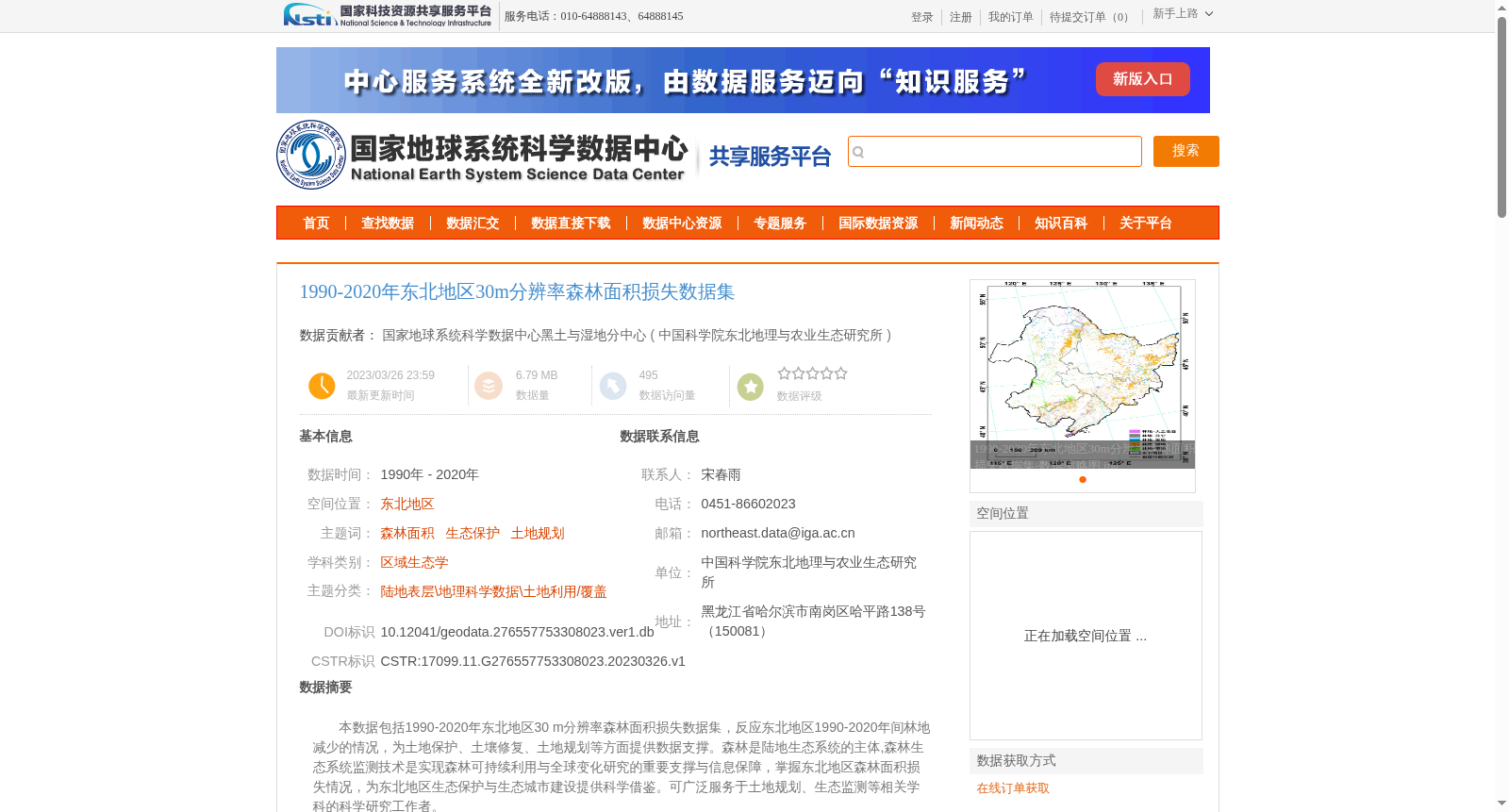
本数据包括1990-2020年东北地区30 m分辨率森林面积损失数据集,反应东北地区1990-2020年间林地减少的情况,为土地保护、土壤修复、土地规划等方面提供数据支撑。森林是陆地生态系统的主体,森林生态系统监测技术是实现森林可持续利用与全球变化研究的重要支撑与信息保障,掌握东北地区森林面积损失情况,为东北地区生态保护与生态城市建设提供科学借鉴。可广泛服务于土地规划、生态监测等相关学科的科学研究工作者。
This dataset is a 30 m resolution forest area loss dataset for Northeast China spanning from 1990 to 2020, which reflects the forestland reduction in the region between 1990 and 2020, and provides data support for land conservation, soil remediation, land planning and other relevant fields. Forests are the main body of terrestrial ecosystems, and forest ecosystem monitoring technology acts as an important support and information guarantee for achieving sustainable forest utilization and global change research. Understanding the forest area loss situation in Northeast China can provide scientific references for ecological conservation and eco-city construction in the region. This dataset can widely serve scientific researchers in relevant disciplines such as land planning and ecological monitoring.
提供机构:
中国科学院东北地理与农业生态研究所
创建时间:
2023-03-26
搜集汇总
数据集介绍
背景与挑战
背景概述
该数据集提供了1990年至2020年东北地区30米分辨率的森林面积损失数据,反映了该期间林地减少情况,基于Landsat遥感影像采用面向对象分类方法生成,数据精度可靠。它旨在为土地保护、土壤修复和生态监测等科学研究提供数据支撑,服务于区域生态学和土地利用规划领域。
以上内容由遇见数据集搜集并总结生成


