SUM-Helsinki
收藏资源简介:
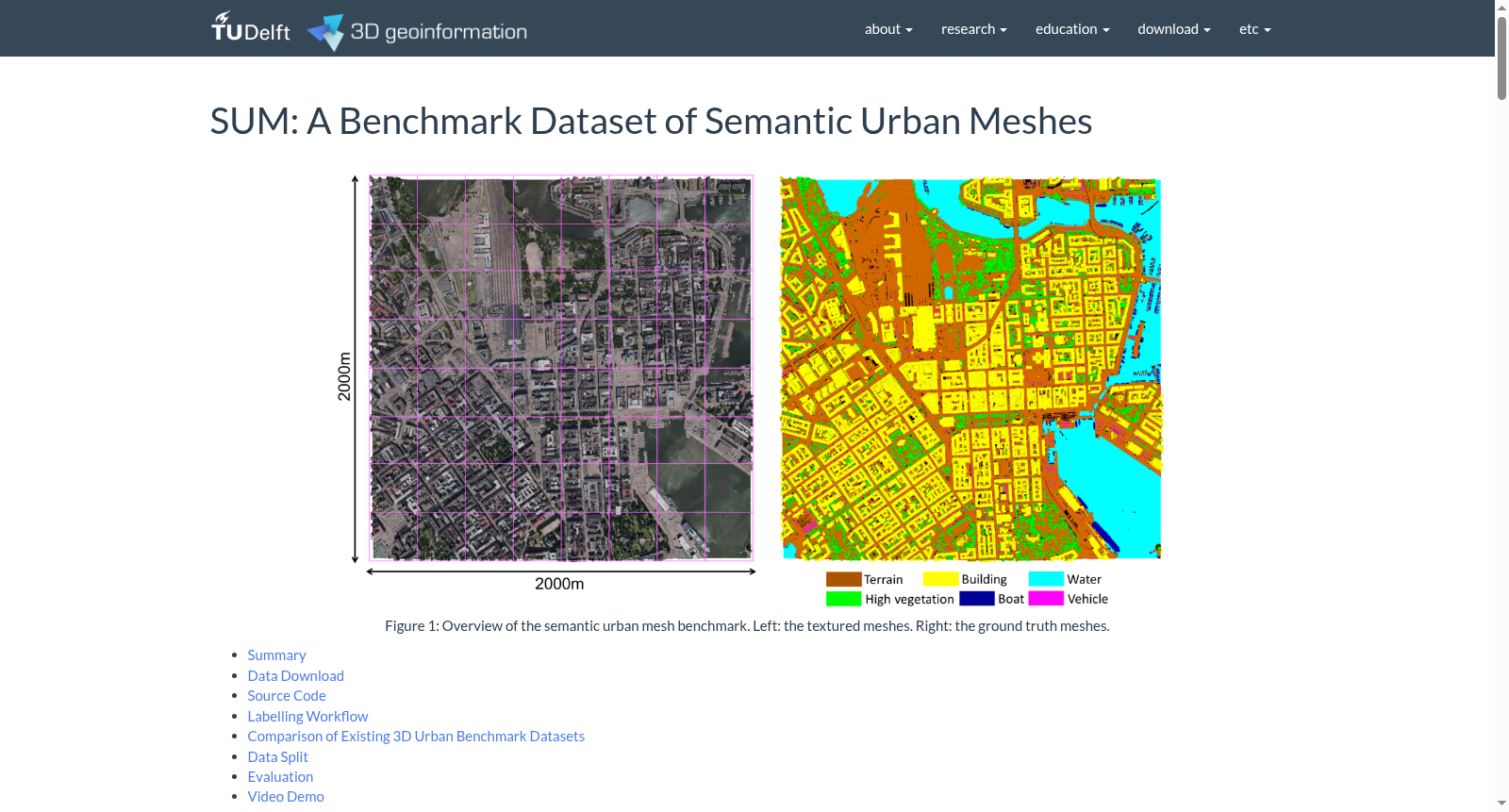
SUM-Helsinki数据集是由代尔夫特理工大学3D地理信息研究组创建的一个大型语义城市网格数据集,覆盖了赫尔辛基约4平方公里的区域,包含1900万个三角形。数据集通过结合航空倾斜图像生成,涵盖了六种常见的城市环境对象类别:地形、高植被、建筑、水体、车辆和船只。创建过程中采用了半自动标注框架,包括初始分割和交互式细化,显著节省了约600小时的标注工作。该数据集主要用于城市场景理解、空间分析和城市规划等应用,旨在通过深度学习方法提升对城市环境的理解和分析能力。
The SUM-Helsinki dataset is a large-scale semantic urban grid dataset developed by the 3D Geospatial Information Research Group of Delft University of Technology. It covers an area of approximately 4 square kilometers in Helsinki and contains 19 million triangles. Constructed by combining aerial oblique images, this dataset covers six common urban environmental object categories: terrain, high vegetation, buildings, water bodies, vehicles, and vessels. A semi-automatic annotation framework including initial segmentation and interactive refinement was adopted during its creation, which significantly saved approximately 600 hours of annotation work. This dataset is mainly used for applications such as urban scene understanding, spatial analysis and urban planning, aiming to enhance the understanding and analysis capabilities of urban environments through deep learning methods.