青藏高原草地土壤pH空间分布图(2019-2022)
收藏国家青藏高原科学数据中心2024-12-26 更新2025-04-26 收录
下载链接:
https://data.tpdc.ac.cn/zh-hans/data/f1fb0984-2667-4a2c-a8b5-1abb6c1cb51d
下载链接
链接失效反馈官方服务:
资源简介:
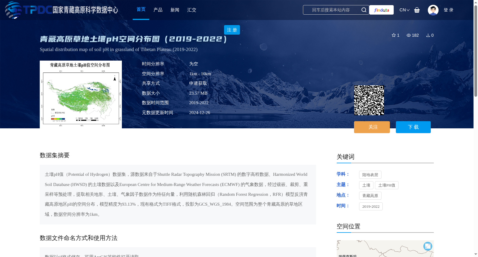
土壤pH值(Potential of Hydrogen)数据集,源数据来自于Shuttle Radar Topography Mission (SRTM) 的数字高程数据、Harmonized World Soil Database (HWSD) 的土壤数据以及European Centre for Medium-Range Weather Forecasts (ECMWF) 的气象数据,经过镶嵌、裁剪、重采样等预处理,提取相关地形、土壤、气象因子数据作为特征向量,利用随机森林回归(Random Forest Regression,RFR)模型反演青藏高原地区pH的空间分布,模型精度为93.13%,现有格式为TIFF格式,投影为GCS_WGS_1984。空间范围为整个青藏高原的草地区域,数据空间分辨率为1km。
Soil pH (Potential of Hydrogen) dataset. The source data is derived from digital elevation data of the Shuttle Radar Topography Mission (SRTM), soil data of the Harmonized World Soil Database (HWSD), and meteorological data from the European Centre for Medium-Range Weather Forecasts (ECMWF). After preprocessing procedures including mosaicking, clipping, and resampling, relevant topographic, soil and meteorological factor data were extracted as feature vectors. The Random Forest Regression (RFR) model was employed to invert the spatial distribution of soil pH across the Qinghai-Tibet Plateau, achieving a model accuracy of 93.13%. The current data is stored in TIFF format with the projection of GCS_WGS_1984. The spatial coverage is the entire grassland area of the Qinghai-Tibet Plateau, and the spatial resolution of the dataset is 1 km.
提供机构:
朱军涛
创建时间:
2024-12-23
搜集汇总
数据集介绍
背景与挑战
背景概述
该数据集提供了2019-2022年青藏高原草地土壤pH值的空间分布图,空间分辨率为1km,采用随机森林回归模型反演,模型精度达93.13%。数据格式为TIFF,适用于ArcGIS等软件,主要用于研究青藏高原草地的土壤特性。
以上内容由遇见数据集搜集并总结生成


