青藏高原大于30平方公里湖泊逐月面积变化(2015-2020)
收藏国家青藏高原科学数据中心2023-11-30 更新2024-03-01 收录
下载链接:
https://data.tpdc.ac.cn/zh-hans/data/d5c202aa-f3a3-4e27-9257-10e79813f520
下载链接
链接失效反馈官方服务:
资源简介:
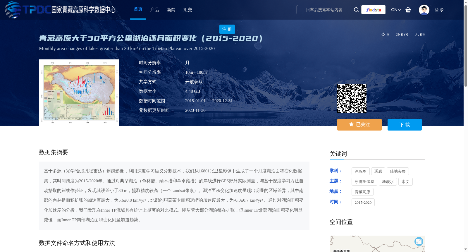
基于多源(光学/合成孔径雷达)遥感影像,利用深度学习语义分割技术,我们从16801张卫星影像中生成了一个月度湖泊面积变化数据集,其时间跨度为2015-2020年。通过对典型湖泊(色林措、纳木措和羊卓雍措)的岸线进行GPS野外实际测量,与基于深度学习方法自动拾取的岸线作验证,发现其误差小于30 m,提取精度较高(一个Landsat像素)。湖泊面积变化加速度呈现出明显的区域差异,其中南部的色林措面积扩张的加速度最大,为5.6±0.8 km²/yr²,北部的玛盖茶卡面积退缩的加速度最大,为-6.0±0.7 km²/yr² 。通过对湖泊面积变化加速度的分析,我们发现在Inner TP流域具有统计上显著的对比模式。即尽管大部分湖泊都在扩张,但inner TP北部湖泊面积变化明显减慢,而Inner TP南部湖泊面积变化则呈加速趋势。
Based on multi-source (optical/synthetic aperture radar, SAR) remote sensing imagery and leveraging deep learning semantic segmentation techniques, we generated a monthly lake area change dataset from 16,801 satellite images, spanning the period from 2015 to 2020. Field GPS surveys were conducted on the shorelines of three typical lakes (Siling Co, Nam Co, and Yamzho Yumco) to validate the automatically extracted shorelines via deep learning methods, which demonstrated that the error is less than 30 meters, indicating a high extraction accuracy equivalent to one Landsat pixel. The acceleration of lake area change exhibits distinct regional disparities: the maximum acceleration of area expansion is recorded in Siling Co in the southern region, at 5.6±0.8 km²/yr², while the maximum acceleration of area retreat is observed in Maigai Caka in the northern region, at -6.0±0.7 km²/yr². Analysis of the lake area change acceleration revealed statistically significant contrasting patterns in the Inner TP basin. Specifically, although most lakes are undergoing expansion, lake area changes in the northern Inner TP have slowed considerably, whereas those in the southern Inner TP show an accelerating trend.
提供机构:
冉将军,邱稼辉,胡瑞刚
创建时间:
2023-11-29
搜集汇总
数据集介绍
背景与挑战
背景概述
该数据集记录了2015-2020年青藏高原大于30平方公里湖泊的逐月面积变化,基于多源遥感影像和深度学习技术生成,精度较高。数据显示湖泊面积变化存在明显区域差异,南部扩张加速,北部退缩加速。
以上内容由遇见数据集搜集并总结生成


