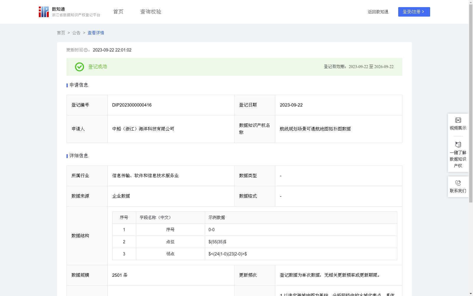
航线规划场景可通航地图拓扑图数据
收藏浙江省数据知识产权登记平台2023-09-22 更新2024-05-08 收录
下载链接:
https://www.zjip.org.cn/home/announce/trends/3347
下载链接
链接失效反馈官方服务:
资源简介:
该数据为二次加工数据,主要以舟山附近海域地图为基础,运用图形学方法,分析网格中的水域代表点以及各相邻网格之间的水域代表点可达关系。数据可用于航线规划等场景。1.以选定海域地图为基础,分析网格中的水域代表点。具体做法是:针对已网格化的海域地图中的每一个网格,获取其所含所有单连通水域多边形(简单多边形);然后按照简单多边形骨架提取算法提取出该水域多边形的几何中心,作为水域代表点;按顺序记录为该网格的水域代表点(点位)。2.分析各相邻网格之间的水域代表点可达关系。具体做法是:取某网格及其相邻的某个网格,分析该两个网格之间点位(水域代表点)的连通关系,以“<相邻网格-可达相邻网格中点位序列><…-…>”的形式存储可达关系。
This is a secondary processed dataset primarily based on the sea area map near Zhoushan. Using computer graphics methods, it analyzes the water representative points within grids and the reachability relationship between water representative points of adjacent grids, and can be applied to scenarios such as route planning.
1. Analyze water representative points in grids based on the selected sea area map. The specific implementation steps are as follows: For each grid in the gridded sea area map, extract all simply-connected water polygons (simple polygons) contained in it; then use a simple polygon skeleton extraction algorithm to extract the geometric center of each water polygon, which serves as the water representative point; record these points in order as the water representative points (positions) of this grid.
2. Analyze the reachability relationship between water representative points of adjacent grids. The specific implementation steps are as follows: Select a certain grid and one of its adjacent grids, analyze the connectivity relationship between their water representative points, and store the reachability relationship in the format of "<adjacent grid - sequence of reachable points in the adjacent grid><…-…>".
提供机构:
中船(浙江)海洋科技有限公司
创建时间:
2023-08-24
搜集汇总
数据集介绍
以上内容由遇见数据集搜集并总结生成


