“一带一路”关键节点区域30m级建成区分布数据(2000,2014)
收藏国家青藏高原科学数据中心2021-04-19 更新2024-03-06 收录
下载链接:
https://data.tpdc.ac.cn/zh-hans/data/ae1ce001-f34d-4d02-977f-1ce80ce0e3c2
下载链接
链接失效反馈官方服务:
资源简介:
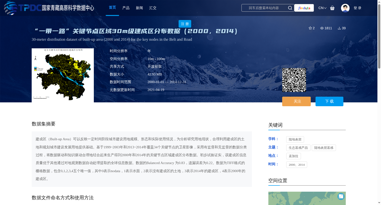
建成区(Built-up Area)可以反映一定时间阶段城市建设用地规模、形态和实际使用情况,为分析研究用地现状,合理利用建成区的土地和规划城市建设发展用地提供基础。基于1999~2003年和2013~2014年覆盖34个关键节点的卫星影像,采用有监督和无监督的数据分类过程,将数据驱动和知识驱动合理地结合起来生产得到2000年和2014年的关键节点区域建成区分布数据。初步试验证实,该建成区信息质量优于其他通过对地观测数据自动处理提取的全球信息数据。数据的Balanced Accuracy 为0.83,遗漏误差为0.22。数据为TIFF格式的栅格数据,包含0,1,2,3,4五个唯一值,其中0表示nodata,1表示水面,2表示没有建成区的土地,3表示2014年的建成区,4表示2000年的建成区。
Built-up Area reflects the scale, form and actual usage status of urban construction land within a specific time period, providing a basis for analyzing and researching current land use conditions, rationally utilizing land within built-up areas, and planning urban construction and development land. Based on satellite imagery covering 34 key nodes from 1999 to 2003 and 2013 to 2014, a reasonable combination of data-driven and knowledge-driven approaches was adopted through supervised and unsupervised data classification processes to produce built-up area distribution data for key node regions in 2000 and 2014. Preliminary experiments have verified that the quality of this built-up area information is superior to other global information data extracted via automatic processing of Earth observation data. The Balanced Accuracy of this dataset is 0.83, and the omission error is 0.22. The data is raster data in TIFF format, containing five unique values: 0, 1, 2, 3 and 4, where 0 represents nodata, 1 represents water surface, 2 represents land without built-up area, 3 represents built-up area in 2014, and 4 represents built-up area in 2000.
提供机构:
周璞,凌峰
创建时间:
2020-12-18
搜集汇总
数据集介绍
背景与挑战
背景概述
该数据集提供了“一带一路”关键节点区域在2000年和2014年的30米级建成区分布数据,基于卫星影像通过有监督和无监督分类方法生产,覆盖34个关键节点,用于分析城市建设用地规模和形态。数据为TIFF栅格格式,包含五个唯一值区分建成区、水面等类别,空间分辨率在10米至100米之间,具有较高的准确性(Balanced Accuracy为0.83),适用于土地利用规划和城市发展研究。
以上内容由遇见数据集搜集并总结生成


