2015-2020年全球哨兵卫星影像数据集
收藏地球大数据科学工程2024-03-04 收录
下载链接:
https://data.casearth.cn/sdo/detail/65449ab1819aec1181234dcb
下载链接
链接失效反馈官方服务:
资源简介:
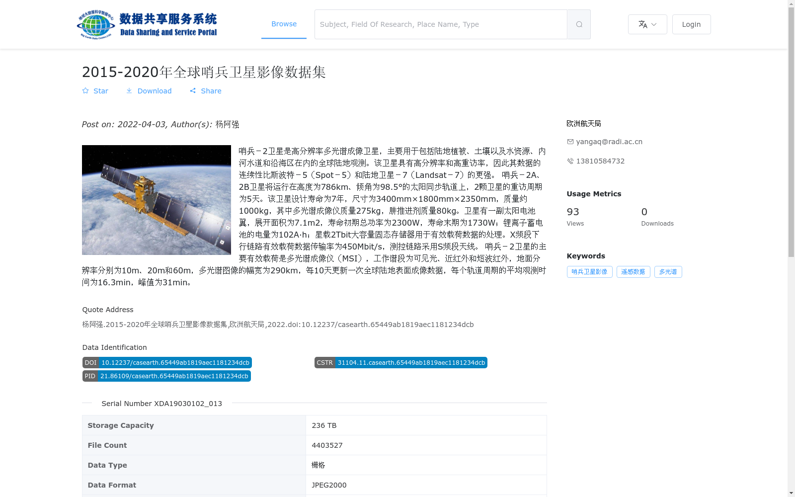
哨兵-2卫星是高分辨率多光谱成像卫星,主要用于包括陆地植被、土壤以及水资源、内河水道和沿海区在内的全球陆地观测。该卫星具有高分辨率和高重访率,因此其数据的连续性比斯波特-5(Spot-5)和陆地卫星-7(Landsat-7)的更强。 哨兵-2A、2B卫星将运行在高度为786km、倾角为98.5°的太阳同步轨道上,2颗卫星的重访周期为5天。该卫星设计寿命为7年,尺寸为3400mm×1800mm×2350mm,质量约1000kg,其中多光谱成像仪质量275kg,肼推进剂质量80kg。卫星有一副太阳电池翼,展开面积为7.1m2,寿命初期总功率为2300W,寿命末期为1730W;锂离子蓄电池的电量为102A·h;星载2Tbit大容量固态存储器用于有效载荷数据的处理。X频段下行链路有效载荷数据传输率为450Mbit/s,测控链路采用S频段天线。 哨兵-2卫星的主要有效载荷是多光谱成像仪(MSI),工作谱段为可见光、近红外和短波红外,地面分辨率分别为10m、20m和60m,多光谱图像的幅宽为290km,每10天更新一次全球陆地表面成像数据,每个轨道周期的平均观测时间为16.3min,峰值为31min。
The Sentinel-2 satellite is a high-resolution multispectral imaging satellite primarily used for global land observation covering terrestrial vegetation, soil, water resources, inland waterways and coastal zones. Featuring high resolution and high revisit frequency, its data continuity is superior to that of Spot-5 and Landsat-7.
Sentinel-2A and 2B satellites operate in a Sun-synchronous orbit with an altitude of 786 km and an inclination of 98.5°, with a 5-day revisit cycle for the two satellites. The designed service life of the satellites is 7 years, with dimensions of 3400mm × 1800mm × 2350mm and a mass of approximately 1000 kg, including a 275 kg multispectral imager and 80 kg of hydrazine propellant. The satellite is equipped with a solar array with a deployed area of 7.1 m². Its total power is 2300 W at the beginning of life (BOL) and 1730 W at the end of life (EOL). The lithium-ion battery has a capacity of 102 A·h. The on-board 2 Tbit high-capacity solid-state memory is used for payload data processing. The X-band downlink has a payload data transmission rate of 450 Mbit/s, and the TT&C (Telemetry, Tracking and Command) link uses S-band antennas.
The primary payload of the Sentinel-2 satellite is the Multispectral Imager (MSI), which operates in visible, near-infrared and short-wave infrared spectral bands with ground resolutions of 10 m, 20 m and 60 m respectively. The multispectral image swath width is 290 km. It updates global land surface imaging data every 10 days, with an average observation time of 16.3 minutes per orbital period and a peak observation time of 31 minutes.
提供机构:
欧洲航天局
搜集汇总
数据集介绍
背景与挑战
背景概述
该数据集包含2015年至2020年全球范围的哨兵-2卫星遥感影像,主要用于陆地植被、土壤和水资源等观测。其特点是高分辨率多光谱成像(地面分辨率10m、20m和60m),幅宽达290km,每10天更新全球数据,具有高重访率和强数据连续性。数据集规模庞大,存储容量为236 TB,包含超过440万个JPEG2000格式的栅格文件,适用于遥感分析和环境监测。
以上内容由遇见数据集搜集并总结生成


