2021-2022年极地边缘区高分辨率(10~30m)冰面融水数据集
收藏地球大数据科学工程2024-05-01 收录
下载链接:
https://data.casearth.cn/sdo/detail/6538a3a6819aec0f261275fa
下载链接
链接失效反馈官方服务:
资源简介:
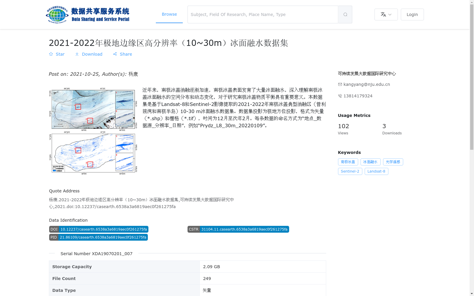
近年来,南极冰盖消融逐渐加速,南极冰盖表面发育了大量冰面融水,深入理解南极冰盖冰面融水的空间分布和动态变化,对于研究南极冰盖物质平衡具有重要意义。本数据集是基于Landsat-8和Sentinel-2影像提取的2021-2022年南极冰盖典型消融区(普利兹湾和南极半岛)10-30 m冰面融水数据集。数据集投影为极地方位投影,格式为矢量(*.shp)和栅格(*.tif),时间为12月至次年2月。每条数据的命名方式为“地点_数据源_分辨率_日期”,例如“Prydz_L8_30m_20220109”。
In recent years, the ablation of the Antarctic Ice Sheet has accelerated progressively, with extensive supraglacial meltwater forming on its surface. Gaining in-depth insights into the spatial distribution and dynamic changes of supraglacial meltwater across the Antarctic Ice Sheet is critically important for investigating the mass balance of the Antarctic Ice Sheet. This dataset is a 10–30 m resolution supraglacial meltwater dataset for the typical ablation zones of the Antarctic Ice Sheet (Prydz Bay and Antarctic Peninsula) during 2021–2022, which was extracted using Landsat-8 and Sentinel-2 satellite imagery. The dataset employs the Polar Azimuthal Projection, and is provided in both vector (*.shp) and raster (*.tif) formats. The temporal coverage spans from December to February of the following year. The naming convention for each data file follows the pattern "Location_Data Source_Resolution_Date", with an example being "Prydz_L8_30m_20220109".
提供机构:
可持续发展大数据国际研究中心
搜集汇总
数据集介绍
背景与挑战
背景概述
该数据集是基于Landsat-8和Sentinel-2卫星影像提取的2021-2022年南极冰盖典型消融区(普利兹湾和南极半岛)高分辨率(10-30米)冰面融水数据,覆盖时间范围为12月至次年2月,数据格式包括矢量(*.shp)和栅格(*.tif)。数据集旨在提供冰面融水的空间分布信息,支持南极冰盖物质平衡研究,具有高时空分辨率的特点,适用于极地环境变化分析。
以上内容由遇见数据集搜集并总结生成


