中国高分辨率国家土壤信息格网基本属性数据集_250米土壤质地(2010-2018)
收藏国家地球系统科学数据中心2024-03-01 更新2024-03-04 收录
下载链接:
https://www.geodata.cn/data/datadetails.html?dataguid=8306349869502&docId=3880
下载链接
链接失效反馈官方服务:
资源简介:
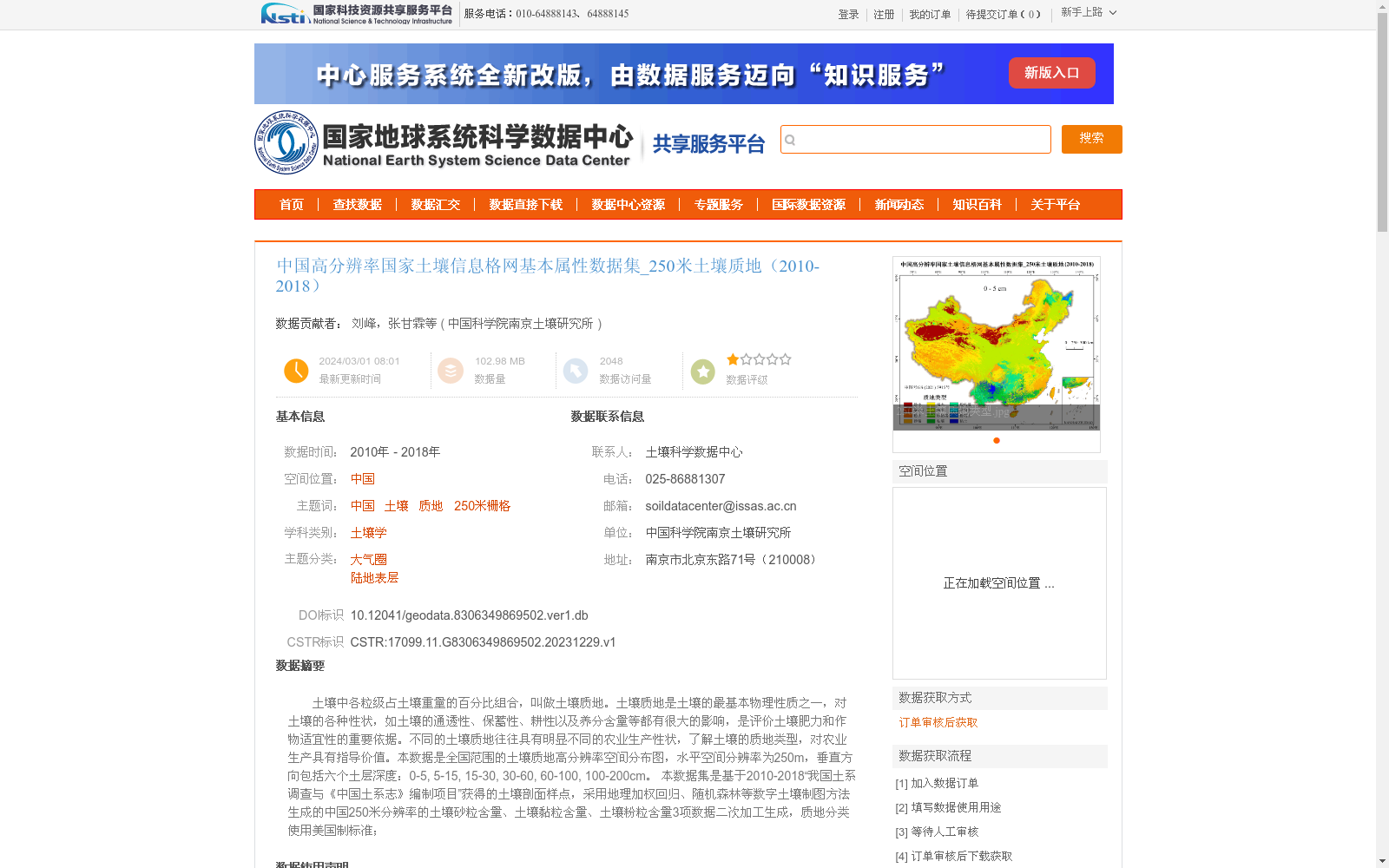
土壤中各粒级占土壤重量的百分比组合,叫做土壤质地。土壤质地是土壤的最基本物理性质之一,对土壤的各种性状,如土壤的通透性、保蓄性、耕性以及养分含量等都有很大的影响,是评价土壤肥力和作物适宜性的重要依据。不同的土壤质地往往具有明显不同的农业生产性状,了解土壤的质地类型,对农业生产具有指导价值。本数据是全国范围的土壤质地高分辨率空间分布图,水平空间分辨率为250m,垂直方向包括六个土层深度:0-5, 5-15, 15-30, 30-60, 60-100, 100-200cm。
本数据集是基于2010-2018“我国土系调查与《中国土系志》编制项目”获得的土壤剖面样点,采用地理加权回归、随机森林等数字土壤制图方法生成的中国250米分辨率的土壤砂粒含量、土壤黏粒含量、土壤粉粒含量3项数据二次加工生成,质地分类使用美国制标准;
Soil texture refers to the combination of percentages of various particle size fractions in soil by weight. As one of the most fundamental physical properties of soil, soil texture greatly affects various soil characteristics including soil aeration and water permeability, water and nutrient retention capacity, soil workability, and nutrient content, and serves as an important basis for evaluating soil fertility and crop suitability. Different soil textures often exhibit distinctly different agricultural production traits, and understanding soil texture types has guiding significance for agricultural production.
This dataset is a high-resolution spatial distribution map of soil texture across China, with a horizontal spatial resolution of 250 m, and covers six soil layer depths in the vertical direction: 0–5, 5–15, 15–30, 30–60, 60–100, and 100–200 cm.
This dataset was secondarily processed from three 250-m resolution datasets of China’s soil sand content, clay content, and silt content. These three datasets were generated using digital soil mapping methods such as Geographically Weighted Regression (GWR) and Random Forest (RF) based on soil profile sampling points obtained from the 2010–2018 National Soil Series Survey and Compilation of *Soil Series of China* project. The soil texture classification follows the United States Department of Agriculture (USDA) standard.
提供机构:
中国科学院南京土壤研究所
创建时间:
2023-12-29
搜集汇总
数据集介绍
背景与挑战
背景概述
该数据集是中国高分辨率国家土壤信息格网的一部分,专注于土壤质地属性,覆盖全国范围,空间分辨率为250米,时间跨度为2010年至2018年。数据包括土壤砂粒、黏粒和粉粒含量,垂直方向涵盖六个土层深度(从0到200厘米),采用地理加权回归和随机森林等方法基于5000多个土壤剖面样点生成,质地分类遵循美国制标准,为土壤肥力评估和农业生产提供重要依据。
以上内容由遇见数据集搜集并总结生成


