REDOS(Reanalysis Dataset of the South China Sea)南海海洋再分析产品(1992-2011)(0.1°)(逐日)(netcdf)
收藏南海海洋数据中心2024-03-01 收录
下载链接:
https://data.scsio.ac.cn/metaData-detail/1116177208545677313
下载链接
链接失效反馈官方服务:
资源简介:
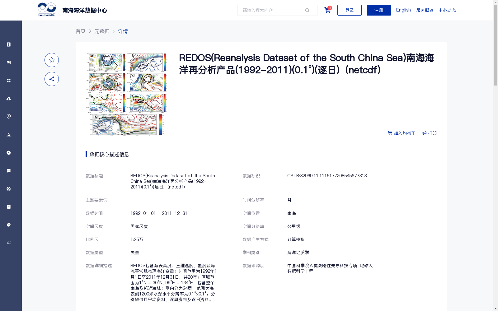
REDOS包含海表高度、三维温度、盐度及海流等常规物理海洋变量;时间范围为1992年1月1日至2011年12月31日,共20年;区域范围为1°N - 30°N, 99°E - 134°E,包含整个南海及邻近海域;垂向分为24层,范围为海表到1200米水深水平分辨率为0.1°×0.1°;分别提供月平均资料、逐周资料及逐日资料。
REDOS contains conventional physical oceanographic variables including sea surface height, three-dimensional temperature, salinity, and ocean currents. Its temporal coverage spans from January 1, 1992 to December 31, 2011, totaling 20 years. The spatial domain ranges from 1°N to 30°N and 99°E to 134°E, covering the entire South China Sea and its adjacent waters. The dataset has 24 vertical layers, extending from the sea surface down to a depth of 1200 meters, with a horizontal resolution of 0.1° × 0.1°. Monthly mean, weekly, and daily data are provided respectively.
提供机构:
中国科学院南海海洋研究所
搜集汇总
数据集介绍
背景与挑战
背景概述
REDOS是南海海洋再分析产品,时间范围为1992年至2011年,包含海表高度、三维温度、盐度及海流等常规物理海洋变量,水平分辨率为0.1°×0.1°,垂向分为24层,覆盖整个南海及邻近海域。该数据集由南海海洋同化系统产生,采用NetCDF格式存储,提供月平均、逐周及逐日资料,适用于海洋地质学等领域的研究。
以上内容由遇见数据集搜集并总结生成


