青藏高原区域耦合地形效应的日地表反照率数据集(2002-2022)
收藏国家青藏高原科学数据中心2024-12-31 更新2024-03-01 收录
下载链接:
https://data.tpdc.ac.cn/zh-hans/data/1db6479e-163e-44ed-b042-c6896f9bd0ee
下载链接
链接失效反馈官方服务:
资源简介:
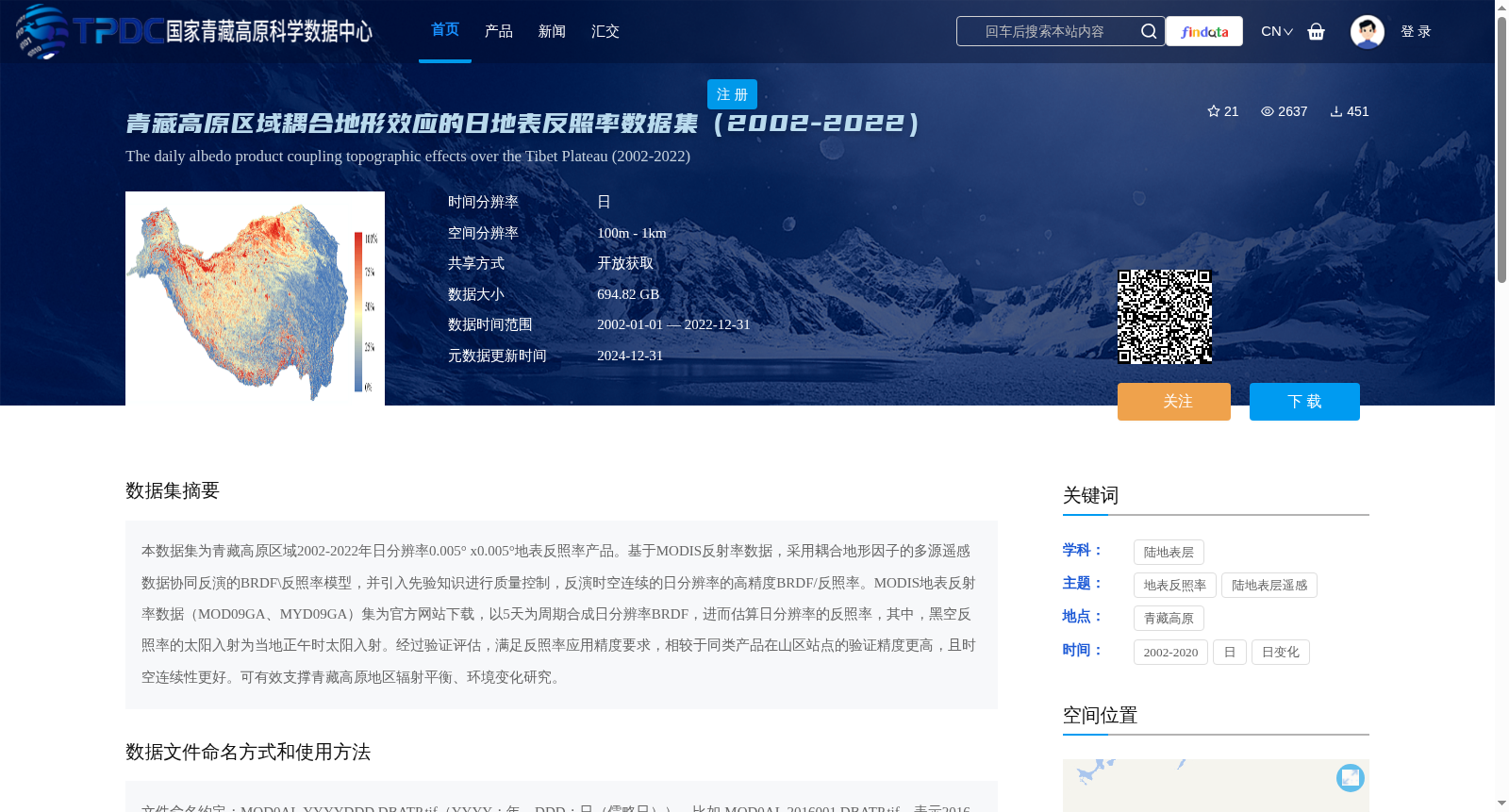
本数据集为青藏高原区域2002-2022年日分辨率0.005° x0.005°地表反照率产品。基于MODIS反射率数据,采用耦合地形因子的多源遥感数据协同反演的BRDF\反照率模型,并引入先验知识进行质量控制,反演时空连续的日分辨率的高精度BRDF/反照率。MODIS地表反射率数据(MOD09GA、MYD09GA)集为官方网站下载,以5天为周期合成日分辨率BRDF,进而估算日分辨率的反照率,其中,黑空反照率的太阳入射为当地正午时太阳入射。经过验证评估,满足反照率应用精度要求,相较于同类产品在山区站点的验证精度更高,且时空连续性更好。可有效支撑青藏高原地区辐射平衡、环境变化研究。
This dataset is a daily-resolution (0.005° × 0.005°) surface albedo product for the Qinghai-Tibet Plateau region covering the period from 2002 to 2022. Based on MODIS surface reflectance data, this product uses a BRDF/albedo inversion model that synergizes multi-source remote sensing data and incorporates topographic factors, with prior knowledge introduced for quality control, to retrieve high-precision, spatio-temporally continuous daily-resolution BRDF and albedo products. The MODIS surface reflectance datasets (MOD09GA, MYD09GA) were downloaded from official online repositories. Daily-resolution BRDF products were synthesized using a 5-day composite cycle, based on which daily-resolution albedo was estimated. Specifically, the solar incident radiation for black-sky albedo is defined as the radiation at local solar noon. Through validation and assessment, this product meets the accuracy requirements for albedo-related applications. Compared with other similar products, it achieves higher validation accuracy at mountainous sites and shows better spatio-temporal continuity. This dataset can effectively support research on radiation balance and environmental change in the Qinghai-Tibet Plateau region.
提供机构:
闻建光,游冬琴,唐勇,韩源
创建时间:
2022-02-07
搜集汇总
数据集介绍
背景与挑战
背景概述
该数据集提供了青藏高原区域2002-2022年日分辨率的地表反照率产品,空间分辨率为100m至1km,数据格式为tif,总大小为694.82 GB。基于MODIS反射率数据,采用耦合地形因子的多源遥感数据协同反演模型,具有较高的验证精度和时空连续性,适用于青藏高原地区辐射平衡和环境变化研究。
以上内容由遇见数据集搜集并总结生成


