太湖叶绿素反演产品图数据集(2008-2013年)
收藏国家地球系统科学数据中心2026-01-28 更新2024-03-04 收录
下载链接:
https://www.geodata.cn/data/datadetails.html?dataguid=25666292248108&docId=155
下载链接
链接失效反馈官方服务:
资源简介:
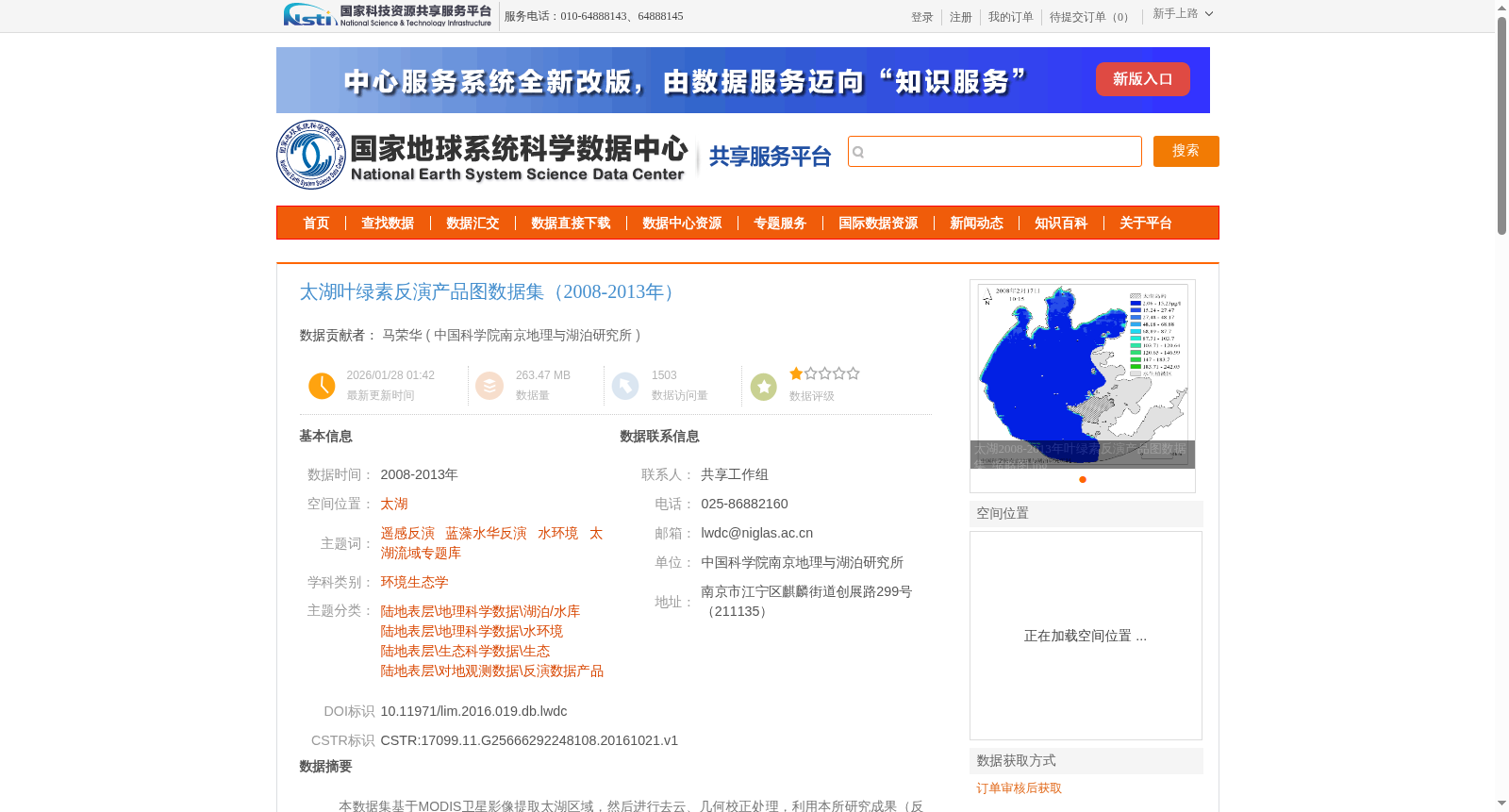
本数据集基于MODIS卫星影像提取太湖区域,然后进行去云、几何校正处理,利用本所研究成果(反演模型),提取太湖的叶绿素浓度。该数据集类型为jpg图片格式文件,为叶绿素浓度反演的出图产品。
数据集按照年份共分为2008-2013年6个文件夹存放,所有产品图数据文件夹包含了共计410个jpg或tif图片文件。
This dataset extracts the Taihu Lake region from MODIS satellite imagery, and conducts cloud removal and geometric correction processing. Subsequently, it employs the retrieval model developed by our institute to retrieve the chlorophyll concentration of Taihu Lake.
This dataset consists of JPG image files, which are the plotting products generated from chlorophyll concentration retrieval.
The dataset is stored in 6 folders corresponding to each year from 2008 to 2013. All product image folders contain a total of 410 JPG or TIF image files.
提供机构:
中国科学院南京地理与湖泊研究所
创建时间:
2016-10-21
搜集汇总
数据集介绍
背景与挑战
背景概述
该数据集是太湖区域2008年至2013年的叶绿素浓度反演产品图集合,基于MODIS卫星影像经过大气校正和模型反演生成,包含410个jpg或tif格式图片,用于监测太湖的水环境状况和蓝藻水华动态。数据集具有明确的时间跨度和空间覆盖,支持环境生态学和水资源管理研究。
以上内容由遇见数据集搜集并总结生成


