2000-2019年中国1km空间分辨率降水栅格数据集
收藏地球大数据科学工程2024-03-04 收录
下载链接:
https://data.casearth.cn/sdo/detail/653a43c8819aec42f0f36266
下载链接
链接失效反馈官方服务:
资源简介:
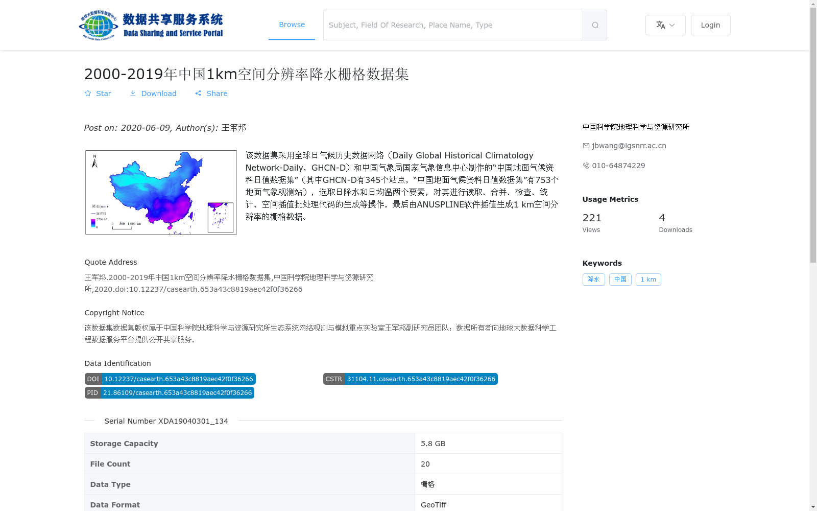
该数据集采用全球日气候历史数据网络(Daily Global Historical Climatology Network-Daily,GHCN-D)和中国气象局国家气象信息中心制作的“中国地面气候资料日值数据集”(其中GHCN-D有345个站点,“中国地面气候资料日值数据集”有753个地面气象观测站),选取日降水和日均温两个要素,对其进行读取、合并、检查、统计、空间插值批处理代码的生成等操作,最后由ANUSPLINE软件插值生成1 km空间分辨率的栅格数据。
This dataset is developed using two data sources: the Daily Global Historical Climatology Network-Daily (GHCN-D) and the "Daily Surface Climatic Dataset of China" produced by the National Meteorological Information Center of the China Meteorological Administration. GHCN-D includes 345 meteorological stations, while the "Daily Surface Climatic Dataset of China" contains 753 ground meteorological observation stations. Two key variables, daily precipitation and daily mean air temperature, are selected. Operations such as data reading, merging, quality checking, statistical analysis, and generation of batch processing codes for spatial interpolation are conducted. Finally, raster data with a spatial resolution of 1 km is generated via interpolation using the ANUSPLINE software.
提供机构:
中国科学院地理科学与资源研究所
搜集汇总
数据集介绍
背景与挑战
背景概述
该数据集是一个2000年至2019年中国范围内的降水栅格数据集,空间分辨率为1公里,基于全球日气候历史数据网络和中国气象局的站点数据,通过ANUSPLIN软件空间插值生成。数据集以GeoTiff格式提供,总容量5.8 GB,包含20个文件,适用于气象和地理研究。
以上内容由遇见数据集搜集并总结生成


