横断山区30m地表覆盖数据(2000年、2010年以及2020年)
收藏国家青藏高原科学数据中心2025-01-13 更新2025-04-05 收录
下载链接:
https://data.tpdc.ac.cn/zh-hans/data/0ec6856e-8128-4690-a3bc-08ea32388e49
下载链接
链接失效反馈官方服务:
资源简介:
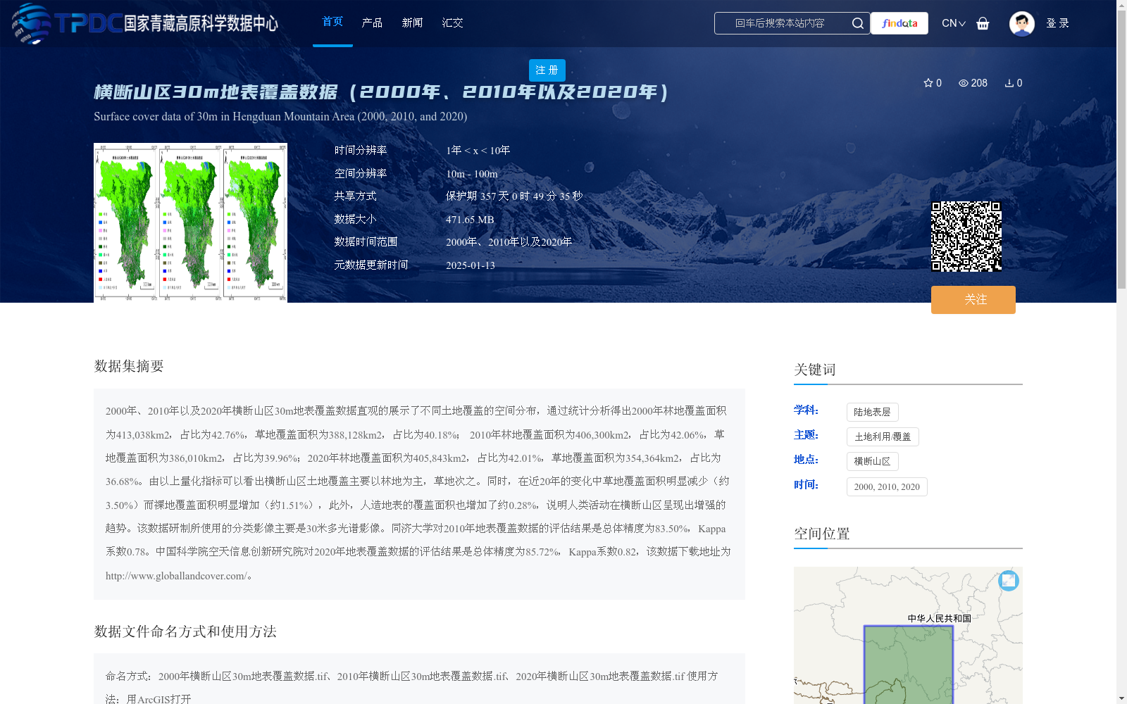
2000年、2010年以及2020年横断山区30m地表覆盖数据直观的展示了不同土地覆盖的空间分布,通过统计分析得出2000年林地覆盖面积为413,038km2,占比为42.76%,草地覆盖面积为388,128km2,占比为40.18%; 2010年林地覆盖面积为406,300km2,占比为42.06%,草地覆盖面积为386,010km2,占比为39.96%;2020年林地覆盖面积为405,843km2,占比为42.01%,草地覆盖面积为354,364km2,占比为36.68%。由以上量化指标可以看出横断山区土地覆盖主要以林地为主,草地次之。同时,在近20年的变化中草地覆盖面积明显减少(约3.50%)而裸地覆盖面积明显增加(约1.51%),此外,人造地表的覆盖面积也增加了约0.28%,说明人类活动在横断山区呈现出增强的趋势。该数据研制所使用的分类影像主要是30米多光谱影像。同济大学对2010年地表覆盖数据的评估结果是总体精度为83.50%,Kappa系数0.78。中国科学院空天信息创新研究院对2020年地表覆盖数据的评估结果是总体精度为85.72%,Kappa系数0.82,该数据下载地址为http://www.globallandcover.com/。
The 30-meter resolution land cover datasets of the Hengduan Mountains for the years 2000, 2010, and 2020 visually demonstrate the spatial distribution of various land cover types. Through statistical analysis, the following results are obtained: In 2000, the forest land covered an area of 413,038 km², accounting for 42.76% of the total area, while grassland covered 388,128 km², making up 40.18%; In 2010, the forest land area reached 406,300 km² (42.06%), and grassland area was 386,010 km² (39.96%); In 2020, the forest land area was 405,843 km² (42.01%), and grassland area decreased to 354,364 km² (36.68%). It can be inferred from the above quantitative indicators that forest land is the dominant land cover type in the Hengduan Mountains, followed by grassland. Over the past 20 years, the grassland cover area has decreased significantly (by approximately 3.50%), while bare land cover has increased notably (by approximately 1.51%). Additionally, the area of artificial surfaces has increased by about 0.28%, suggesting an intensifying trend of human activities in the Hengduan Mountains. The classified images utilized for developing this dataset are primarily 30-meter multispectral images. The 2010 land cover data was evaluated by Tongji University, achieving an overall accuracy of 83.50% and a Kappa coefficient of 0.78. The 2020 land cover data was assessed by the Aerospace Information Research Institute, Chinese Academy of Sciences, with an overall accuracy of 85.72% and a Kappa coefficient of 0.82. The download link for this dataset is http://www.globallandcover.com/
提供机构:
邱海军
创建时间:
2025-01-07
搜集汇总
数据集介绍
背景与挑战
背景概述
该数据集提供了横断山区2000年、2010年和2020年的30米分辨率地表覆盖数据,展示了林地、草地等土地覆盖类型的空间分布及其随时间的变化。数据显示,近20年间草地面积明显减少,裸地和人造地表面积增加,反映了人类活动增强的趋势,且数据精度评估显示总体精度在83.50%至85.72%之间。
以上内容由遇见数据集搜集并总结生成


