亚洲高山区逐日无云MODIS 积雪指数(NDSI)与积雪物候数据集(2000-2021)
收藏国家青藏高原科学数据中心2022-09-29 更新2024-03-01 收录
下载链接:
https://data.tpdc.ac.cn/zh-hans/data/70e403c0-0378-4034-9e7a-3b53b5a52126
下载链接
链接失效反馈官方服务:
资源简介:
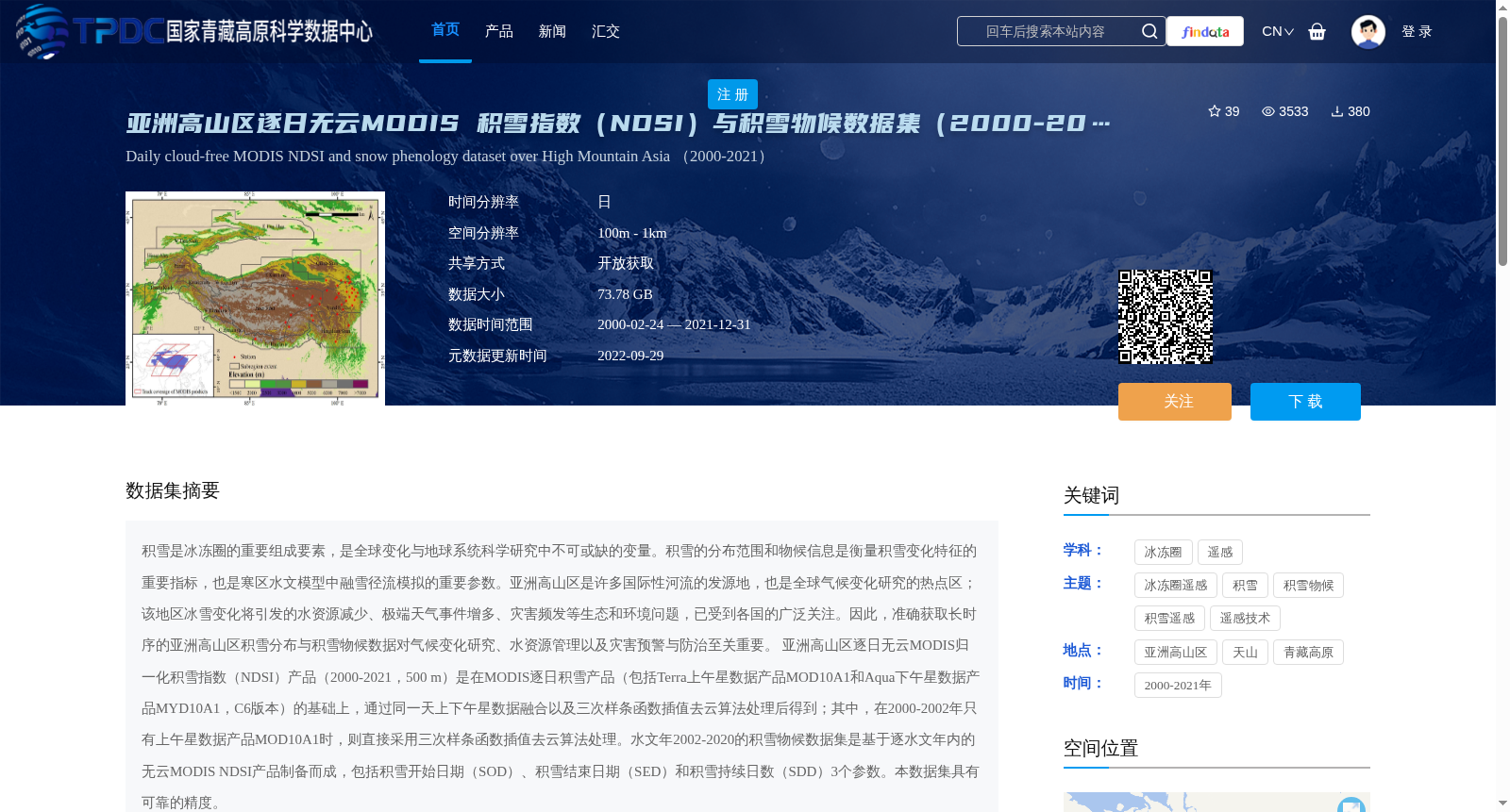
积雪是冰冻圈的重要组成要素,是全球变化与地球系统科学研究中不可或缺的变量。积雪的分布范围和物候信息是衡量积雪变化特征的重要指标,也是寒区水文模型中融雪径流模拟的重要参数。亚洲高山区是许多国际性河流的发源地,也是全球气候变化研究的热点区;该地区冰雪变化将引发的水资源减少、极端天气事件增多、灾害频发等生态和环境问题,已受到各国的广泛关注。因此,准确获取长时序的亚洲高山区积雪分布与积雪物候数据对气候变化研究、水资源管理以及灾害预警与防治至关重要。
亚洲高山区逐日无云MODIS归一化积雪指数(NDSI)产品(2000-2021,500 m)是在MODIS逐日积雪产品(包括Terra上午星数据产品MOD10A1和Aqua下午星数据产品MYD10A1,C6版本)的基础上,通过同一天上下午星数据融合以及三次样条函数插值去云算法处理后得到;其中,在2000-2002年只有上午星数据产品MOD10A1时,则直接采用三次样条函数插值去云算法处理。水文年2002-2020的积雪物候数据集是基于逐水文年内的无云MODIS NDSI产品制备而成,包括积雪开始日期(SOD)、积雪结束日期(SED)和积雪持续日数(SDD)3个参数。本数据集具有可靠的精度。
Snow cover is a critical component of the cryosphere and an indispensable variable in global change and Earth system science research. The spatial distribution and phenological information of snow cover are important indicators for characterizing snow cover variation, and critical parameters for snowmelt runoff simulation in cold-region hydrological models. The High Mountain Asia (HMA) region serves as the headwaters of numerous international rivers and a focal area for global climate change research; ecological and environmental issues including reduced water resources, increased extreme weather events, and frequent disasters triggered by snow and ice changes in this region have garnered widespread attention from the international community. Therefore, accurately acquiring long-time-series snow cover spatial distribution and snow phenology data for High Mountain Asia is of paramount importance for climate change research, water resource management, and disaster early warning and prevention.
The daily cloud-free MODIS Normalized Difference Snow Index (NDSI) product (2000–2021, 500 m) for High Mountain Asia was developed based on the MODIS daily snow cover products (including the Terra morning satellite data product MOD10A1 and Aqua afternoon satellite data product MYD10A1, Collection 6 version) via fusion of same-day morning and afternoon satellite data and cloud removal using the cubic spline function interpolation algorithm. For the period 2000–2002, when only the MOD10A1 morning satellite data product was available, cloud removal was directly performed using the cubic spline function interpolation algorithm. The snow phenology dataset covering hydrological years 2002–2020 was developed using cloud-free MODIS NDSI products for each individual hydrological year, and includes three parameters: Snow Onset Date (SOD), Snow End Date (SED), and Snow Duration Days (SDD). This dataset exhibits reliable accuracy.
提供机构:
唐志光,邓刚
创建时间:
2022-09-23
搜集汇总
数据集介绍
背景与挑战
背景概述
该数据集包含亚洲高山区2000-2021年的逐日无云MODIS积雪指数(NDSI)和积雪物候数据,空间分辨率为500米,适用于气候变化和水资源管理研究。数据通过先进算法处理,具有高精度和可靠性。
以上内容由遇见数据集搜集并总结生成


