中亚-西亚地区资源环境基础地理数据集
收藏国家青藏高原科学数据中心2022-12-23 更新2024-03-07 收录
下载链接:
https://data.tpdc.ac.cn/zh-hans/data/bd046274-3d42-480a-b549-3f3d0d483c9c
下载链接
链接失效反馈资源简介:
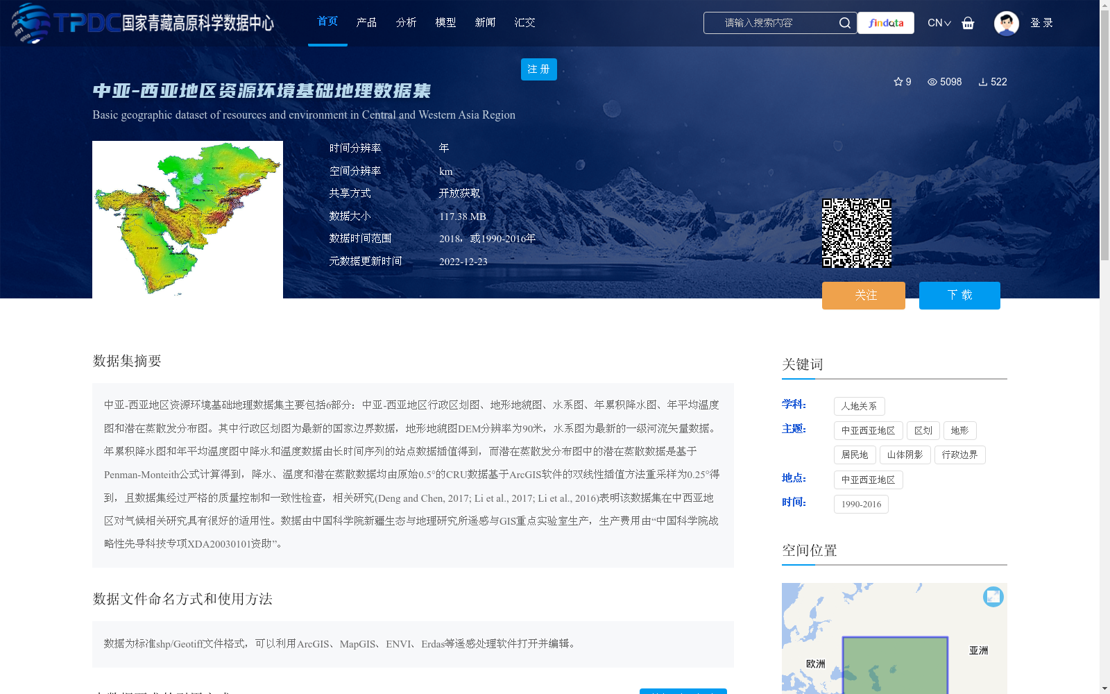
中亚-西亚地区资源环境基础地理数据集主要包括6部分:中亚-西亚地区行政区划图、地形地貌图、水系图、年累积降水图、年平均温度图和潜在蒸散发分布图。其中行政区划图为最新的国家边界数据,地形地貌图DEM分辨率为90米,水系图为最新的一级河流矢量数据。年累积降水图和年平均温度图中降水和温度数据由长时间序列的站点数据插值得到,而潜在蒸散发分布图中的潜在蒸散数据是基于Penman-Monteith公式计算得到,降水、温度和潜在蒸散数据均由原始0.5°的CRU数据基于ArcGIS软件的双线性插值方法重采样为0.25°得到,且数据集经过严格的质量控制和一致性检查,相关研究(Deng and Chen, 2017; Li et al., 2017; Li et al., 2016)表明该数据集在中西亚地区对气候相关研究具有很好的适用性。数据由中国科学院新疆生态与地理研究所遥感与GIS重点实验室生产,生产费用由“中国科学院战略性先导科技专项XDA20030101资助”。
The Geographic Dataset of Resource and Environmental Baseline in Central Asia-West Asia Region mainly consists of six components: administrative division map, topographic and geomorphic map, hydrological system map, annual cumulative precipitation map, annual average temperature map, and potential evapotranspiration distribution map of Central Asia-West Asia Region. The administrative division map adopts the latest national boundary data. The DEM resolution of the topographic and geomorphic map is 90 meters, and the hydrological system map uses the latest first-level river vector data. The precipitation and temperature data included in the annual cumulative precipitation map and annual average temperature map are interpolated from long-time series station observations. The potential evapotranspiration data in the potential evapotranspiration distribution map is calculated based on the Penman-Monteith equation. All precipitation, temperature and potential evapotranspiration data were resampled from the original 0.5° CRU data to 0.25° via the bilinear interpolation method of ArcGIS software. Furthermore, this dataset has undergone strict quality control and consistency validation. Relevant studies (Deng and Chen, 2017; Li et al., 2017; Li et al., 2016) have demonstrated that this dataset exhibits excellent applicability for climate-related research in Central Asia-West Asia Region. This dataset was produced by the Key Laboratory of Remote Sensing and GIS, Xinjiang Institute of Ecology and Geography, Chinese Academy of Sciences, and its production was funded by the "Strategic Priority Research Program of the Chinese Academy of Sciences XDA20030101".
提供机构:
国家青藏高原科学数据中心
创建时间:
2019-01-19
AI搜集汇总
数据集介绍
背景与挑战
背景概述
该数据集是中亚-西亚地区的资源环境基础地理数据集,包含行政区划、地形地貌、水系、降水、温度和潜在蒸散发等6类地图,其中地形数据分辨率为90米,气候数据基于站点插值和公式计算重采样为0.25°,并经过质量控制。数据集由中国科学院生产,时间覆盖1990-2016年或2018年,适用于气候研究,支持开放获取。
以上内容由AI搜集并总结生成


