青藏高原生态问题空间模拟数据集(1990、2020)
收藏国家青藏高原科学数据中心2023-12-05 更新2024-03-01 收录
下载链接:
https://data.tpdc.ac.cn/zh-hans/data/032c1c10-36b5-4d3e-81fc-2e7756eca4f7
下载链接
链接失效反馈官方服务:
资源简介:
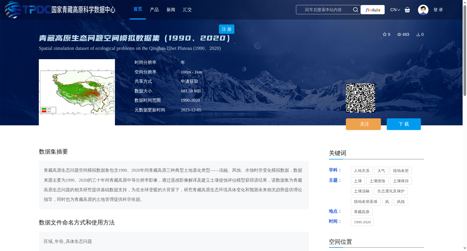
青藏高原生态问题空间模拟数据集包含1990、2020年间青藏高原三种典型土地退化类型——冻融、风蚀、水蚀时空变化模拟数据,数据来源主要为1990、2020的三十年间青藏高原中等分辨率影像,通过遥感影像解译及建立土壤侵蚀评估模型获得该结果,该数据集为青藏高原生态问题的相关研究提供基础数据支持,为在全球变暖的大背景下,研究青藏高原生态环境具体变化和预测未来相关趋势提供理论指导,同时也为青藏高原的土地管理提供科学依据。
Spatial Simulation Dataset of Ecological Issues on the Qinghai-Tibet Plateau contains spatiotemporal change simulation data of three typical land degradation types, namely freeze-thaw, wind erosion and water erosion, on the Qinghai-Tibet Plateau during 1990 to 2020. The dataset is mainly derived from medium-resolution remote sensing images of the Qinghai-Tibet Plateau over the 30-year period from 1990 to 2020, and was obtained through remote sensing image interpretation and the establishment of a soil erosion assessment model. This dataset provides basic data support for relevant studies on ecological issues of the Qinghai-Tibet Plateau, offers theoretical guidance for researching the specific changes of the ecological environment on the Qinghai-Tibet Plateau and predicting relevant future trends under the background of global warming, and also provides scientific basis for land management on the Qinghai-Tibet Plateau.
提供机构:
张路
创建时间:
2023-04-17
搜集汇总
数据集介绍
背景与挑战
背景概述
该数据集提供了1990和2020年青藏高原三种典型土地退化类型(冻融、风蚀、水蚀)的时空变化模拟数据,基于中等分辨率遥感影像通过解译和土壤侵蚀评估模型生成。它具有年时间分辨率和100m-1km空间分辨率,旨在支持青藏高原生态问题研究、环境变化预测和土地管理,为相关科学工作提供基础数据支持。
以上内容由遇见数据集搜集并总结生成


