怒江水资源时空分布数据集(1998-2017)
收藏国家青藏高原科学数据中心2022-11-02 更新2024-03-01 收录
下载链接:
https://data.tpdc.ac.cn/zh-hans/data/59b0c043-add0-42f0-a5a3-239482cc018f
下载链接
链接失效反馈官方服务:
资源简介:
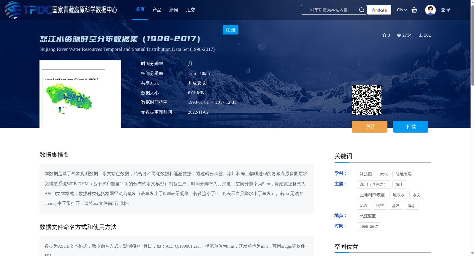
本数据是基于气象观测数据、水文站点数据,结合各种同化数据和遥感数据,通过耦合积雪、冰川和冻土物理过程的青藏高原多圈层水文模型系统WEB-DHM(基于水和能量平衡的分布式水文模型)制备生成,时间分辨率为月尺度,空间分辨率为5km,原始数据格式为ASCII文本格式,数据种类包括格网径流与蒸发(若蒸发小于0,则表示凝华;若径流小于0,则表示当月降水小于蒸发)。若asc无法在arcmap中正常打开,请将asc文件前5行顶格。
This dataset was generated based on meteorological observation data, hydrological station data, various assimilation data and remote sensing data, using the multi-sphere hydrological modeling system WEB-DHM (Distributed Hydrological Model based on water and energy balance) for the Qinghai-Tibet Plateau, which couples the physical processes of snow cover, glaciers and frozen soil. It has a monthly temporal resolution and 5 km spatial resolution, with the original data format being ASCII text. The data categories include grid runoff and evaporation: if evaporation is less than 0, it indicates sublimation; if runoff is less than 0, it means that the monthly precipitation is less than evaporation. If the .asc files fail to open properly in ArcMap, please left-align the first 5 lines of the .asc files.
提供机构:
王磊,柴晨好
创建时间:
2022-10-23
搜集汇总
数据集介绍
背景与挑战
背景概述
怒江水资源时空分布数据集(1998-2017)是一个基于多源数据和WEB-DHM模型生成的月尺度、5km空间分辨率的水资源数据集,包含径流与蒸发数据,适用于水文和气候研究。
以上内容由遇见数据集搜集并总结生成


