2000年一带一路沿线1km土地覆被数据集
收藏地球大数据科学工程2024-03-04 收录
下载链接:
https://data.casearth.cn/sdo/detail/6538882c819aec0f26fac908
下载链接
链接失效反馈官方服务:
资源简介:
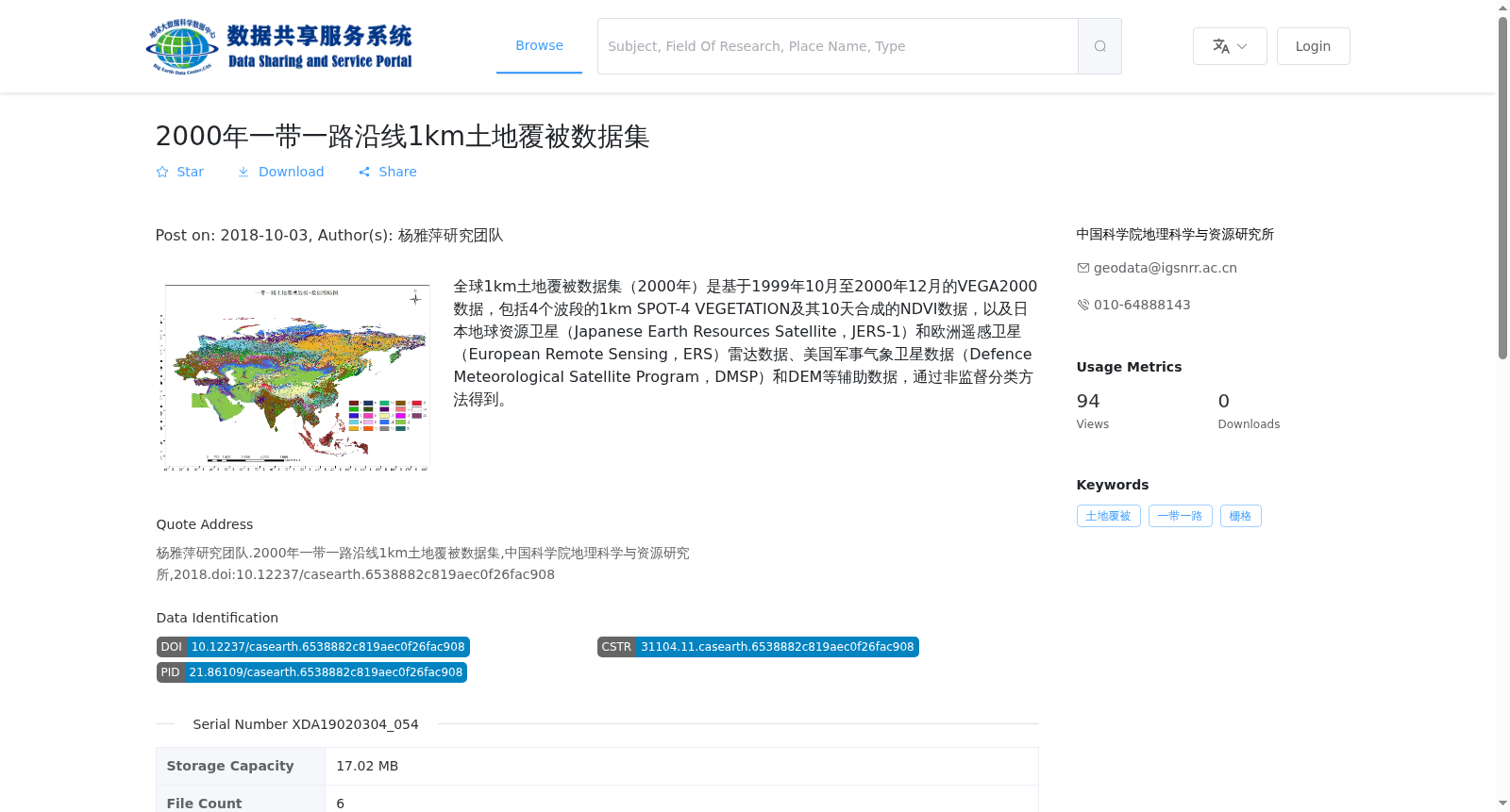
全球1km土地覆被数据集(2000年)是基于1999年10月至2000年12月的VEGA2000数据,包括4个波段的1km SPOT-4 VEGETATION及其10天合成的NDVI数据,以及日本地球资源卫星(Japanese Earth Resources Satellite,JERS-1)和欧洲遥感卫星(European Remote Sensing,ERS)雷达数据、美国军事气象卫星数据(Defence Meteorological Satellite Program,DMSP)和DEM等辅助数据,通过非监督分类方法得到。
The Global 1km Land Cover Dataset (2000) is developed based on VEGA2000 data acquired from October 1999 to December 2000. It includes 1km SPOT-4 VEGETATION data with 4 spectral bands and its 10-day composite NDVI data, as well as auxiliary data such as radar data from the Japanese Earth Resources Satellite (JERS-1) and European Remote Sensing (ERS) satellites, data from the Defense Meteorological Satellite Program (DMSP), and digital elevation model (DEM) data. The dataset was generated via unsupervised classification methods.
提供机构:
中国科学院地理科学与资源研究所
搜集汇总
数据集介绍
背景与挑战
背景概述
该数据集为2000年一带一路沿线区域的1公里分辨率土地覆被数据,基于多源遥感数据(包括SPOT-4 VEGETATION、雷达和气象卫星)通过非监督分类方法生成,文件格式为GeoTiff,总大小17.02 MB。
以上内容由遇见数据集搜集并总结生成


