缅甸行政区划数据(2015年)
收藏国家地球系统科学数据中心2018-03-02 更新2024-03-04 收录
下载链接:
https://www.geodata.cn/data/datadetails.html?dataguid=7695467&docId=21318
下载链接
链接失效反馈官方服务:
资源简介:
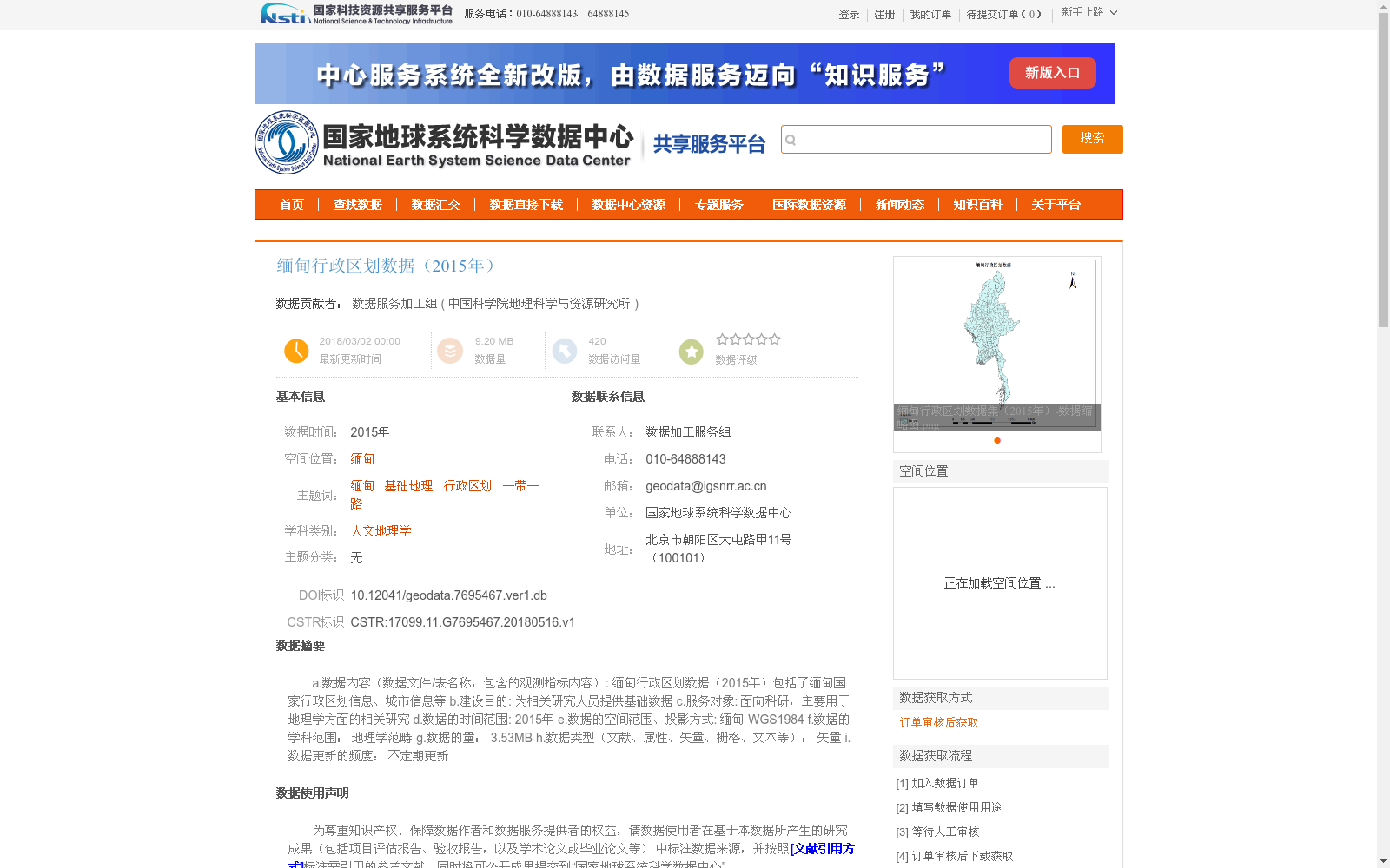
a.数据内容(数据文件/表名称,包含的观测指标内容):
缅甸行政区划数据(2015年)包括了缅甸国家行政区划信息、城市信息等
b.建设目的:
为相关研究人员提供基础数据
c.服务对象:
面向科研,主要用于地理学方面的相关研究
d.数据的时间范围:
2015年
e.数据的空间范围、投影方式:
缅甸
WGS1984
f.数据的学科范围:
地理学范畴
g.数据的量:
3.53MB
h.数据类型(文献、属性、矢量、栅格、文本等):
矢量
i.数据更新的频度:
不定期更新
a. Data Content (data file/table name, included content items): The 2015 Myanmar Administrative Division Dataset includes Myanmar's national administrative division information, urban information and other relevant contents.
b. Dataset Development Purpose: To provide basic data support for relevant researchers and scholars.
c. Target User Group: Aimed at the scientific research community, mainly used for relevant studies in the field of geography.
d. Temporal Coverage: The year 2015.
e. Spatial Coverage and Projection Method: Spatial coverage is the territory of Myanmar; The adopted projection coordinate system is WGS1984.
f. Disciplinary Scope: Belongs to the discipline of geography.
g. Data Volume: 3.53 MB.
h. Data Type: Vector (among common data types including literature, attribute, vector, raster, text, etc.).
i. Update Frequency: Irregular updates.
提供机构:
中国科学院地理科学与资源研究所
创建时间:
2018-05-16
搜集汇总
数据集介绍
背景与挑战
背景概述
该数据集是2015年的缅甸行政区划矢量数据,包含国家行政区划和城市信息,空间范围为缅甸并使用WGS1984投影。它主要面向地理学领域的科研人员,特别是与“一带一路”相关的研究,数据经过人工核对和翻译,质量较高,为相关研究提供了基础地理数据支持。
以上内容由遇见数据集搜集并总结生成


