全国尺度InSAR地表年平均形变速率图
收藏地球大数据科学工程2024-03-04 收录
下载链接:
https://data.casearth.cn/sdo/detail/653f4ee1819aec42f02f3a3e
下载链接
链接失效反馈官方服务:
资源简介:
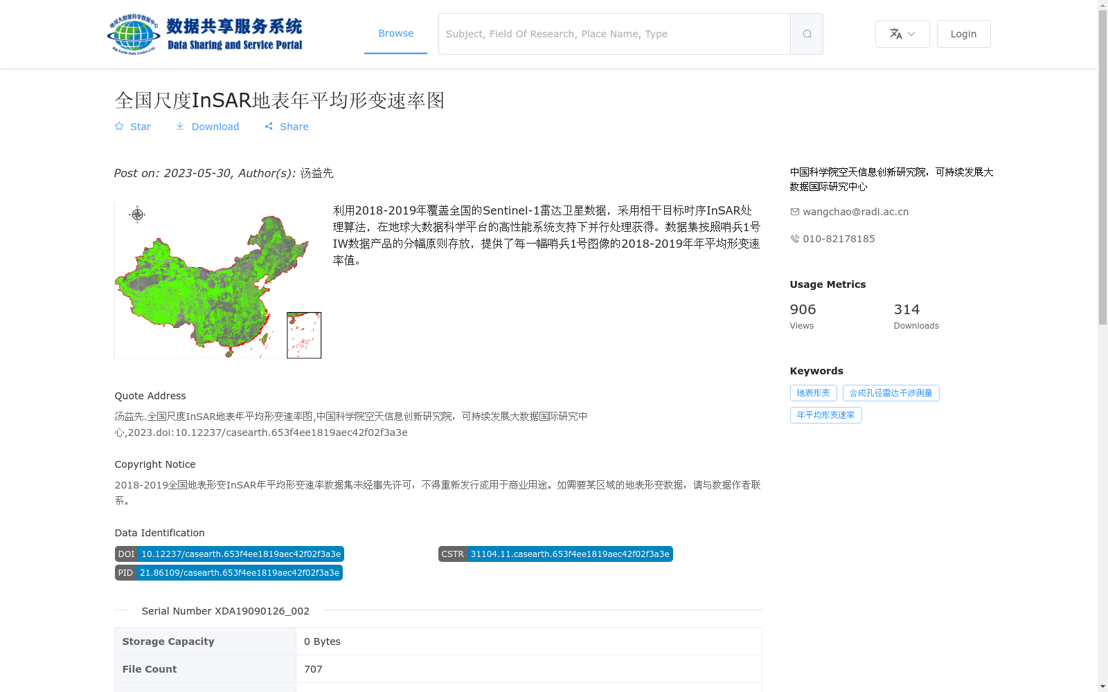
利用2018-2019年覆盖全国的Sentinel-1雷达卫星数据,采用相干目标时序InSAR处理算法,在地球大数据科学平台的高性能系统支持下并行处理获得。数据集按照哨兵1号IW数据产品的分幅原则存放,提供了每一幅哨兵1号图像的2018-2019年年平均形变速率值。
This dataset was generated through parallel processing using the time-series InSAR algorithm for coherent targets, based on nationwide Sentinel-1 radar satellite data acquired between 2018 and 2019, with support from the high-performance computing system of the Earth Big Data Science Platform. It is stored in compliance with the tiling principle of Sentinel-1 IW data products, and provides the annual average surface deformation rate values for each Sentinel-1 image tile over the 2018–2019 period.
提供机构:
中国科学院空天信息创新研究院,可持续发展大数据国际研究中心
搜集汇总
数据集介绍
背景与挑战
背景概述
该数据集是基于2018-2019年Sentinel-1雷达卫星数据,采用相干目标时序InSAR处理算法生成的全国尺度地表年平均形变速率图,空间分辨率为80米,以GeoTiff格式分幅存储,共707个文件。它提供了中国范围内每一幅哨兵1号图像的年平均形变速率值,适用于地表形变监测和地质灾害研究,由中国科学院空天信息创新研究院发布,具有明确的学术引用和版权限制。
以上内容由遇见数据集搜集并总结生成


