1990年三江平原30 m分辨率湿地水禽栖息地适宜性评价数据集
收藏国家地球系统科学数据中心2022-03-14 更新2024-03-04 收录
下载链接:
https://www.geodata.cn/data/datadetails.html?dataguid=54423777180549&docId=9881
下载链接
链接失效反馈官方服务:
资源简介:
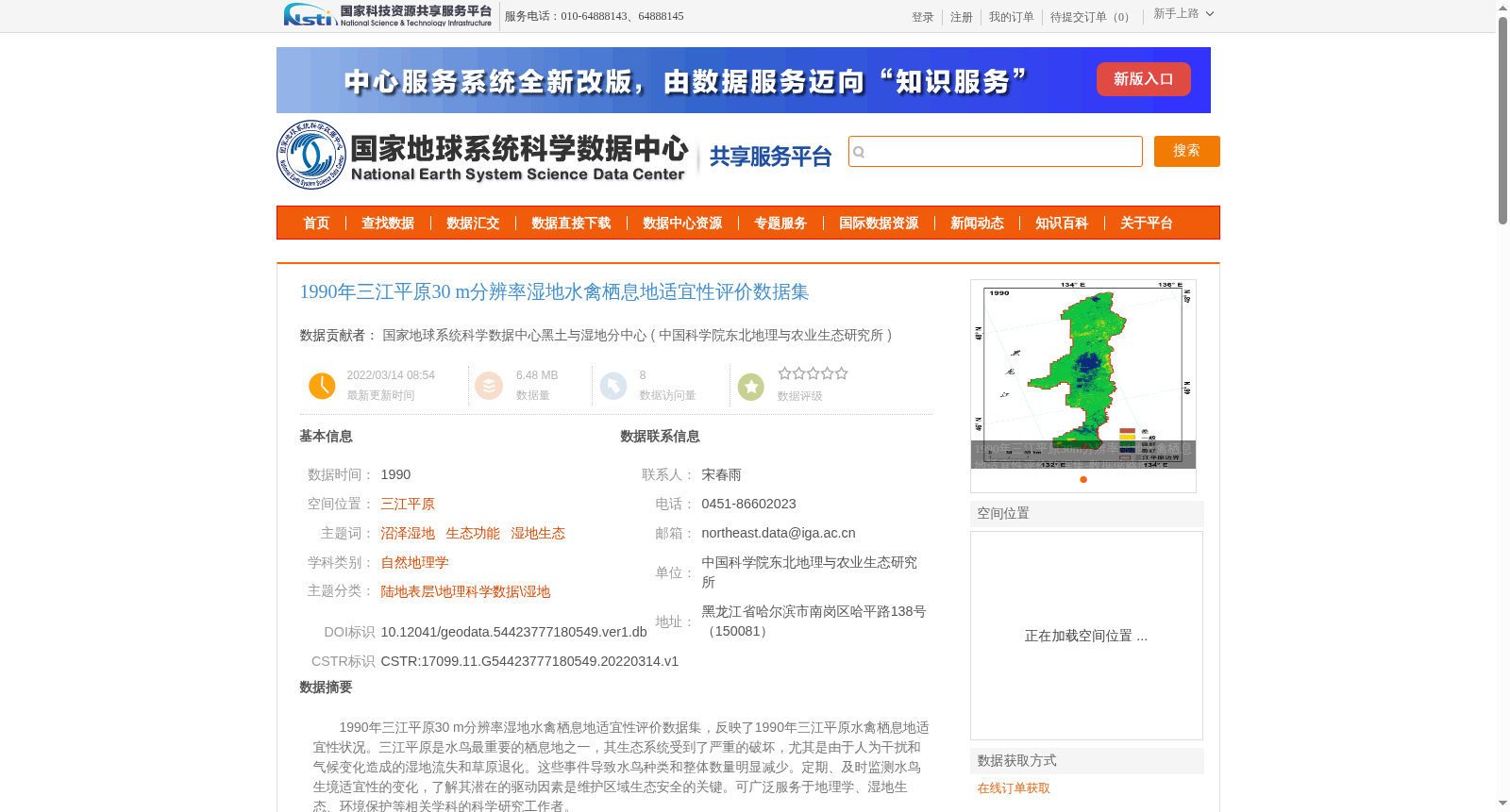
1990年三江平原30 m分辨率湿地水禽栖息地适宜性评价数据集,反映了1990年三江平原水禽栖息地适宜性状况。三江平原是水鸟最重要的栖息地之一,其生态系统受到了严重的破坏,尤其是由于人为干扰和气候变化造成的湿地流失和草原退化。这些事件导致水鸟种类和整体数量明显减少。定期、及时监测水鸟生境适宜性的变化,了解其潜在的驱动因素是维护区域生态安全的关键。可广泛服务于地理学、湿地生态、环境保护等相关学科的科学研究工作者。
The 30 m-resolution Wetland Waterfowl Habitat Suitability Assessment Dataset of the Sanjiang Plain in 1990 reflects the habitat suitability status of waterfowl in this region during 1990. As one of the most critical habitats for waterbirds, the Sanjiang Plain's ecosystem has suffered severe damage, notably wetland loss and grassland degradation driven by human disturbances and climate change. These disturbances have caused a marked reduction in both waterbird species richness and total population size. Regular and timely monitoring of changes in waterfowl habitat suitability, as well as elucidation of its underlying driving forces, are critical for safeguarding regional ecological security. This dataset can be widely utilized by scientific researchers across related disciplines including geography, wetland ecology, and environmental protection.
提供机构:
中国科学院东北地理与农业生态研究所
创建时间:
2022-03-14
搜集汇总
数据集介绍
背景与挑战
背景概述
该数据集是1990年三江平原30米分辨率的湿地水禽栖息地适宜性评价数据,用于反映水禽栖息地的适宜性状况。它针对三江平原这一重要水鸟栖息地,由于人为干扰和气候变化导致湿地流失和草原退化,水鸟种类和数量减少,数据集通过监测生境变化来支持生态安全研究。数据集基于遥感影像解译和ArcGIS分析,结合水源、干扰、遮蔽物和食物来源等因子计算,适用于地理学、湿地生态和环境保护等领域的科学研究。
以上内容由遇见数据集搜集并总结生成


