兰州大学寒旱区科学观测网络CARN(连城站物候相机观测数据集-2021)
收藏国家青藏高原科学数据中心2023-01-11 更新2024-03-01 收录
下载链接:
https://data.tpdc.ac.cn/zh-hans/data/0ff6e4ca-de44-46cd-a0ff-4a3a57cf7c92
下载链接
链接失效反馈官方服务:
资源简介:
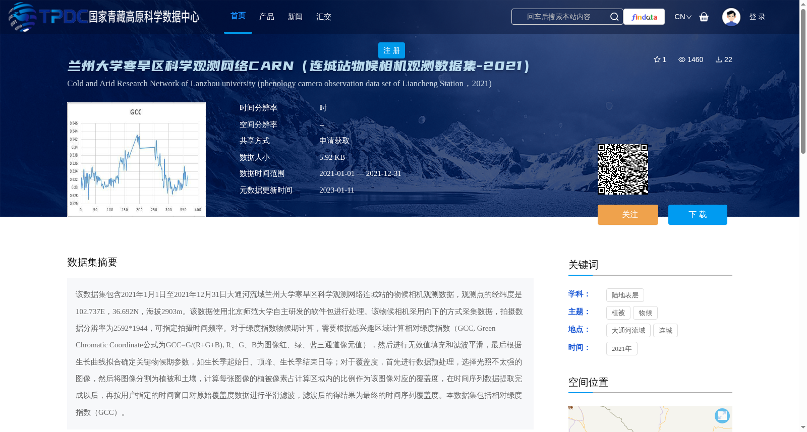
该数据集包含2021年1月1日至2021年12月31日大通河流域兰州大学寒旱区科学观测网络连城站的物候相机观测数据,观测点的经纬度是102.737E,36.692N,海拔2903m。该数据使用北京师范大学自主研发的软件包进行处理。该物候相机采用向下的方式采集数据,拍摄数据分辨率为2592*1944,可指定拍摄时间频率。对于绿度指数物候期计算,需要根据感兴趣区域计算相对绿度指数(GCC, Green Chromatic Coordinate公式为GCC=G/(R+G+B), R、G、B为图像红、绿、蓝三通道像元值),然后进行无效值填充和滤波平滑,最后根据生长曲线拟合确定关键物候期参数,如生长季起始日、顶峰、生长季结束日等;对于覆盖度,首先进行数据预处理,选择光照不太强的图像,然后将图像分割为植被和土壤,计算每张图像的植被像素占计算区域内的比例作为该图像对应的覆盖度,在时间序列数据提取完成以后,再按用户指定的时间窗口对原始覆盖度数据进行平滑滤波,滤波后的得结果为最终的时间序列覆盖度。本数据集包括相对绿度指数(GCC)。
This dataset contains phenological camera observation data collected at the Liancheng Station of the Cold and Arid Regions Scientific Observation Network of Lanzhou University, located within the Datong River Basin, during the period from January 1, 2021 to December 31, 2021. The observation site has geographic coordinates of 102.737°E, 36.692°N, and an altitude of 2903 meters. This dataset was processed using a software package independently developed by Beijing Normal University. The phenological camera acquires data in a downward-facing configuration, with an image resolution of 2592×1944, and the shooting frequency is configurable. For phenological phase calculation based on the greenness index: first, compute the relative Green Chromatic Coordinate (GCC) for the region of interest, with the formula GCC = G/(R+G+B), where R, G, and B represent the pixel values of the red, green, and blue channels of the image, respectively; then perform invalid value imputation and filtering smoothing; finally, determine key phenological parameters including the start date of the growing season, peak value, and end date of the growing season via growth curve fitting. For vegetation coverage calculation: first, conduct data preprocessing by selecting images with moderate lighting conditions; subsequently, segment each image into vegetation and soil regions, and calculate the proportion of vegetation pixels within the specified calculation area as the coverage value corresponding to that image. After extracting the time-series coverage data, apply smoothing filtering to the original coverage data using a user-specified time window, and the filtered result serves as the final time-series coverage product. This dataset includes the relative Green Chromatic Coordinate (GCC).
提供机构:
赵长明,张仁懿
创建时间:
2022-05-01
搜集汇总
数据集介绍
背景与挑战
背景概述
该数据集是兰州大学寒旱区科学观测网络连城站2021年全年的物候相机观测数据,覆盖大通河流域(经纬度102.737E, 36.692N,海拔2903m),包含相对绿度指数(GCC)和覆盖度时间序列数据,用于分析植被生长季起始、顶峰和结束等关键物候参数。数据集具有高时间分辨率(时),通过专业软件处理,适用于寒旱区植被动态研究。
以上内容由遇见数据集搜集并总结生成


