祁连山区域30m土地覆盖分类产品数据集(1990-2020年,每5年一期)
收藏国家青藏高原科学数据中心2024-09-10 更新2024-05-26 收录
下载链接:
https://data.tpdc.ac.cn/zh-hans/data/5da839d4-6454-4c4a-a1fb-0c70a2d5470a
下载链接
链接失效反馈官方服务:
资源简介:
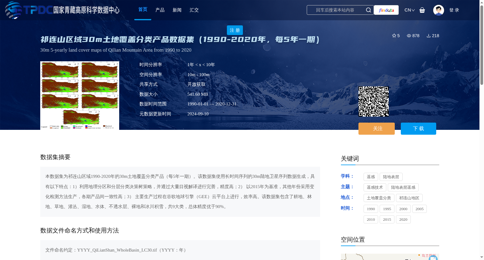
本数据集为祁连山区域1990-2020年的30m土地覆盖分类产品(每5年一期)。该数据集使用长时间序列的30m陆地卫星序列数据生成,具有以下特点:1)利用地理分区和分层分类决策树策略,并通过大量目视解译进行完善,精度高;2) 以2015年为基准,其他年份采用变化检测方法生产,各期产品间一致性高;3) 主要生产过程在谷歌地球引擎(GEE)云平台上进行,效率高。该数据集包含了耕地、林地、草地、灌丛、湿地、水体、不透水层、裸地和冰川积雪,共9大类,总体精度优于90%。
This dataset is a 30m land cover classification product for the Qilian Mountains region spanning 1990 to 2020, with each phase released every 5 years. It is generated using long-time-series 30m Landsat satellite data, and has the following characteristics: 1) It adopts a geographic zoning and hierarchical classification decision tree strategy, and is refined through extensive visual interpretation, achieving high accuracy; 2) It takes 2015 as the baseline year, while product phases for other years are generated via change detection methods, ensuring high consistency across all phases; 3) The core production workflow is conducted on the Google Earth Engine (GEE) cloud platform, delivering high efficiency. This dataset includes 9 major land cover categories: cropland, forestland, grassland, shrubland, wetland, water body, impervious surface, bare land, and glacier and snow cover, with an overall accuracy exceeding 90%.
提供机构:
杨爱霞, 仲波
创建时间:
2024-04-08
搜集汇总
数据集介绍
背景与挑战
背景概述
该数据集为祁连山区域1990-2020年每5年一期的30米土地覆盖分类产品,采用高精度分类方法生产,包含9大类土地覆盖类型,总体精度优于90%。数据集以2015年为基准,通过变化检测方法确保各期产品间的高一致性。
以上内容由遇见数据集搜集并总结生成


